MyTopo
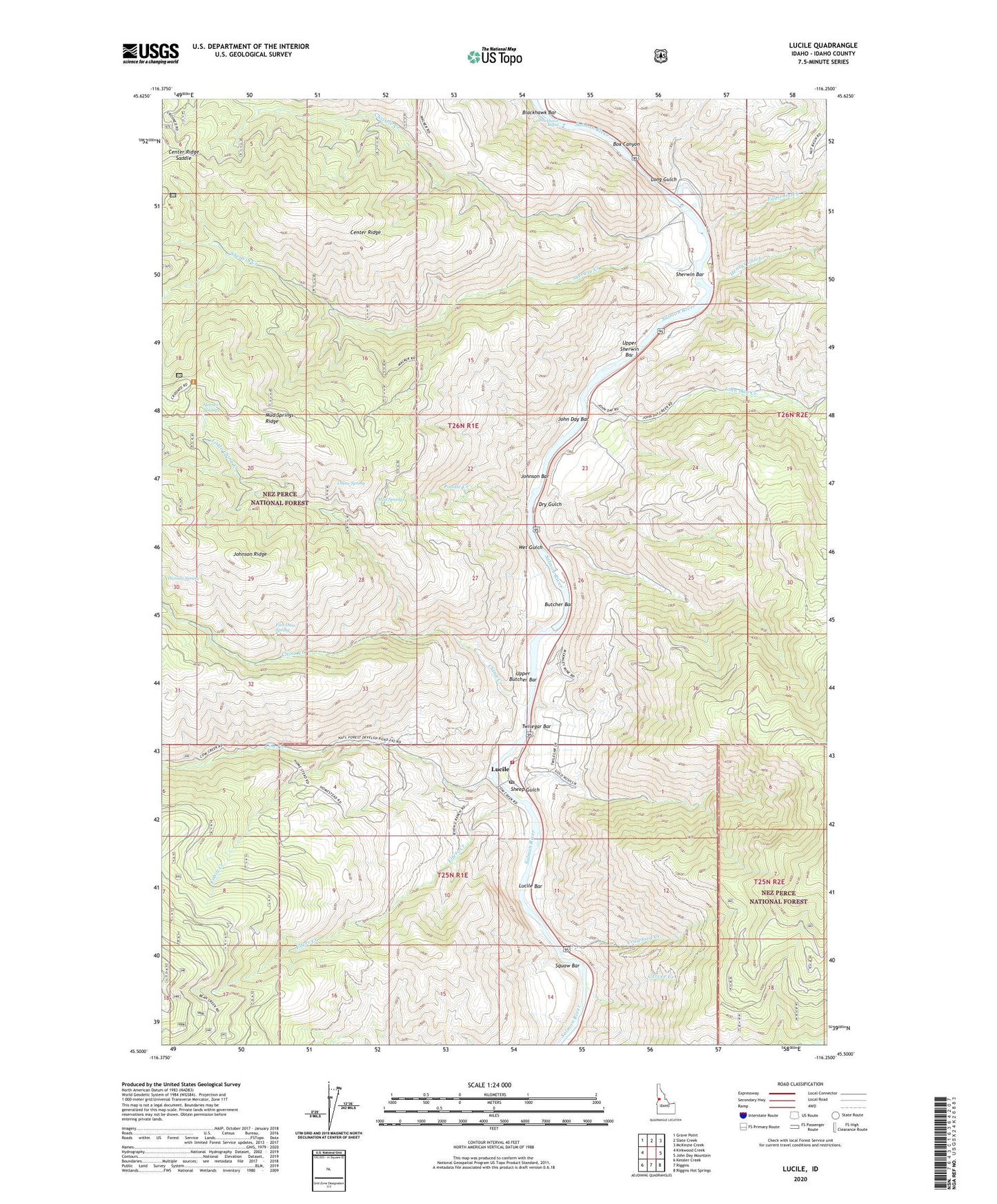
Lucile Idaho US Topo Map
Couldn't load pickup availability
Also explore the Lucile Forest Service Topo of this same quad for updated USFS data
2024 topographic map quadrangle Lucile in the state of Idaho. Scale: 1:24000. Based on the newly updated USGS 7.5' US Topo map series, this map is in the following counties: Idaho. The map contains contour data, water features, and other items you are used to seeing on USGS maps, but also has updated roads and other features. This is the next generation of topographic maps. Printed on high-quality waterproof paper with UV fade-resistant inks.
Quads adjacent to this one:
West: Kirkwood Creek
Northwest: Grave Point
North: Slate Creek
Northeast: McKinzie Creek
East: John Day Mountain
Southeast: Riggins Hot Springs
South: Riggins
Southwest: Kessler Creek
This map covers the same area as the classic USGS quad with code o45116e3.
Contains the following named places: Blackhawk Rapid, Bob Sewell, Box Canyon, Butcher Bar, Cabin Creek, Carver Creek, Center Ridge, Center Ridge Saddle, Chief Joseph War Historical Marker, China Creek, China Spring, Christie Creek, Circle C Ranch, Cow Creek, Cow Creek School, Crawford Creek, Dry Gulch, Eagle Gulch, Elfers Creek, Fish Dam Spring, George Gill, Hayes, Henry Rhett, Henrys Gulch, Herb Brown, Horner Springs, John Day Bar, John Day Creek, Johnson Bar, Johnson Ridge, Little China Creek, Long Gulch, Lucile, Lucile Bar, Lucile Post Office, McKinley Mine, Mud Springs, Mud Springs Ridge, Poodle Creek, Salmon River Rural Fire District Station 4, Sewell, Sheep Gulch, Sherwin Bar, Sherwin Creek, Squaw Bar, Thomas Spring, Thompson Place, Twilegar Bar, Upper Butcher Bar, Upper Sherwin Bar, Wet Gulch, ZIP Code: 83542