MyTopo
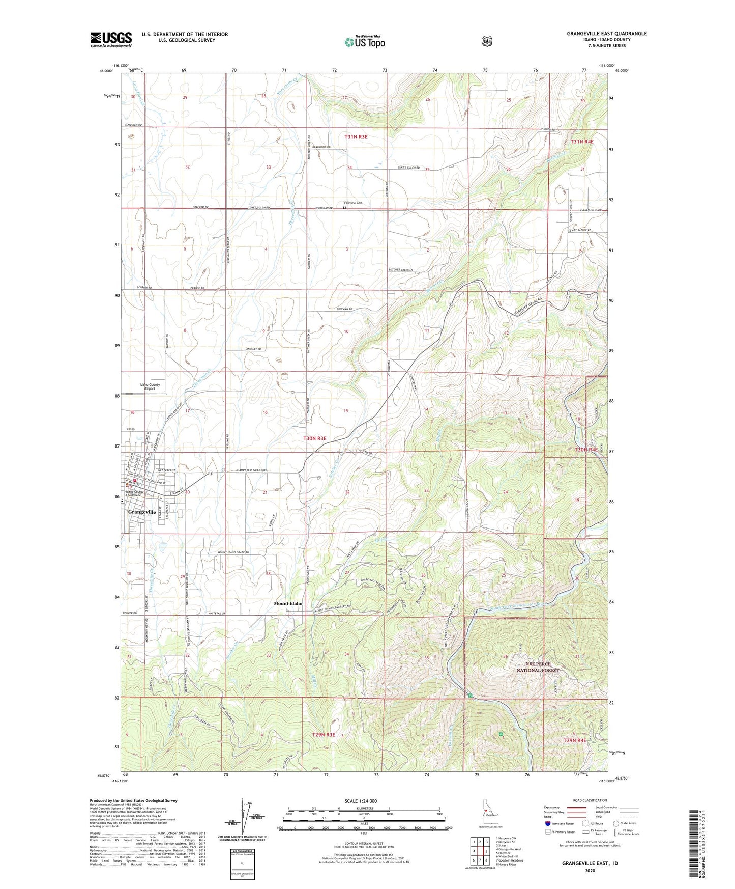
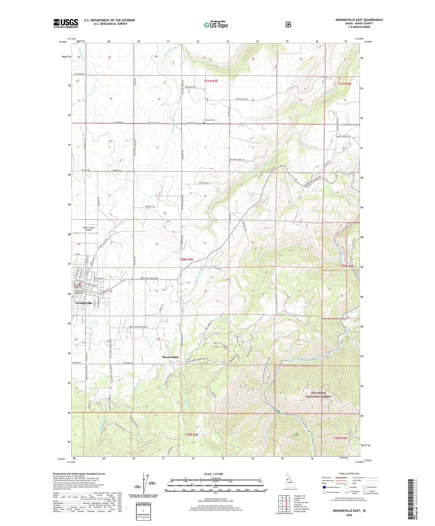
Grangeville East Idaho US Topo Map
Couldn't load pickup availability
Also explore the Grangeville East Forest Service Topo of this same quad for updated USFS data
2024 topographic map quadrangle Grangeville East in the state of Idaho. Scale: 1:24000. Based on the newly updated USGS 7.5' US Topo map series, this map is in the following counties: Idaho. The map contains contour data, water features, and other items you are used to seeing on USGS maps, but also has updated roads and other features. This is the next generation of topographic maps. Printed on high-quality waterproof paper with UV fade-resistant inks.
Quads adjacent to this one:
West: Grangeville West
Northwest: Nezperce SW
North: Nezperce SE
Northeast: Stites
East: Harpster
Southeast: Hungry Ridge
South: Goodwin Meadows
Southwest: White Bird Hill
This map covers the same area as the classic USGS quad with code o45116h1.
Contains the following named places: A Manes, Blakely, Boundary Campground, City of Grangeville, Cotter Bar Picnic Area, Cox, Dewey Mine, Elmen, Fairview Cemetery, Farrens Creek, Grangeville, Grangeville Elementary - Junior High School, Grangeville Fire Department, Grangeville Police Department, Grangeville Post Office, Groom, Idaho County Airport, Idaho County Poor Farm, Idaho County Sheriff's Office, KORT-FM (Grangeville), Likkep, Mill Creek, Morre, Mount Idaho, Mundt, Schwartz Creek, Snodgrass, Yastes, ZIP Code: 83530