MyTopo
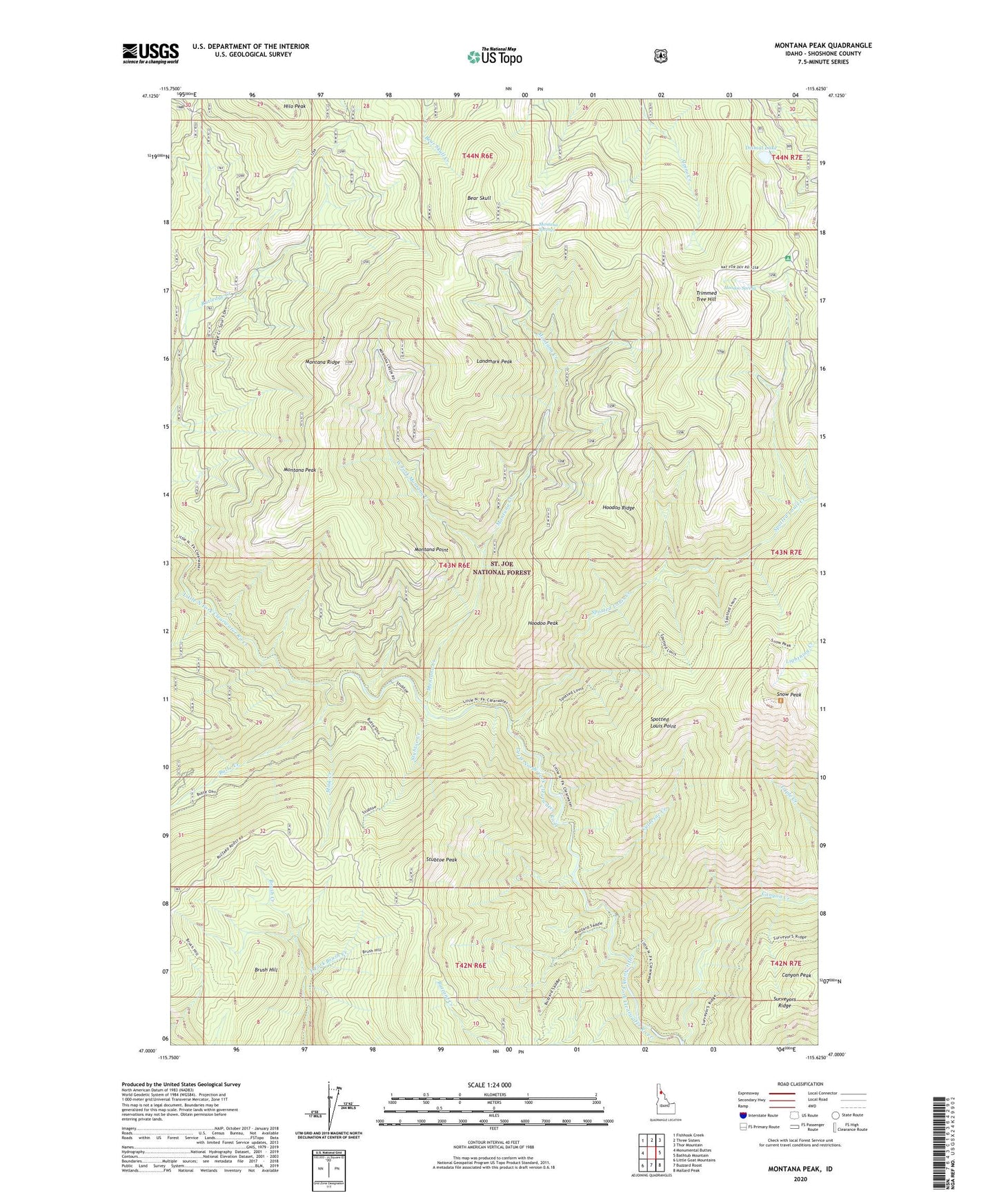
Montana Peak Idaho US Topo Map
Couldn't load pickup availability
Also explore the Montana Peak Forest Service Topo of this same quad for updated USFS data
2024 topographic map quadrangle Montana Peak in the state of Idaho. Scale: 1:24000. Based on the newly updated USGS 7.5' US Topo map series, this map is in the following counties: Shoshone. The map contains contour data, water features, and other items you are used to seeing on USGS maps, but also has updated roads and other features. This is the next generation of topographic maps. Printed on high-quality waterproof paper with UV fade-resistant inks.
Quads adjacent to this one:
West: Monumental Buttes
Northwest: Fishhook Creek
North: Three Sisters
Northeast: Thor Mountain
East: Bathtub Mountain
Southeast: Mallard Peak
South: Buzzard Roost
Southwest: Little Goat Mountains
This map covers the same area as the classic USGS quad with code o47115a6.
Contains the following named places: Bear Skull, Brush Hill, Butte Creek, Canyon Creek, Culdesac Creek, Dismal Lake, Durham Creek, East Fork Brush Creek, Hoodoo Peak, Hoodoo Ridge, Hoodoo Spring, Landmark Peak, Mammouth Springs Campground, Mink Creek, Montana Creek, Montana Peak, Montana Point, Montana Ridge, Montana Springs, Snow Peak, Snow Peak Wildlife Management Area, Spotted Louis Creek, Spotted Louis Point, Stubtoe Creek, Stubtoe Peak, Trimmed Tree Hill, West Fork Montana Creek