MyTopo
Weiser South Idaho US Topo Map
Couldn't load pickup availability
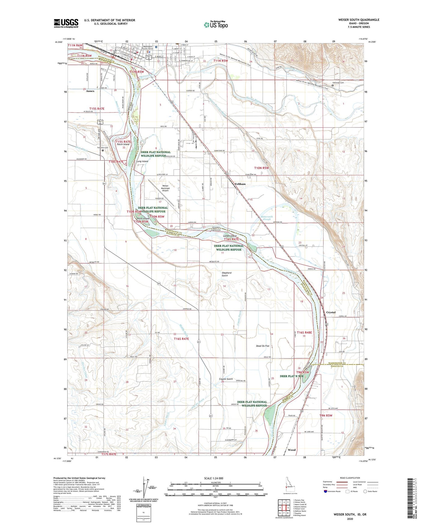
2024 topographic map quadrangle Weiser South in the states of Oregon, Idaho. Scale: 1:24000. Based on the newly updated USGS 7.5' US Topo map series, this map is in the following counties: Washington, Malheur, Payette. The map contains contour data, water features, and other items you are used to seeing on USGS maps, but also has updated roads and other features. This is the next generation of topographic maps. Printed on high-quality waterproof paper with UV fade-resistant inks.
Quads adjacent to this one:
West: Moores Hollow
Northwest: Porters Flat
North: Weiser North
Northeast: Mann Creek SE
East: Weiser Cove
Southeast: Birding Island
South: Payette
Southwest: Malheur Butte
Contains the following named places: Ammondo School, Annex, Annex Canal, Annex Census Designated Place, Annex Elementary School, Buttermilk Slough, Coyote Drain, Coyote Gulch, Crystal, Crystal School, Dead Ox Flat, Dead Ox Flat Division, Eastside School, Fairview Cemetery, Feltham, Galloway Cemetery, Hyline Hall, Jefferson School, KWEI-AM (Weiser), KWEI-FM (Weiser), Larson Island, Long Island, Lower Crystal School, Lower Payette Ditch, Mann Creek, Middle Ditch, Monroe Creek, Mosquite, Mosquite Post Office, Oregon Slope, Oregon Slope Community Hall, Park School, Patch Island, Roberts Access Area, Shepherd Gulch, Smith Island, Sunnyside School, Upper Ditch, Washington County Sheriff's Office, Weiser Area Rural Fire District Station 1, Weiser City Fire and Rescue, Weiser Junction, Weiser Memorial Hospital, Weiser Municipal Airport, Weiser Police Station, Weiser Post Office, Weiser River, Westside School, Wildcat Island, Wood