MyTopo
Malheur Butte Oregon US Topo Map
Couldn't load pickup availability
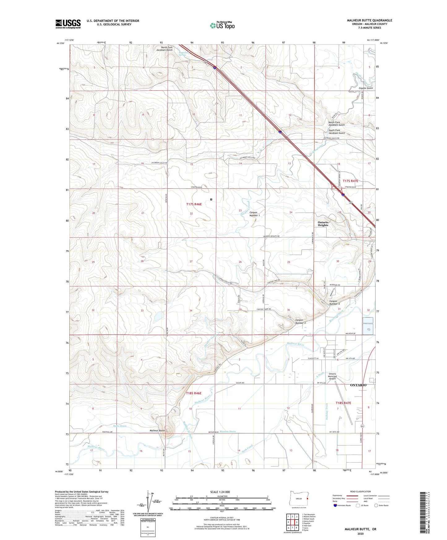
2023 topographic map quadrangle Malheur Butte in the state of Oregon. Scale: 1:24000. Based on the newly updated USGS 7.5' US Topo map series, this map is in the following counties: Malheur. The map contains contour data, water features, and other items you are used to seeing on USGS maps, but also has updated roads and other features. This is the next generation of topographic maps. Printed on high-quality waterproof paper with UV fade-resistant inks.
Quads adjacent to this one:
West: Henry Gulch
Northwest: Tub Mountain
North: Moores Hollow
Northeast: Weiser South
East: Payette
Southeast: Nyssa
South: Cairo
Southwest: Vale East
This map covers the same area as the classic USGS quad with code o44117a1.
Contains the following named places: A Drain, Blanton Drain, Brosman Ditch, Butte Drain, Butterfield Springs, Canyon Number 2, Canyon Number 3, Dork Canal, Halliday Drain, KXBQ-FM, Malheur Butte, North Fork Jacobsen Gulch, Ontario Division, Ontario Heights, Ontario Heights Church, Ontario Municipal Airport, Ontario Municipal Golf Course, Snake River Correctional Institution, South Fork Jacobsen Gulch, ZIP Code: 97914