MyTopo
Beecher East Illinois US Topo Map
Couldn't load pickup availability
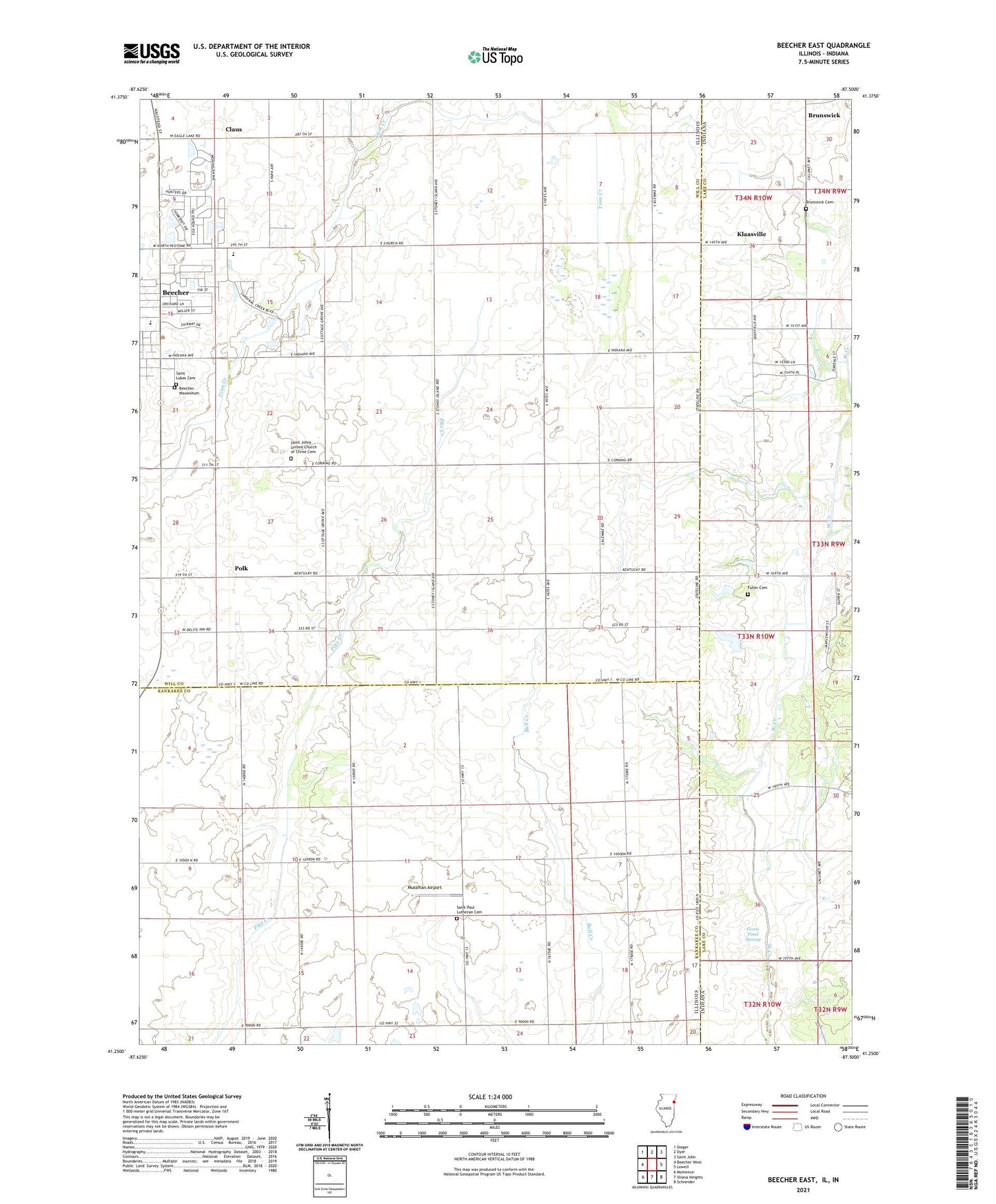
2024 topographic map quadrangle Beecher East in the states of Illinois, Indiana. Scale: 1:24000. Based on the newly updated USGS 7.5' US Topo map series, this map is in the following counties: Will, Kankakee, Lake. The map contains contour data, water features, and other items you are used to seeing on USGS maps, but also has updated roads and other features. This is the next generation of topographic maps. Printed on high-quality waterproof paper with UV fade-resistant inks.
Quads adjacent to this one:
West: Beecher West
Northwest: Steger
North: Dyer
Northeast: Saint John
East: Lowell
Southeast: Schneider
South: Illiana Heights
Southwest: Momence
Contains the following named places: Beecher, Beecher High School, Brock, Brunswick Cemetery, Bulterna Farms and Greenhouses, Camp Area Number Five, Claus, Deeke School, Eagle Lake, Eagle Lake Census Designated Place, Fuller Cemetery, Goose Pond Swamp, Klaasville, Mussman Airport, Polk, Saint John United Church of Christ, Saint Johns United Church of Christ Cemetery, Saint Lukes Cemetery, Saint Paul Lutheran Cemetery, Saint Pauls Lutheran Church, Shady Lawn Golf Course, Township of Washington, Township of Yellowhead, Village of Beecher, Washington Township Center Shopping Center, WTAS-FM (Crete), ZIP Code: 60401