MyTopo
Lowell Indiana US Topo Map
Couldn't load pickup availability
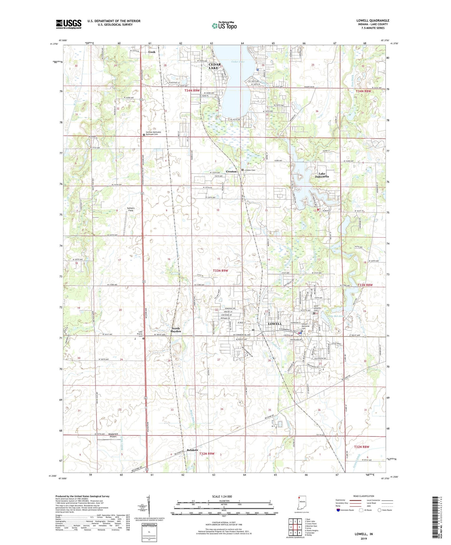
2022 topographic map quadrangle Lowell in the state of Indiana. Scale: 1:24000. Based on the newly updated USGS 7.5' US Topo map series, this map is in the following counties: Lake. The map contains contour data, water features, and other items you are used to seeing on USGS maps, but also has updated roads and other features. This is the next generation of topographic maps. Printed on high-quality waterproof paper with UV fade-resistant inks.
Quads adjacent to this one:
West: Beecher East
Northwest: Dyer
North: Saint John
Northeast: Crown Point
East: Leroy
Southeast: Shelby
South: Schneider
Southwest: Illiana Heights
This map covers the same area as the classic USGS quad with code o41087c4.
Contains the following named places: Apostolic Fellowship Church, Belshaw, Bethany Chapel, Bruce Ditch, Buckley Homestead County Park, Cedar Lake, Cedar Lake Police Department, Cedar Lake United Methodist Church, Community Bible Church, Creston, Creston Cemetery, Dalecarlia Bible Church, Evergreen Park, First Baptist Church, First Baptist Church of Lowell, First Church of the Nazarene, First United Methodist Church, Foss Ditch, German Methodist Episcopal Cemetery, Hope Lutheran Church, Lake Bel-Aire, Lake Dalecarlia, Lake Dalecarlia Census Designated Place, Lake Dalecarlia Dam East, Lake Dalecarlia Dam West, Lake Dalecarlia Volunteer Fire Department, Lake Prairie Cemetery, Lake Prairie Church, Lake Prairie Elementary School, Lakeside Baptist Church, Liberty Park, Lowell, Lowell Baptist School, Lowell Commercial Historic District, Lowell Memorial Cemetery, Lowell Middle School, Lowell Police Department, Lowell Post Office, Lowell Public Library, Lowell Senior High School, Lowell Southern Baptist Church, Lowell Volunteer Fire Department, Maple Grove Greenhouse and Nursery, McConnel Ditch, North Hayden, Oak Hill Elementary School, Oakland School, Onehundredthirtyseventh Avenue Park, Pheasant Valley Country Club, Redwing Lake, Reservation Park, Saint Edwards Cemetery, Saint Edwards Church, Saint Edwards School, South Lake County Community Services, South Shore Country Club, Sutton's Field, Three Creeks Elementary School, Town of Cedar Lake, Town of Lowell, Township of Cedar Creek, Township of West Creek, Tri - Creek Emergency Medical Services, Trinity Lutheran Church, Wietbrock Airport, ZIP Codes: 46303, 46356