MyTopo
Dyer Indiana US Topo Map
Couldn't load pickup availability
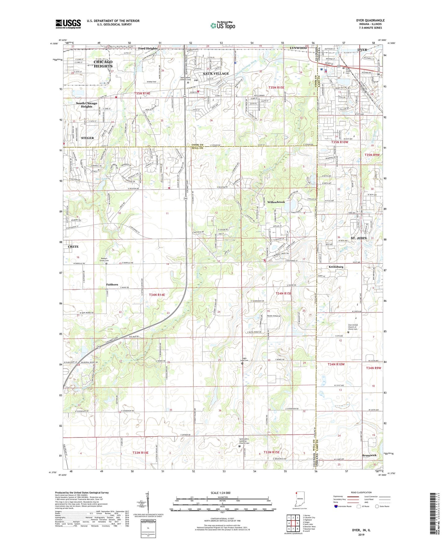
2022 topographic map quadrangle Dyer in the states of Illinois, Indiana. Scale: 1:24000. Based on the newly updated USGS 7.5' US Topo map series, this map is in the following counties: Lake, Will, Cook. The map contains contour data, water features, and other items you are used to seeing on USGS maps, but also has updated roads and other features. This is the next generation of topographic maps. Printed on high-quality waterproof paper with UV fade-resistant inks.
Quads adjacent to this one:
West: Steger
Northwest: Harvey
North: Calumet City
Northeast: Highland
East: Saint John
Southeast: Lowell
South: Beecher East
Southwest: Beecher West
This map covers the same area as the classic USGS quad with code o41087d5.
Contains the following named places: Balmoral Woods Estates Country Club, Beebe's Grove Cemetery, Bloom Trail High School, Brunswick, Camp Crete, Crete Fire Department Station 2, Crete Township Fire Protection District Station 2, Deer Lake, Deer Lake Dam, Dyer, Dyer Police Department, Dyer Post Office, Dyer Presbyterian Church, Dyer United Methodist Church, Dyer Volunteer Fire Department Station 1, Eagle Lake Cemetery, Emmanuel Christian Reformed Church, Faithorn, First Baptist Church, First Christian Church of Dyer, Franciscan Health Dyer, George Bibich Elementary School, Goodenow Grove Forest Preserve, Grace Lutheran Church, Kahler Middle School, Katz Corner School, Kreitzburg, Lakewood Country Club, Lansing Drainage Ditch, Lincoln Oaks Golf Course, Lincolnshire, Lincolnshire Country Club, Longwood Country Club, Mount Carmel School, Mulderink Heliport, Pheasant Hills Park, Plum Creek Forest Preserve, Plum Grove Forest Preserve, Plum Valley, Plum Valley Census Designated Place, Rickover Junior High School, Rivers of Living Water Church, Saint James Catholic Cemetery, Saint James Hospital, Saint James School, Saint Johns Church, Saint John's Lutheran Church Cemetery, Saint Joseph Cemetery, Saint Joseph Church, Saint Joseph School, Saint Mark's Lutheran Church, Saint Marks School, Saint Rocco Church, Sauk Plaza Shopping Center, Sauk Trail School, Sauk Village, Sauk Village Baptist Church, Sauk Village Fire Department, Sauk Village Police Department, Sauk Village Post Office, Sauk Village Village Hall, Steger Fire Department Station 1 Headquarters, Steger Fire Department Station 3, Strassburg Elementary School, Town of Dyer, Township of Crete, Victory Hill Church, Village of Crete, Village of Sauk Village, Village of Steger, Wagoner Elementary School, Willowbrook, Willowbrook Census Designated Place, Windmill Acres, Zion United Church of Christ, Zion United Church of Christ Cemetery, ZIP Codes: 46311, 60417