MyTopo
Illiana Heights Illinois US Topo Map
Couldn't load pickup availability
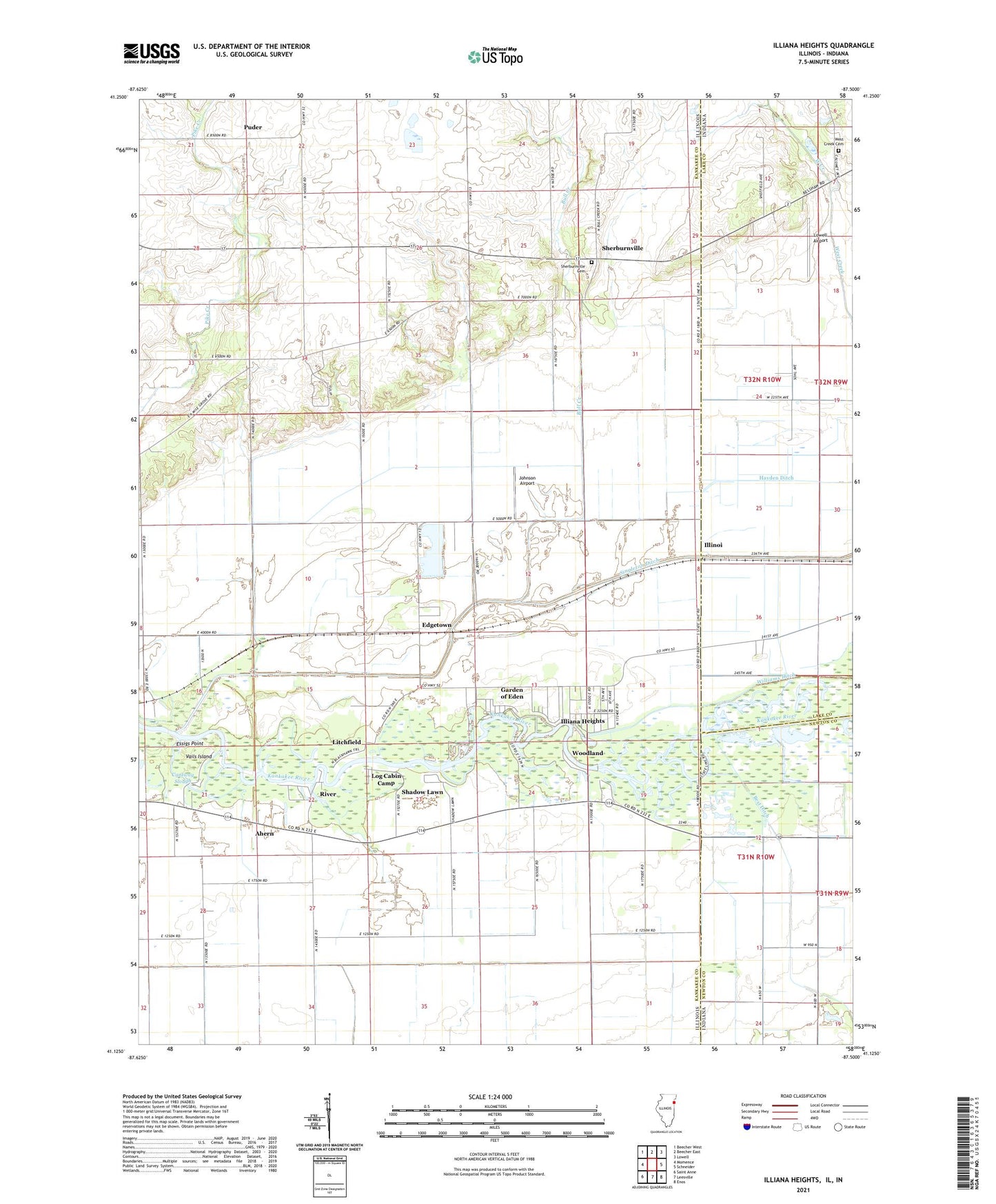
2024 topographic map quadrangle Illiana Heights in the states of Illinois, Indiana. Scale: 1:24000. Based on the newly updated USGS 7.5' US Topo map series, this map is in the following counties: Kankakee, Lake, Newton. The map contains contour data, water features, and other items you are used to seeing on USGS maps, but also has updated roads and other features. This is the next generation of topographic maps. Printed on high-quality waterproof paper with UV fade-resistant inks.
Quads adjacent to this one:
West: Momence
Northwest: Beecher West
North: Beecher East
Northeast: Lowell
East: Schneider
Southeast: Enos
South: Leesville
Southwest: Saint Anne
Contains the following named places: Ahern, Ainsworth School, Bull Creek, Cantway Slough, Carlson Ditch, Delmar, Edgetown, Essigs Point, Garden of Eden, Hayden Ditch, Hess School, Illiana Heights, Illinoi, Illinoi School, Johnson Airport, Kankakee River State Park, Lake, Litchfield, Log Cabin Camp, Love Field, Lowell Airport, Minne Monesse Golf Course, Momence Wetlands Nature Preserve, Munyon Farms, Ostrander School, Puder, River, Shadow Lawn, Sherburnville, Sherburnville Cemetery, Squires School, Township of Momence, Vails Island, West Creek Cemetery, Williams Ditch, Woodland, ZIP Code: 60954