MyTopo
Saint John Indiana US Topo Map
Couldn't load pickup availability
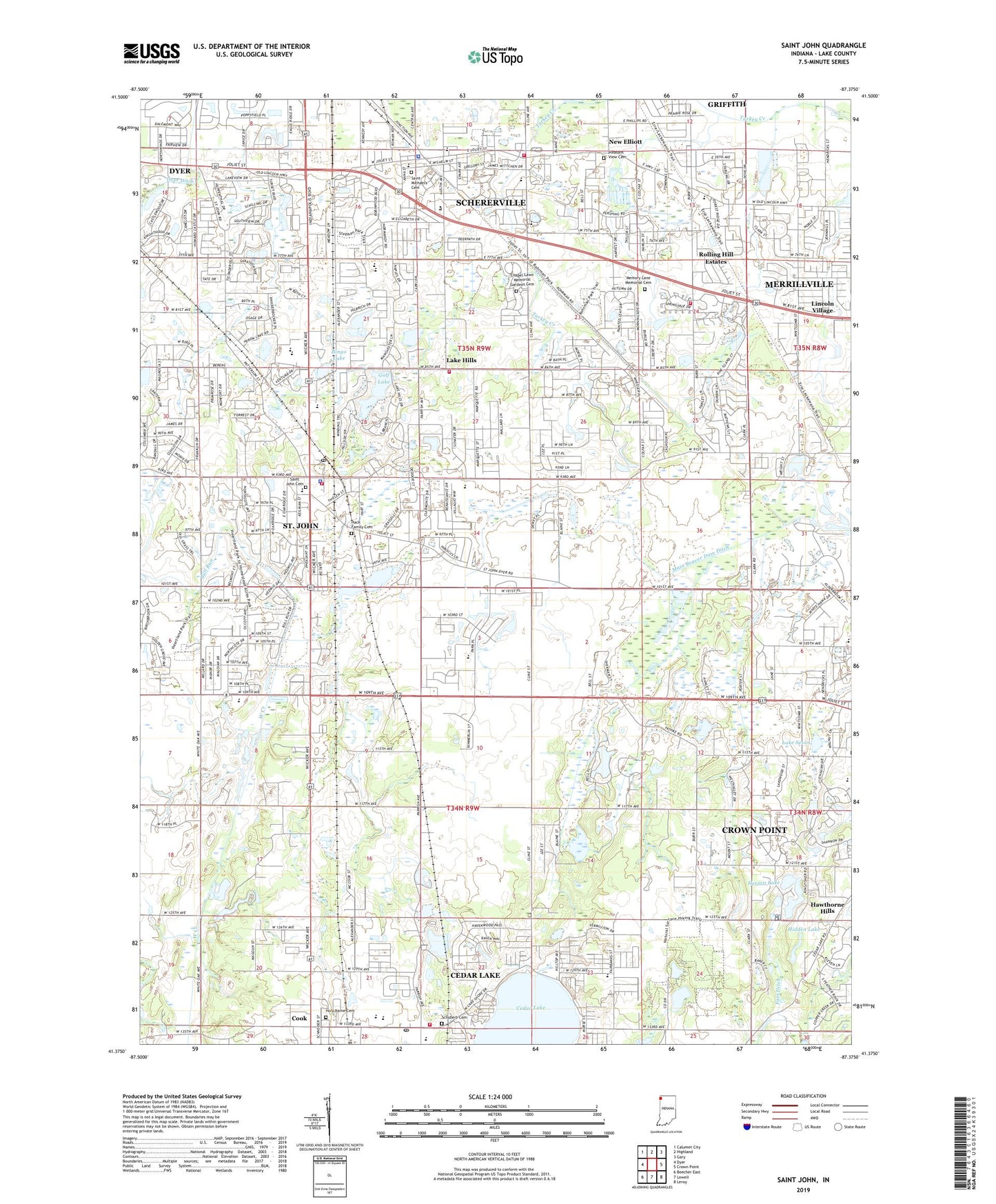
2022 topographic map quadrangle Saint John in the state of Indiana. Scale: 1:24000. Based on the newly updated USGS 7.5' US Topo map series, this map is in the following counties: Lake. The map contains contour data, water features, and other items you are used to seeing on USGS maps, but also has updated roads and other features. This is the next generation of topographic maps. Printed on high-quality waterproof paper with UV fade-resistant inks.
Quads adjacent to this one:
West: Dyer
Northwest: Calumet City
North: Highland
Northeast: Gary
East: Crown Point
Southeast: Leroy
South: Lowell
Southwest: Beecher East
This map covers the same area as the classic USGS quad with code o41087d4.
Contains the following named places: Beidron Park, Bingo Lake, Bull Run, Cedar Lake Fire Department, Cedar Lake Mobile Home Park, Cedar Lake Post Office, Chapel Lawn Memorial Gardens Cemetery, Civic Memorial Park, Cook, Deer Run Plaza Shopping Center, Douglas MacArthur Elementary School, Dyer Ditch, Elmridge Park, First Baptist Church, Fortyone Ranch Mobile Home Park, Foxwood Park, Golf Lake, Hack Family Cemetery, Hanover Central Junior/Senior High School, Hawthorne Hills, Hermit Lake, Hidden Lake, Holy Name Catholic Church, Holy Name Cemetery, Homan Elementary School, Homestead Acres Park Number 1, Homestead Acres Park Number 2, Hoosier Boys Town, Hyles-Anderson College, Illiana Racetrack, Immanuel Presbyterian Church, James E Larimer Park, Jane Horton Ball Elementary School, Klinedorf Airport, Kolling Elementary School, Lake Central High School, Lake County, Lake Hills, Lake Hills Baptist Church, Lake Hills Golf and Country Club, Lake Hills Volunteer Fire Department, Lake Seven, Lake Street Elementary School, Lancer Park, Lemon Lake County Park, Lincoln Ridge Plaza Shopping Center, Lincoln School, Lincoln Village, Main Beaver Ditch, Memory Lane Memorial Park, Michael Grimmer Middle School, Monastery Golf Club, New Elliott, New Life Bible Church, Oak Knoll Golf Course, Oak Ridge Center Shopping Center, Palmira Golf Course, Peace Lutheran Church, Peifer Elementary School, Peter G Redar Park, Pine Island Plaza Shopping Center, Pleasant View Cemetery, Prairie West Park, Rohrman Park, Rolling Hill Estates, Saint George Hellenic Greek Church, Saint George School, Saint John, Saint John Cemetery, Saint John Fire Department, Saint John Police Department, Saint John Post Office, Saint John the Evangelist Catholic Church, Saint Johns Seminary, Saint Michael Church, Saint Michael's Cemetery, Schererville, Schererville Fire Department Station 2, Schererville Fire Department Station 3, Schererville Police Department, Schubert Cemetery, Stephen Park, The Crossroads Shopping Center, Timber Lane Park, Timothy Ball Elementary School, Town of Saint John, Town of Schererville, Township of Hanover, Township of Saint John, United Emergency Medical Services, Victoria Centre Shopping Center, WZVN-FM (Lowell), ZIP Codes: 46373, 46375