MyTopo
Davis Illinois US Topo Map
Couldn't load pickup availability
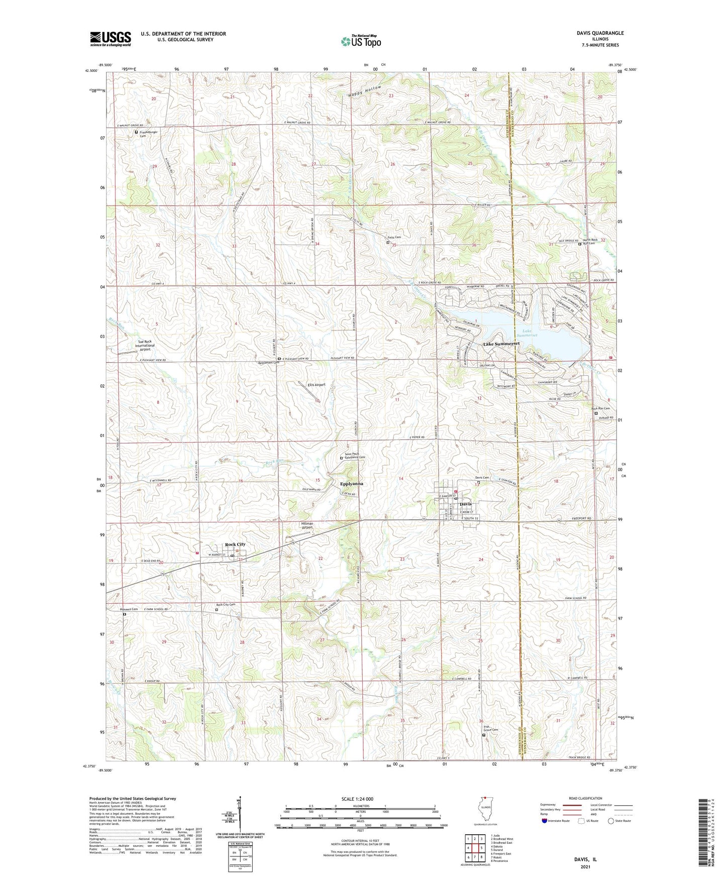
2024 topographic map quadrangle Davis in the state of Illinois. Scale: 1:24000. Based on the newly updated USGS 7.5' US Topo map series, this map is in the following counties: Stephenson, Winnebago. The map contains contour data, water features, and other items you are used to seeing on USGS maps, but also has updated roads and other features. This is the next generation of topographic maps. Printed on high-quality waterproof paper with UV fade-resistant inks.
Quads adjacent to this one:
West: Dakota
Northwest: Juda
North: Brodhead West
Northeast: Brodhead East
East: Durand
Southeast: Pecatonica
South: Ridott
Southwest: Freeport East
This map covers the same area as the classic USGS quad with code o42089d4.
Contains the following named places: Bethlehem Cemetery, Brown School, Buss Quarry, Chester Wyss Airport, Church Hill School, Davis, Davis Cemetery, Davis Fire Protection District, Davis Post Office, Davis United Methodist Church, Eggerts School, Ellis Airport, Epplyanna, Felts Cemetery, Felts School, Frankeburger Cemetery, Goodrich Fire Department, Halvorson Cemetery, Henze School, Hillman Airport, Irish Grove Cemetery, Irish Grove Church, Lake Summerset, Lake Summerset Census Designated Place, Lake Summerset Dam, North Rock Run Cemetery, Pioneers Cemetery, Pleasant Valley School, Pleasant View School, Prairie Block School, Putman School, Rock City, Rock City Cemetery, Rock City Fire Protection District, Rock City Post Office, Rock City Quarry, Rock Run Cemetery, Saint Paul Cemetery, Saint Pauls Epleyanna Cemetery, Saint Pauls United Church of Christ, Sue Rock International Airport, Township of Rock Grove, Township of Rock Run, Tri - District Ambulance Service, Village of Davis, Village of Rock City, Walnut Grove School, ZIP Codes: 61019, 61070