MyTopo
Wabash Island Kentucky US Topo Map
Couldn't load pickup availability
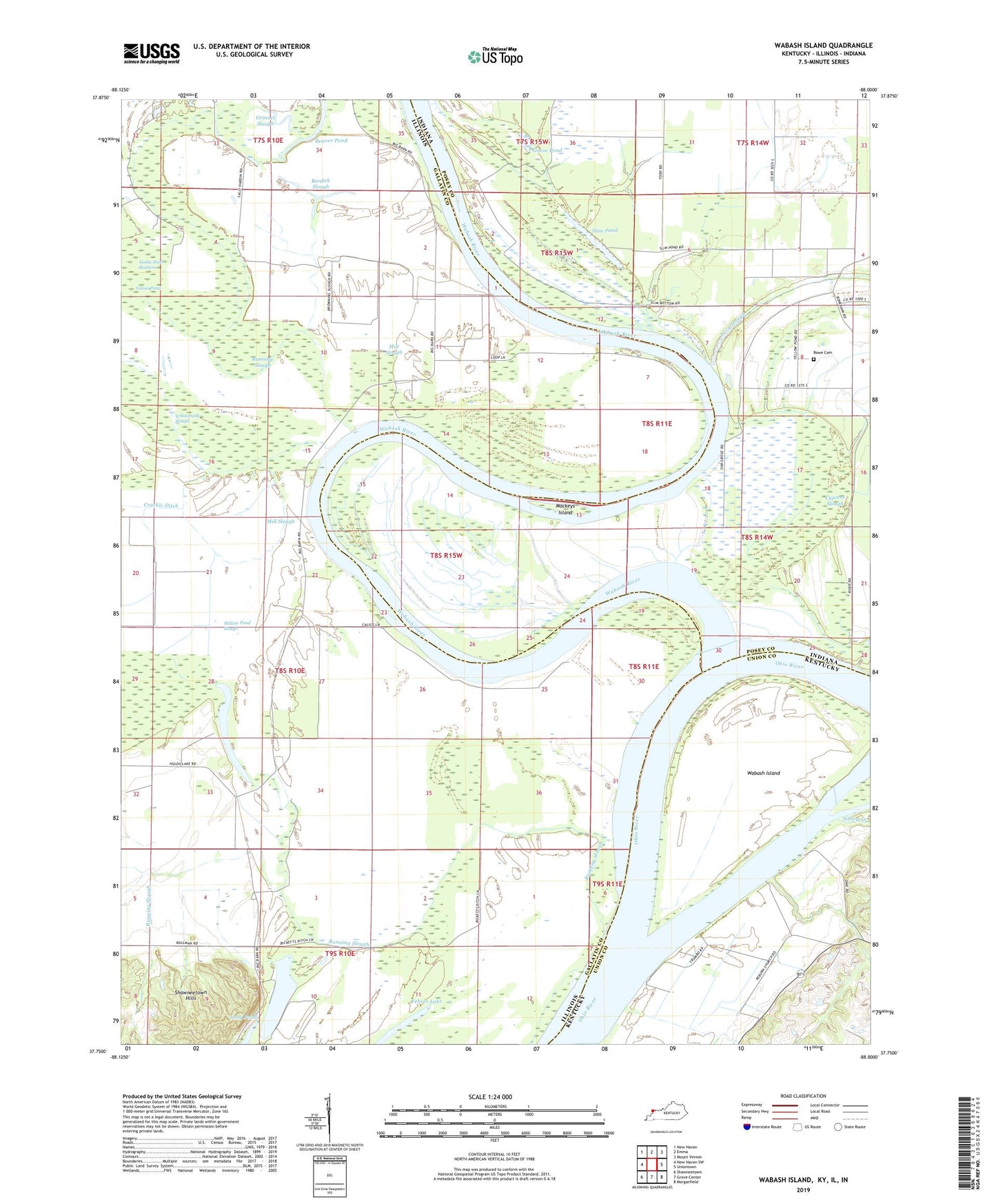
2022 topographic map quadrangle Wabash Island in the states of Illinois, Indiana, Kentucky. Scale: 1:24000. Based on the newly updated USGS 7.5' US Topo map series, this map is in the following counties: Union, Gallatin, Posey. The map contains contour data, water features, and other items you are used to seeing on USGS maps, but also has updated roads and other features. This is the next generation of topographic maps. Printed on high-quality waterproof paper with UV fade-resistant inks.
Quads adjacent to this one:
West: New Haven SW
Northwest: New Haven
North: Emma
Northeast: Mount Vernon
East: Uniontown
Southeast: Morganfield
South: Grove Center
Southwest: Shawneetown
This map covers the same area as the classic USGS quad with code o37088g1.
Contains the following named places: Beaver Pond, Berdick Slough, Black School, Bone Bank, Cypress Slough, Fehrer Lake, Goose Pond, Goose Pond Scatters, Grinnel Slough, Hulda Lake, Levy Slough, Long Pond, Mackeys Island, Mill Slough, Oak Grove, Reburn Church, Reyburn, Round Pond, Rowe Cemetery, Running Slough, Sibley Creek, Slim Pond, Township of New Haven, Wabash Island, Wabash River, Willow Pond Slough, Yellowbank Slough