MyTopo
L'Erable Illinois US Topo Map
Couldn't load pickup availability
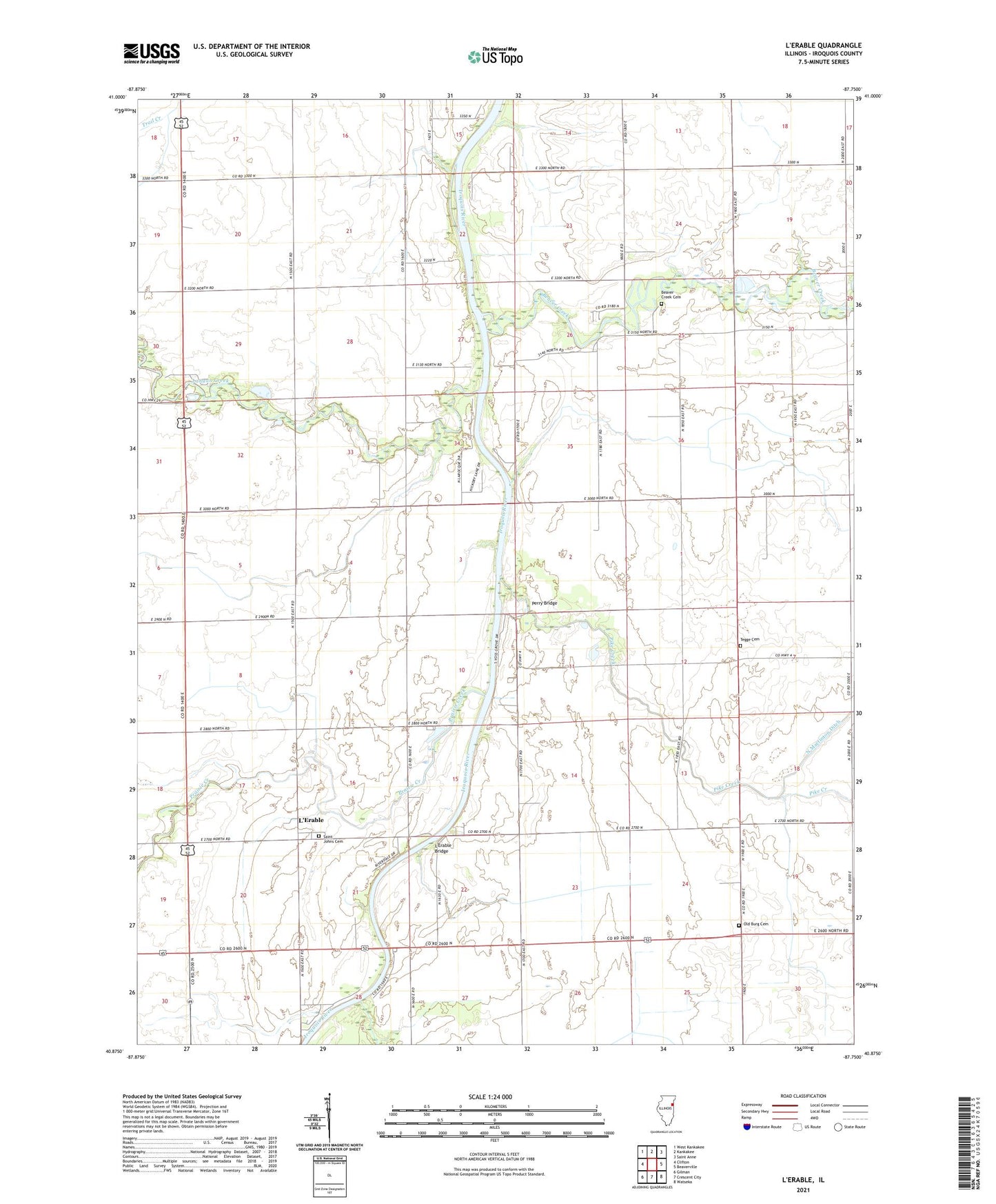
2024 topographic map quadrangle L'Erable in the state of Illinois. Scale: 1:24000. Based on the newly updated USGS 7.5' US Topo map series, this map is in the following counties: Iroquois. The map contains contour data, water features, and other items you are used to seeing on USGS maps, but also has updated roads and other features. This is the next generation of topographic maps. Printed on high-quality waterproof paper with UV fade-resistant inks.
Quads adjacent to this one:
West: Clifton
Northwest: West Kankakee
North: Kankakee
Northeast: Saint Anne
East: Beaverville
Southeast: Watseka
South: Crescent City
Southwest: Gilman
This map covers the same area as the classic USGS quad with code o40087h7.
Contains the following named places: Baron School, Beaver Creek, Beaver Creek Cemetery, Brault School, Clabby School, College Corner School, Dodsonville School, Dutour School, Hubb School, Jones School, Langan Creek, L'Erable, L'Erable Bridge, Liberty School, North Martinton Ditch, Nottke Airport, Old Burg Cemetery, Old Burg School, Perry Bridge, Pike Creek, Prairie Creek, Saint Johns Cemetery, Switzer School, Tegge Cemetery, Vanderporten School, ZIP Code: 60951