MyTopo
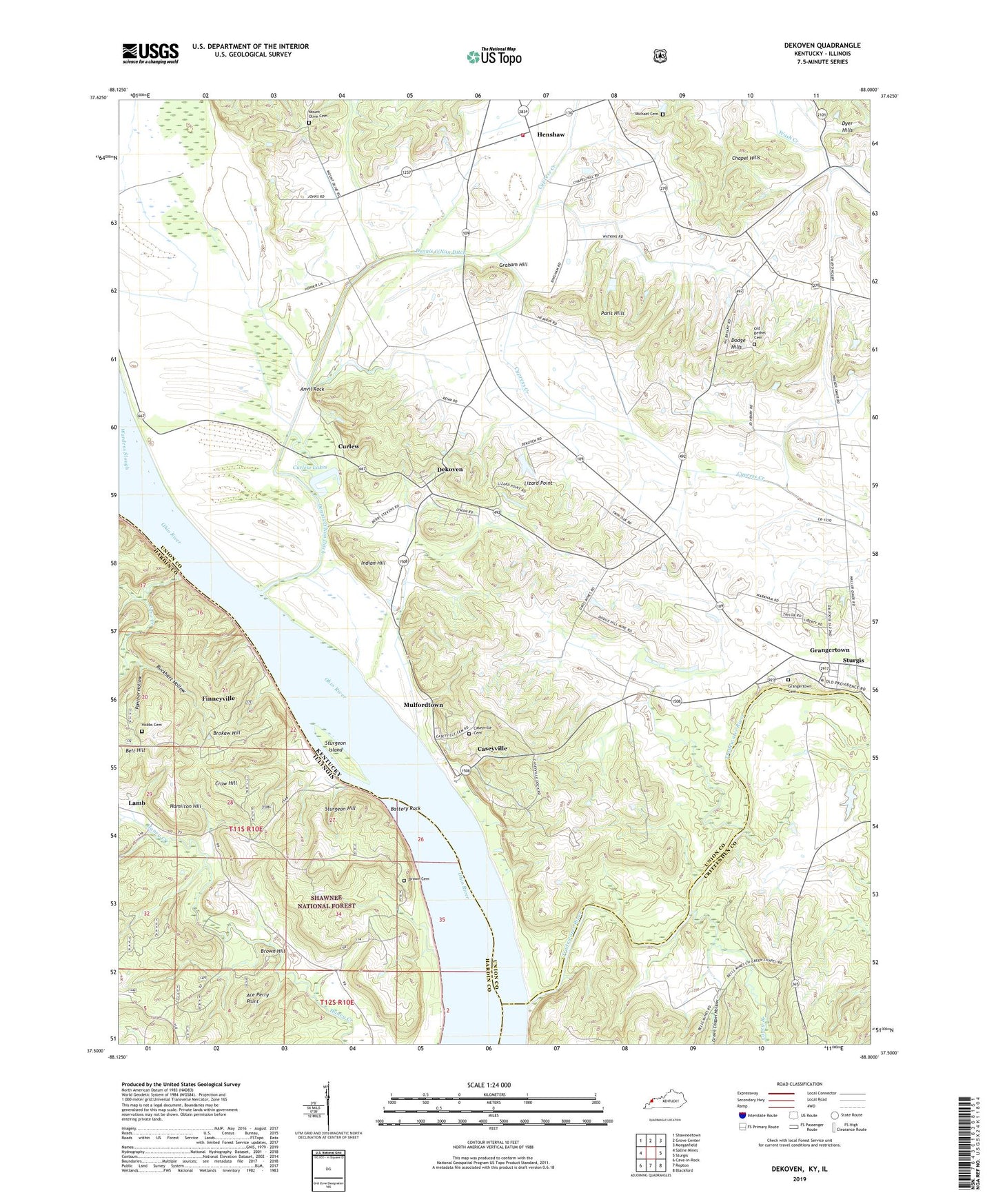
Dekoven Kentucky US Topo Map
Couldn't load pickup availability
Also explore the Dekoven Forest Service Topo of this same quad for updated USFS data
2022 topographic map quadrangle Dekoven in the states of Kentucky, Illinois. Scale: 1:24000. Based on the newly updated USGS 7.5' US Topo map series, this map is in the following counties: Union, Hardin, Crittenden. The map contains contour data, water features, and other items you are used to seeing on USGS maps, but also has updated roads and other features. This is the next generation of topographic maps. Printed on high-quality waterproof paper with UV fade-resistant inks.
Quads adjacent to this one:
West: Saline Mines
Northwest: Shawneetown
North: Grove Center
Northeast: Morganfield
East: Sturgis
Southeast: Blackford
South: Repton
Southwest: Cave-in-Rock
This map covers the same area as the classic USGS quad with code o37088e1.
Contains the following named places: Ace Perry Point, Anvil Rock, Battery Rock, Battery Rock School, Bells Mine, Bells Mines Church, Brokaw Hill, Brown Cemetery, Brown Hill, Buckhart Hollow, Cane Creek, Caney Branch, Caseyville, Caseyville Cemetery, Cattail Pond, Chapel Hills, Crow Hill, Curlew, Curlew Lakes, Dekoven, Dekoven Census Designated Place, Dennis O'Nan Ditch, Dodge Hills, Finneyville, Gentry Landing, Graham Hill, Grangertown, Grangertown Cemetery, Green Chapel Hollow, Hamilton Hill, Henshaw, Henshaw Volunteer Fire Department, Hobbs Cemetery, Indian Hill, Lamb, Lizard Point, Locust Lick Creek, Michael Cemetery, Mount Olive Cemetery, Mulfordtown, Old Bethel Cemetery, Old Bethel Church, Panther Hollow, Paris Hills, Saint Ambrose Church, Sellers Landing, Sturgeon Hill, Sturgeon Island, Tradewater River, Wardens Slough, ZIP Code: 42459