MyTopo
Grove Center Kentucky US Topo Map
Couldn't load pickup availability
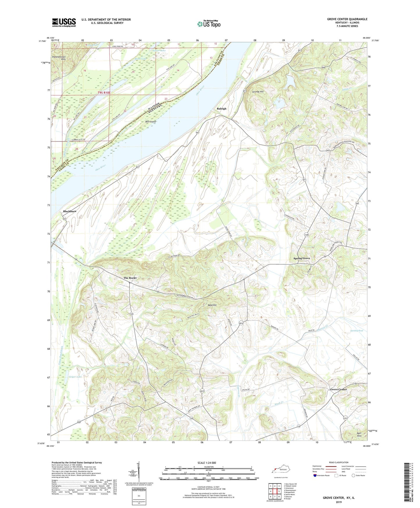
2022 topographic map quadrangle Grove Center in the states of Kentucky, Illinois. Scale: 1:24000. Based on the newly updated USGS 7.5' US Topo map series, this map is in the following counties: Union, Gallatin. The map contains contour data, water features, and other items you are used to seeing on USGS maps, but also has updated roads and other features. This is the next generation of topographic maps. Printed on high-quality waterproof paper with UV fade-resistant inks.
Quads adjacent to this one:
West: Shawneetown
Northwest: New Haven SW
North: Wabash Island
Northeast: Uniontown
East: Morganfield
Southeast: Sturgis
South: Dekoven
Southwest: Saline Mines
This map covers the same area as the classic USGS quad with code o37088f1.
Contains the following named places: Bald Hill, Bell Island, Big Lake, Black Lake, Blackburn, Fish Lake, Geiger Lake, Goose Pond, Goose Pond Ditch, Grove Center, Grundy Hill, Harding Pond, Millrace Slough, Mount Olive, Mount Olive Church, Mullin Pond, Raleigh, Shiloh Church, Spring Grove, The Rocks, Township of Shawnee, Wash Creek, Welsh Lake, Woodland Church, Zion Church