MyTopo
Hillsboro Indiana US Topo Map
Couldn't load pickup availability
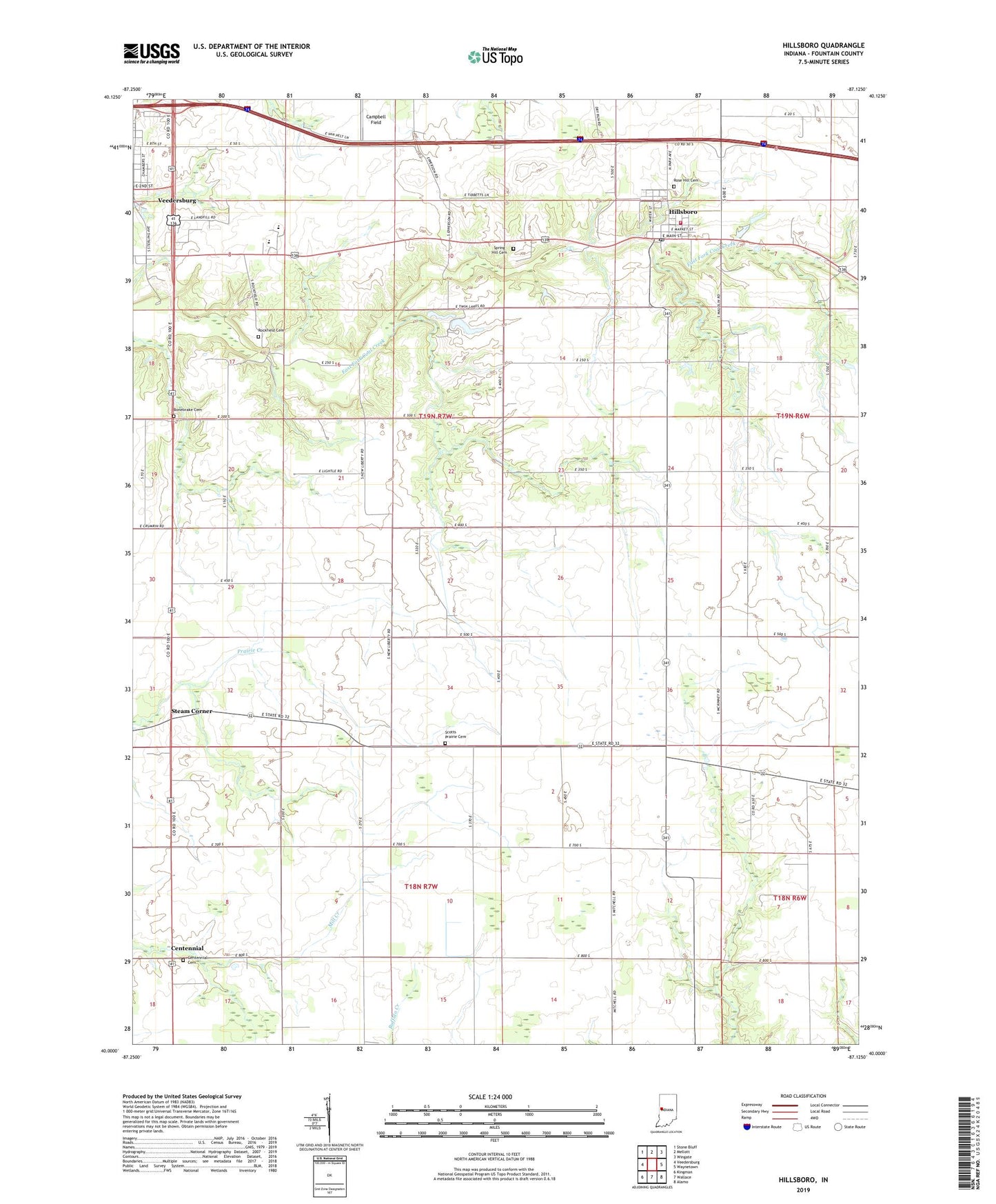
2022 topographic map quadrangle Hillsboro in the state of Indiana. Scale: 1:24000. Based on the newly updated USGS 7.5' US Topo map series, this map is in the following counties: Fountain. The map contains contour data, water features, and other items you are used to seeing on USGS maps, but also has updated roads and other features. This is the next generation of topographic maps. Printed on high-quality waterproof paper with UV fade-resistant inks.
Quads adjacent to this one:
West: Veedersburg
Northwest: Stone Bluff
North: Mellott
Northeast: Wingate
East: Waynetown
Southeast: Alamo
South: Wallace
Southwest: Kingman
This map covers the same area as the classic USGS quad with code o40087a2.
Contains the following named places: Bonebrake Cemetery, Centennial, Centennial Cemetery, Fountain County, Fountain County Ambulance Service, Hillsboro, Hillsboro Fire Station, Hillsboro Post Office, Hillsboro Town Marshal, New Liberty Church, Prairie Chapel, Rockfield Cemetery, Rose Hill Cemetery, Scotts Prairie Cemetery, Scotts Prairie Church, Spring Hill Cemetery, Steam Corner, Town of Hillsboro, Township of Cain, Wooley Corner, ZIP Code: 47949