MyTopo
Waynetown Indiana US Topo Map
Couldn't load pickup availability
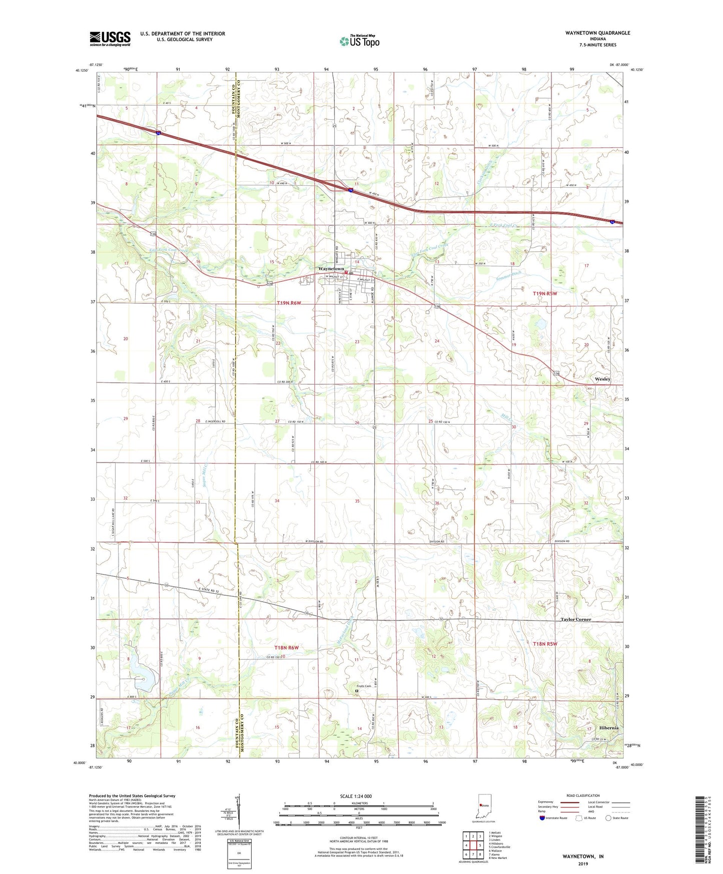
2022 topographic map quadrangle Waynetown in the state of Indiana. Scale: 1:24000. Based on the newly updated USGS 7.5' US Topo map series, this map is in the following counties: Montgomery, Fountain. The map contains contour data, water features, and other items you are used to seeing on USGS maps, but also has updated roads and other features. This is the next generation of topographic maps. Printed on high-quality waterproof paper with UV fade-resistant inks.
Quads adjacent to this one:
West: Hillsboro
Northwest: Mellott
North: Wingate
Northeast: Linden
East: Crawfordsville
Southeast: New Market
South: Alamo
Southwest: Wallace
This map covers the same area as the classic USGS quad with code o40087a1.
Contains the following named places: Christian Union Church, Clarkson Ditch, Fruits Cemetery, Hibernia, McFarland Ditch, Sommer Ditch, Sugar Mill Lake, Sugar Mill Lake Dam, Taylor Corner, Town of Waynetown, Township of Wayne, Waynetown, Waynetown Community Fire Department, Waynetown Elementary and Junior High School, Waynetown Post Office, Wesley, ZIP Code: 47990