MyTopo
Amboy Indiana US Topo Map
Couldn't load pickup availability
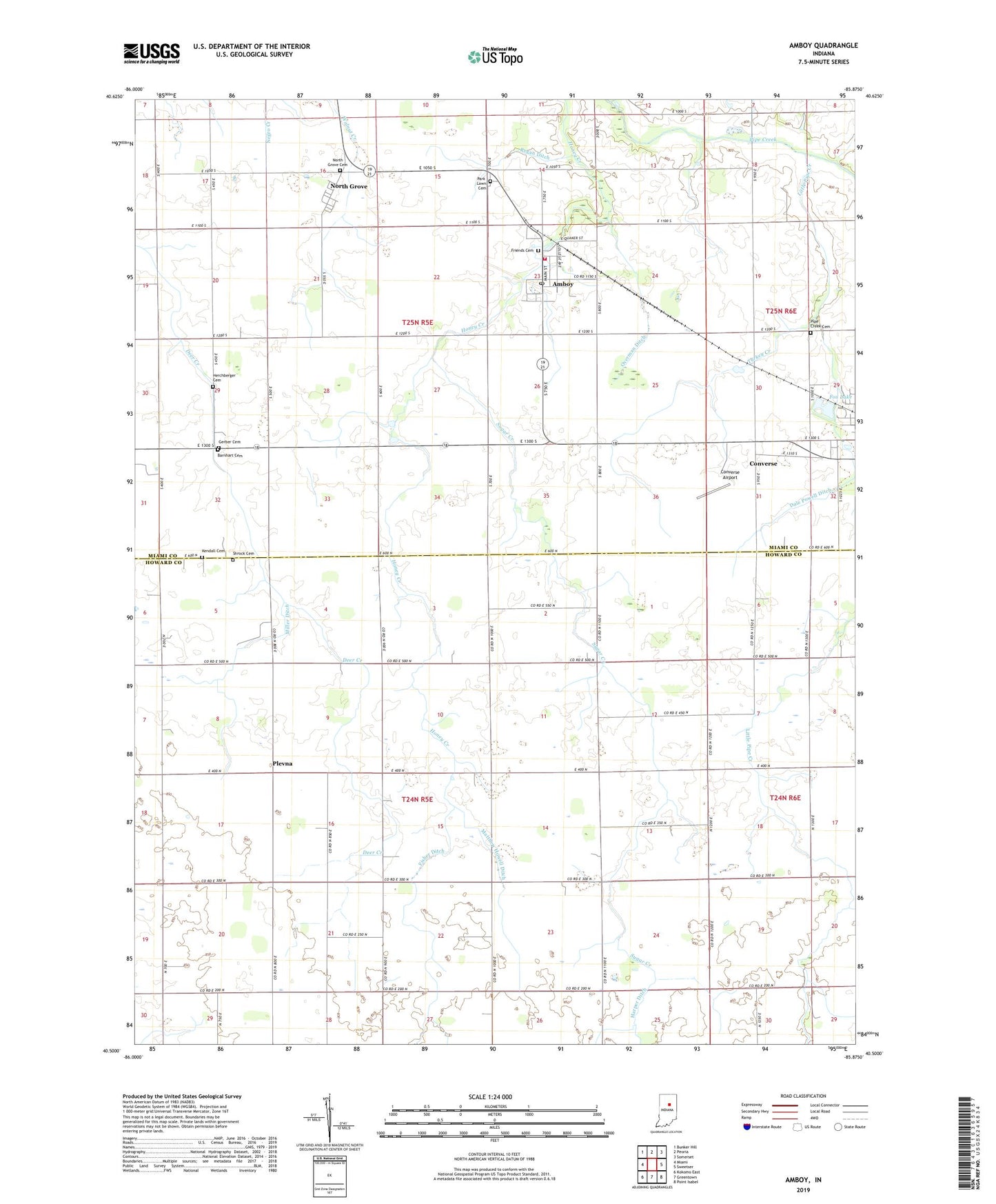
2022 topographic map quadrangle Amboy in the state of Indiana. Scale: 1:24000. Based on the newly updated USGS 7.5' US Topo map series, this map is in the following counties: Howard, Miami. The map contains contour data, water features, and other items you are used to seeing on USGS maps, but also has updated roads and other features. This is the next generation of topographic maps. Printed on high-quality waterproof paper with UV fade-resistant inks.
Quads adjacent to this one:
West: Miami
Northwest: Bunker Hill
North: Peoria
Northeast: Somerset
East: Sweetser
Southeast: Point Isabel
South: Greentown
Southwest: Kokomo East
This map covers the same area as the classic USGS quad with code o40085e8.
Contains the following named places: Amboy, Amboy Post Office, Amboy Volunteer Fire Company, Amboy Volunteer Fire Department, Barnhart Cemetery, Converse Airport, Converse Volunteer Ambulance - Substation, Dale Powell Ditch, Dunkard Church, Eastern Jackson School, Fisher Ditch, Fox Lake, Friends Cemetery, Gerber Cemetery, Harper Ditch, Herchberger Cemetery, Honey Creek Church, Howard Miami Church, Kendall Cemetery, Little Pipe Creek, Matthew Howell Ditch, Miller Ditch, North Grove, North Grove Cemetery, Overman Ditch, Park Lawn Cemetery, Pipe Creek Cemetery, Plevna, Regan Ditch, Shrock Cemetery, Sugar Creek, Town of Amboy, Township of Harrison, Township of Jackson, Township of Liberty, Turkey Creek