MyTopo
Miami Indiana US Topo Map
Couldn't load pickup availability
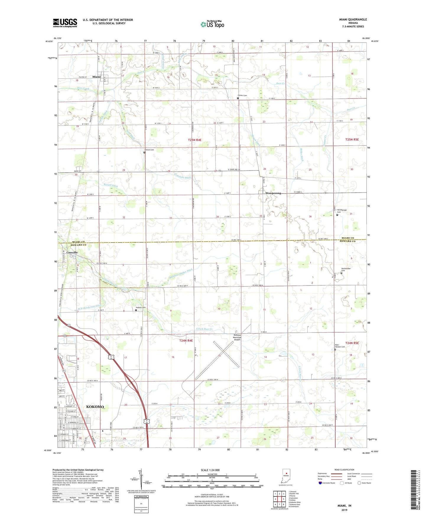
2022 topographic map quadrangle Miami in the state of Indiana. Scale: 1:24000. Based on the newly updated USGS 7.5' US Topo map series, this map is in the following counties: Howard, Miami. The map contains contour data, water features, and other items you are used to seeing on USGS maps, but also has updated roads and other features. This is the next generation of topographic maps. Printed on high-quality waterproof paper with UV fade-resistant inks.
Quads adjacent to this one:
West: Galveston
Northwest: Onward
North: Bunker Hill
Northeast: Peoria
East: Amboy
Southeast: Greentown
South: Kokomo East
Southwest: Kokomo West
This map covers the same area as the classic USGS quad with code o40086e1.
Contains the following named places: Bennetts Switch, Bon Air Elementary and Middle School, Bon Air Park, Cassville, Chitick Cemetery, Climer Cemetery, Copper Creek, Coucher Ditch, Dorflingers Airport, Grinslade Ditch, Hershberger Cemetery, Hochstedler Cemetery, Hudson Cemetery, Jenkins Ditch, Klise Ditch, Kokomo Municipal Airport, Kokomo Zion Church, Mast - Hensler Cemetery, Matthew Anaker Ditch, Miami, Miller Ditch, Rich Valley Church, Riley School, Shrock Ditch, Township of Clay, Township of Howard, W N Henderson Ditch, Wawpecong, Wise Ditch, ZIP Code: 46959