MyTopo
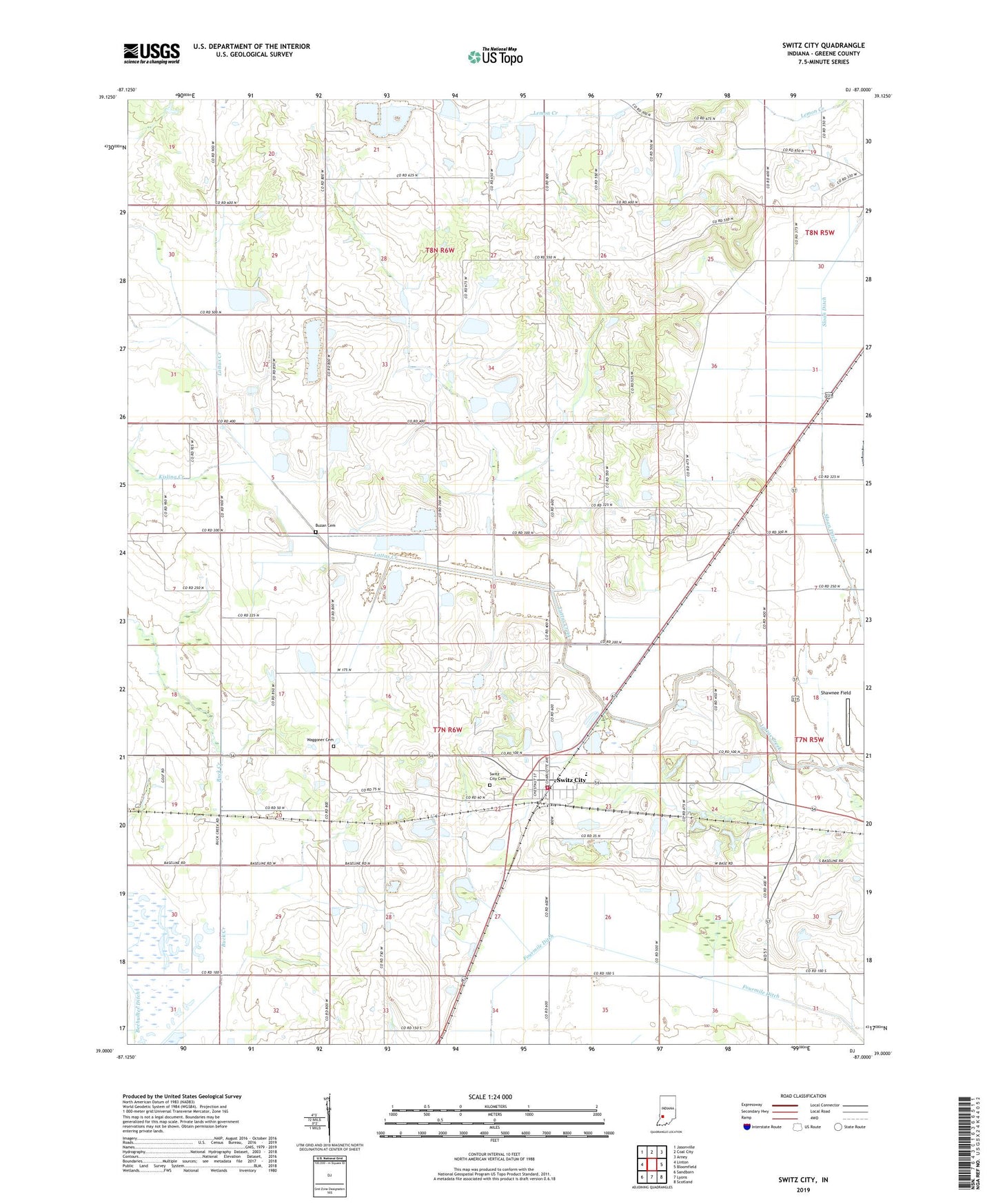
Switz City Indiana US Topo Map
Couldn't load pickup availability
2022 topographic map quadrangle Switz City in the state of Indiana. Scale: 1:24000. Based on the newly updated USGS 7.5' US Topo map series, this map is in the following counties: Greene. The map contains contour data, water features, and other items you are used to seeing on USGS maps, but also has updated roads and other features. This is the next generation of topographic maps. Printed on high-quality waterproof paper with UV fade-resistant inks.
Quads adjacent to this one:
West: Linton
Northwest: Jasonville
North: Coal City
Northeast: Arney
East: Bloomfield
Southeast: Scotland
South: Lyons
Southwest: Sandborn
This map covers the same area as the classic USGS quad with code o39087a1.
Contains the following named places: @ Bohley Cemetery, 47465, Buzan Cemetery, Dixon, Fairplay - Grant Fire Protection Territory, Fourmile Ditch, Hall Branch, Harrah Chapel, Shawnee Field, Switz City, Switz City Cemetery, Switz City Central School, Switz City Post Office, Tally Cemetery, Town of Switz City, Township of Fairplay, Township of Grant, Waggoner Cemetery