MyTopo
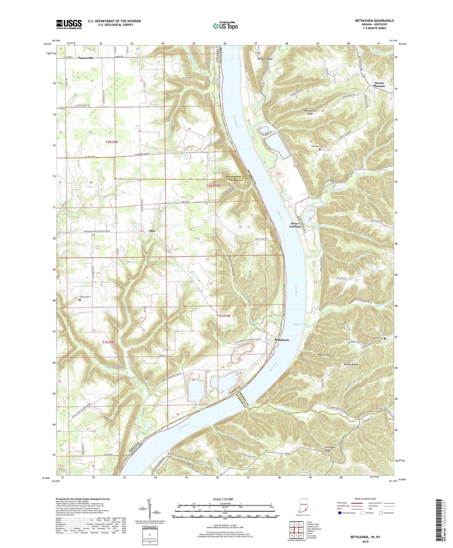
Bethlehem Indiana US Topo Map
Couldn't load pickup availability
2023 topographic map quadrangle Bethlehem in the states of Indiana, Kentucky. Scale: 1:24000. Based on the newly updated USGS 7.5' US Topo map series, this map is in the following counties: Clark, Trimble, Jefferson, Oldham. The map contains contour data, water features, and other items you are used to seeing on USGS maps, but also has updated roads and other features. This is the next generation of topographic maps. Printed on high-quality waterproof paper with UV fade-resistant inks.
Quads adjacent to this one:
West: New Washington
Northwest: Kent
North: Madison West
Northeast: Madison East
East: Bedford
Southeast: Smithfield
South: La Grange
Southwest: Owen
Contains the following named places: Abbott Hollow, Barebone Creek, Bells Branch, Bethel Church, Bethlehem, Bethlehem Reach, Big Saluda Creek, Browning Branch, Carters Branch, Corn Creek, Covington Church, Covington Ridge, Dodson Hollow, Dog Branch, Doolittle Hollow, Elizabeth Church, Hurricane Hollow, Jeff Branch, King Landing, Knob Creek, Little Camp Creek, Little Saluda Creek, Mahoney Cemetery, Marble Hill, Marble Hill Nuclear Power Station, Middle Creek, Miles Point, Morton Cemetery, Mount Pleasant, Otto, Pattersons Landing, Pattons Creek, Paynesville, Phillips Branch, Ralston Cemetery, Schoolhouse Branch, Squaw Creek, Township of Bethlehem, Trimble County Emergency Response Team - Louisville Gas and Electric, Turner Cemetery, Wentworth Ridge, Wesley Chapel, Wises Landing, ZIP Codes: 47104, 47162