MyTopo
La Grange Kentucky US Topo Map
Couldn't load pickup availability
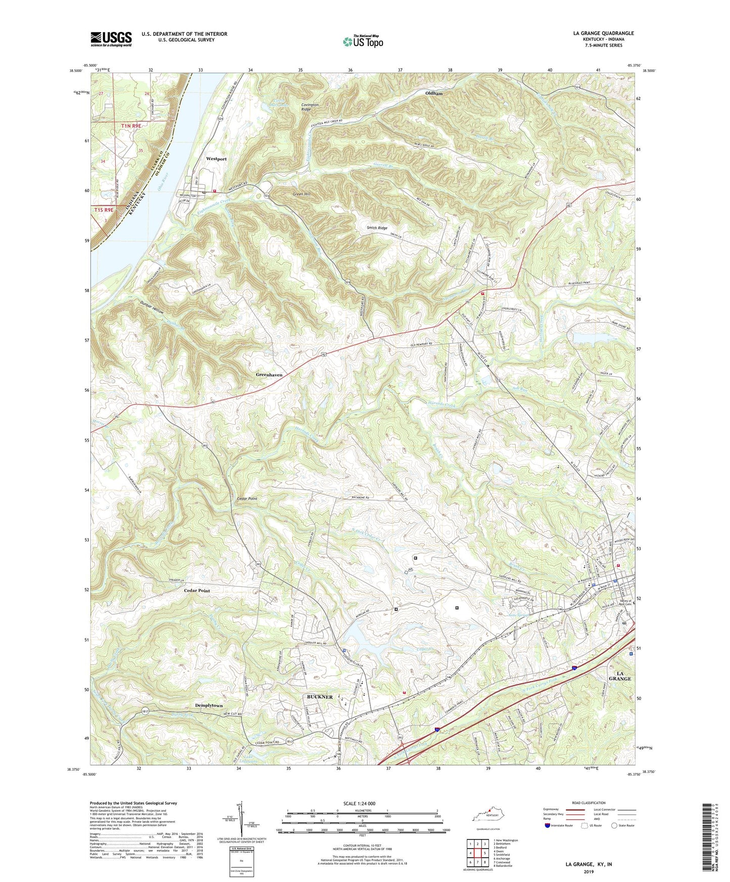
2022 topographic map quadrangle La Grange in the state of Kentucky. Scale: 1:24000. Based on the newly updated USGS 7.5' US Topo map series, this map is in the following counties: Oldham, Clark. The map contains contour data, water features, and other items you are used to seeing on USGS maps, but also has updated roads and other features. This is the next generation of topographic maps. Printed on high-quality waterproof paper with UV fade-resistant inks.
Quads adjacent to this one:
West: Owen
Northwest: New Washington
North: Bethlehem
Northeast: Bedford
East: Smithfield
Southeast: Ballardsville
South: Crestwood
Southwest: Anchorage
This map covers the same area as the classic USGS quad with code o38085d4.
Contains the following named places: Anita Springs, Ash Run, Baptist Health La Grange, Brush Creek, Buckner, Buckner Census Designated Place, Caney Fork, Cedar Creek, Cedar Point, Circle Dart Lake, City of La Grange, Darby Fork, Demplytown, Dunbar Branch, Dunbar Hollow, Eighteenmile Church, Eighteenmile Creek, Eighteenmile Island, Garrett Branch, Green Hill, Greenhaven, Harris Branch, Kentucky State Reformatory, La Grange, La Grange Division, La Grange Elementary School, La Grange Fire and Rescue, La Grange Fire and Rescue Department Station 2, La Grange Police Department, La Grange Post Office, La Grange Square Shopping Center, Lake Lotawata, Luther Luckett Correctional Complex, North Fork Cedar Creek, Oldham, Oldham County, Oldham County Emergency Medical Services, Oldham County Police Department, Oldham County Sheriff's Office, Reformatory Lake, Roederer Correctional Complex, Russell Corner, Smith Ridge, Sycamore Run, Valley of Rest Cemetery, WAVE-TV (Louisville), Westport, Westport Census Designated Place, Westport Post Office, Westport Volunteer Fire Department, ZIP Codes: 40031, 40077