MyTopo
New Washington Indiana US Topo Map
Couldn't load pickup availability
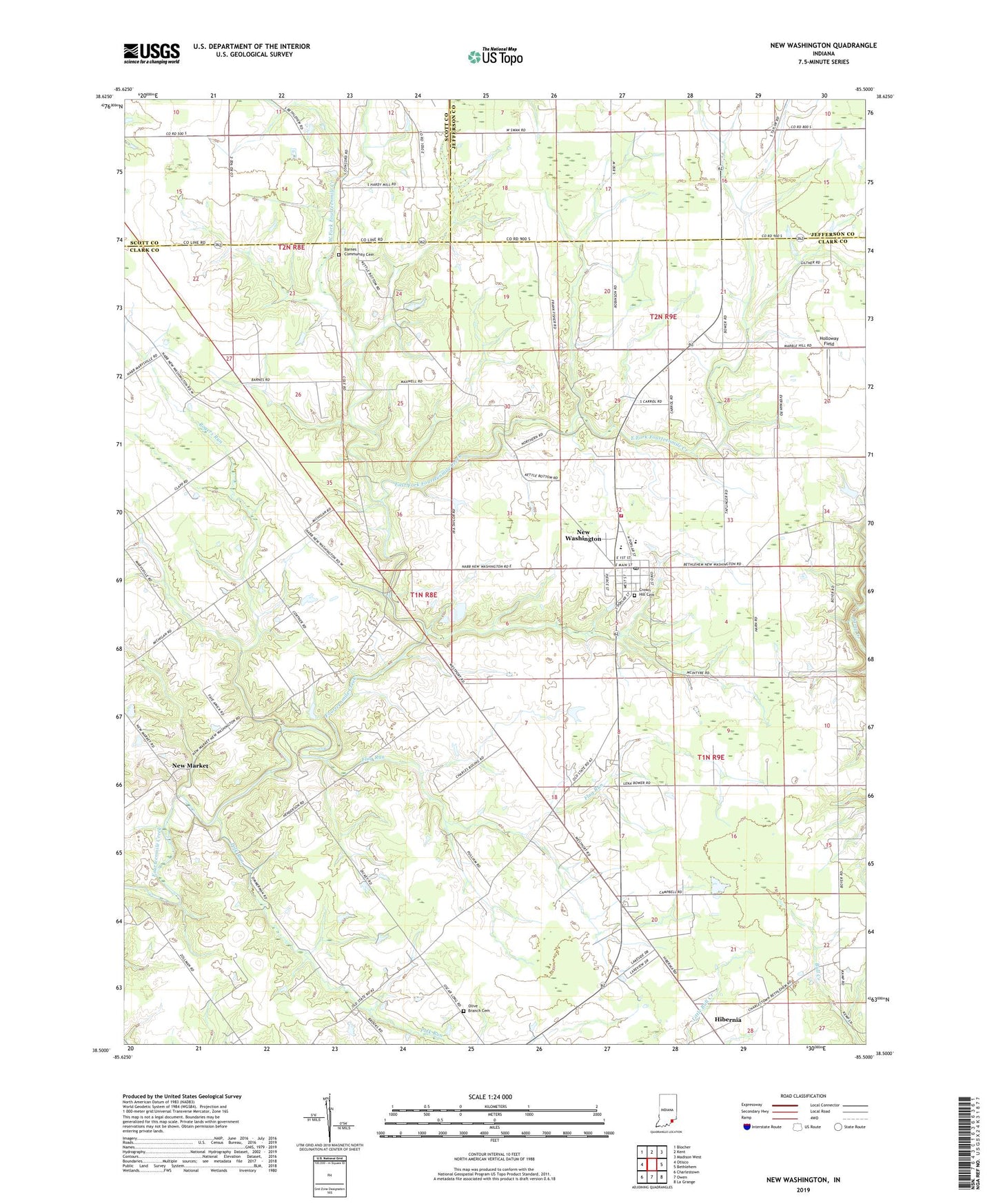
2022 topographic map quadrangle New Washington in the state of Indiana. Scale: 1:24000. Based on the newly updated USGS 7.5' US Topo map series, this map is in the following counties: Clark, Jefferson, Scott. The map contains contour data, water features, and other items you are used to seeing on USGS maps, but also has updated roads and other features. This is the next generation of topographic maps. Printed on high-quality waterproof paper with UV fade-resistant inks.
Quads adjacent to this one:
West: Otisco
Northwest: Blocher
North: Kent
Northeast: Madison West
East: Bethlehem
Southeast: La Grange
South: Owen
Southwest: Charlestown
This map covers the same area as the classic USGS quad with code o38085e5.
Contains the following named places: Barnes Community Cemetery, Camp Creek, Crown Hill Cemetery, East Fork Fourteenmile Creek, Flag Run, Hibernia, Holloway Field, New Market, New Washington, New Washington Census Designated Place, New Washington Fire Department, New Washington Post Office, New Washington Volunteer Fire Department, Olive Branch Cemetery, Pleasant View Church, Polk Run, Polk Run Post Office, Rogers Run, Township of Washington, Tryus Church, Twin Lakes Airport, West Fork Fourteenmile Creek, ZIP Codes: 47141, 47147