MyTopo
Owen Indiana US Topo Map
Couldn't load pickup availability
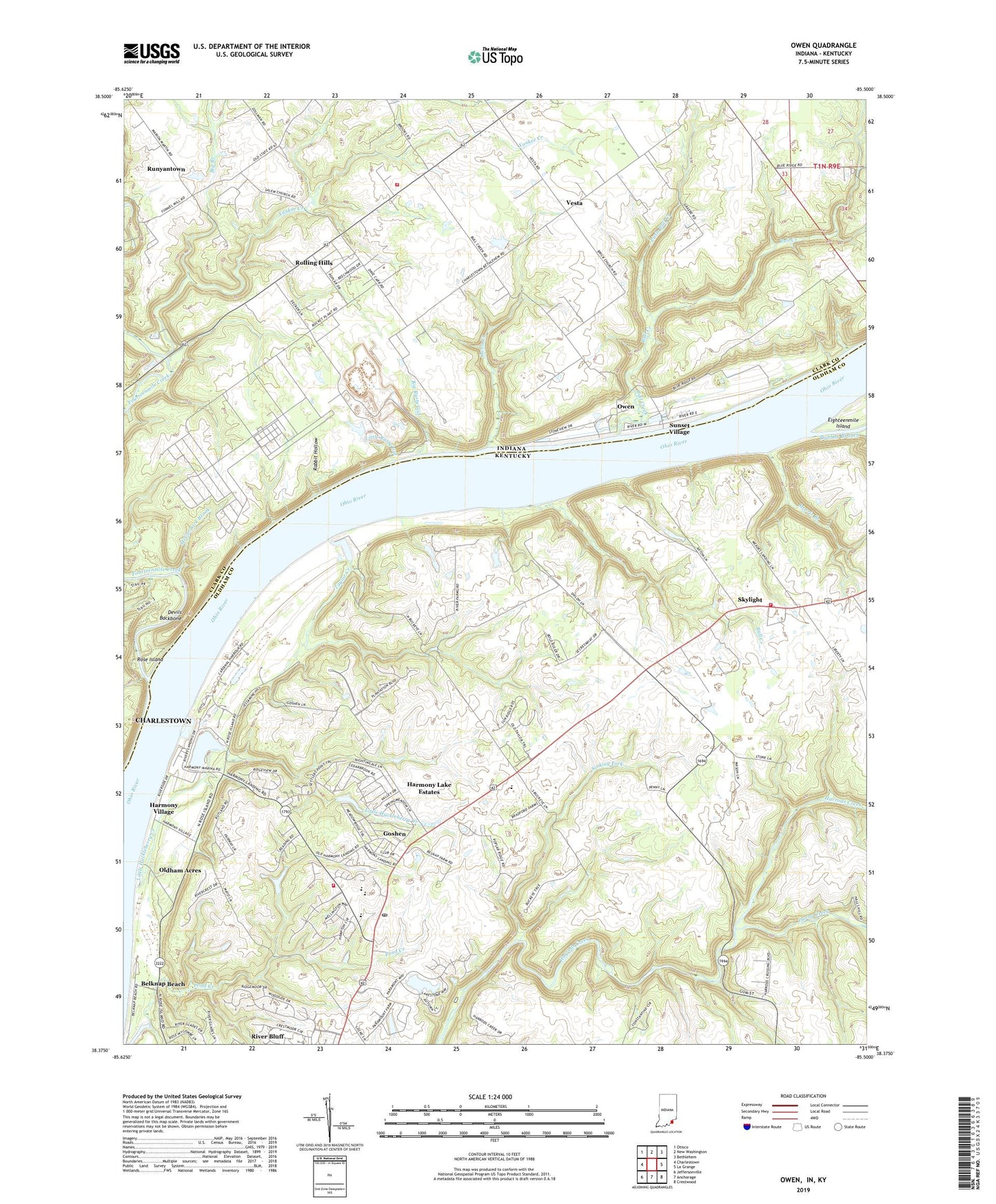
2022 topographic map quadrangle Owen in the state of Indiana. Scale: 1:24000. Based on the newly updated USGS 7.5' US Topo map series, this map is in the following counties: Clark, Oldham. The map contains contour data, water features, and other items you are used to seeing on USGS maps, but also has updated roads and other features. This is the next generation of topographic maps. Printed on high-quality waterproof paper with UV fade-resistant inks.
Quads adjacent to this one:
West: Charlestown
Northwest: Otisco
North: New Washington
Northeast: Bethlehem
East: La Grange
Southeast: Crestwood
South: Anchorage
Southwest: Jeffersonville
Contains the following named places: Belknap Beach, Bull Creek, City of Goshen, Darby Creek, Goshen, Goshen Post Office, Halls Landing, Harmony Lake Estates, Harmony Landing, Harmony Landing Country Club, Harmony Village, Liberty, Liberty Elementary School, Liberty School, Little Huckleberry Creek, Little Vine Church, Morris Branch, North Oldham Fire Department - Goshen Station, North Oldham Fire Department Station 2, Oldham Acres, Rule Church, Shiloh Methodist Church, Sinking Fork, Skylight, South Fork Darby Creek, Taylor Creek, ZIP Code: 40026