MyTopo
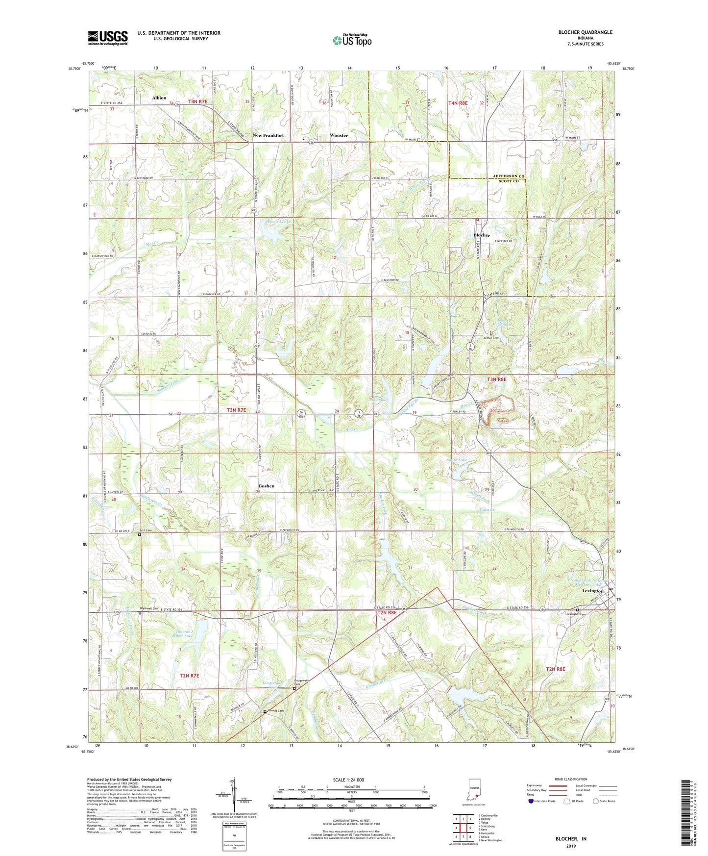
Blocher Indiana US Topo Map
Couldn't load pickup availability
2022 topographic map quadrangle Blocher in the state of Indiana. Scale: 1:24000. Based on the newly updated USGS 7.5' US Topo map series, this map is in the following counties: Scott, Jefferson. The map contains contour data, water features, and other items you are used to seeing on USGS maps, but also has updated roads and other features. This is the next generation of topographic maps. Printed on high-quality waterproof paper with UV fade-resistant inks.
Quads adjacent to this one:
West: Scottsburg
Northwest: Crothersville
North: Deputy
Northeast: Volga
East: Kent
Southeast: New Washington
South: Otisco
Southwest: Henryville
This map covers the same area as the classic USGS quad with code o38085f6.
Contains the following named places: Albion, Bethel Cemetery, Blocher, Bridgewater Cemetery, Clarks Grant Park, Emmanuel Church, Englishton Park Home, Estil Cemetery, Goshen, Hardy Quarry, Hog Creek, Hopewell Cemetery, Howard Lake, Johnson Township Volunteer Fire Department, Kimberlin Creek, Kimberlin Creek Church, Kinderhook Lake, Lake McCulloch, Leroy Smith Lake Dam, Lexington, Lexington Cemetery, Lexington Elementary School, Lexington Post Office, Morgan Trail Park, New Frankfort, Newland Creek, Pine Lake, Pine Lake Dam, Pleasant Ridge Church, Presbyterian National Missions Lake, Presbyterian National Missions Lake Dam, Reeves Cemetery, Scaffold Lick Church, Scott County, Scott County Quarry, Smith Lake, Stucker Fork Structure Number 4, Thomas J Miller Lake, Thomas J Miller Lake Dam, Town Creek, Township of Lexington, White Eye Branch, Woods Fork, Wooster