MyTopo
Henryville Indiana US Topo Map
Couldn't load pickup availability
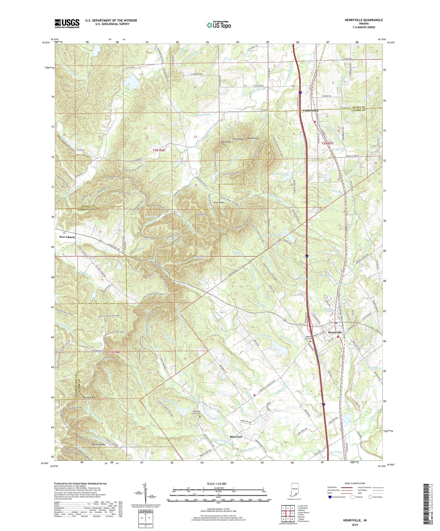
2022 topographic map quadrangle Henryville in the state of Indiana. Scale: 1:24000. Based on the newly updated USGS 7.5' US Topo map series, this map is in the following counties: Clark, Scott, Washington. The map contains contour data, water features, and other items you are used to seeing on USGS maps, but also has updated roads and other features. This is the next generation of topographic maps. Printed on high-quality waterproof paper with UV fade-resistant inks.
Quads adjacent to this one:
West: South Boston
Northwest: Little York
North: Scottsburg
Northeast: Blocher
East: Otisco
Southeast: Charlestown
South: Speed
Southwest: Borden
This map covers the same area as the classic USGS quad with code o38085e7.
Contains the following named places: Bartle Knobs, Berry Run, Big Bass Lake, Blue Lick, Blue Lick Church, Blue Lick Creek, Bowen Lake, Bowen Lake Dam, Bowen Run, Bowers Creek, Bull Run, Calf Run, Caney Fork, Country Lake, Country Lake Camp Dam, Cow Run, Fairview Church, Franke Lake, Franke Lake Dam, Grain Run, Guernsey Creek, Hall Run, Henry Brook, Henryville, Henryville Census Designated Place, Henryville Elementary School, Henryville Junior and Senior High School, Henryville Post Office, Hilltop Run, Leaf Run, Left Branch Blue Lick Creek, Left Drain, Lodge Creek, Look Run, Meal Run, Middle Poplar Branch, Milk Brook, Mill Branch, Monroe Township Fire Department, Monroe Township Volunteer Fire Department Station 2, Monroe Township Volunteer Fire Department Station 3, Mount Zion Cemetery, Mountain Grove, Mountain Grove Cemetery, New Chapel Church, New Liberty, New Liberty Field, North Branch Big Ox Creek, North Fairview Run, Oak Knob, Oak Lake, Oak Run, Out Brook, Pigeon Roost Memorial, Pigeon Roost Station, Pine Knob, Pine Lake, Pine Run, Purdue University Forestry Camp, Rain Run, Right Branch Blue Lick Creek, Right Drain, Rock Knob, Roger Creek, Round Knob, Schlamm Lake, Schlamm Lake Dam, Sheep Branch, Silver Hills, South Branch Big Ox Creek, South Fairview Run, Stick Run, Sticky Branch, Swing Brook, Township of Monroe, Try Run, Underwood, Underwood Drain, Underwood Run, Vote Run, Weed Run, West Fork Silver Creek, Wheel Run, Willys Chapel, WMPI-FM (Scottsburg), Wolf Run, Woof Lake, Wrong Branch, ZIP Codes: 47126, 47177