MyTopo
Canaan Indiana US Topo Map
Couldn't load pickup availability
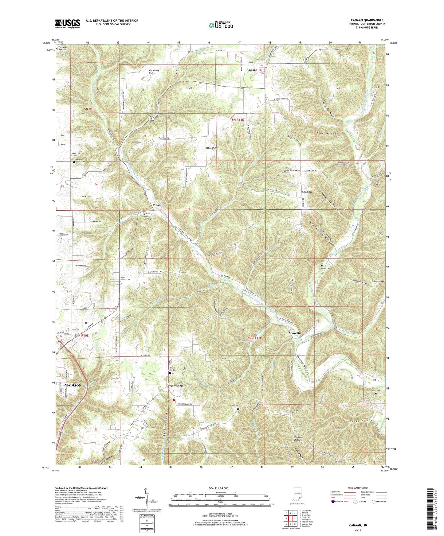
2022 topographic map quadrangle Canaan in the state of Indiana. Scale: 1:24000. Based on the newly updated USGS 7.5' US Topo map series, this map is in the following counties: Jefferson. The map contains contour data, water features, and other items you are used to seeing on USGS maps, but also has updated roads and other features. This is the next generation of topographic maps. Printed on high-quality waterproof paper with UV fade-resistant inks.
Quads adjacent to this one:
West: Clifty Falls
Northwest: San Jacinto
North: Rexville
Northeast: Cross Plains
East: Bennington
Southeast: Carrollton
South: Madison East
Southwest: Madison West
This map covers the same area as the classic USGS quad with code o38085g3.
Contains the following named places: Bacon Ridge, Blacksnake Hollow, Brushy Fork, Canaan, Canaan Census Designated Place, Canaan Elementary School, Canaan Post Office, Canaan Volunteer Fire Company, Central, Central School, China, Copeland Ridge, Dog Run, Dry Fork, Eagle Springs Grange Hall, Grandview Memorial Gardens, Greasy Hollow, Halls Ridge, Hebron Church Cemetery, Indian Kentuck Baptist Church, Indian Kentuck Cemetery, Indian Mound, Jefferson Lake, Joyce Cemetery, Kings Daughters Hospital, Manville, Milton Cemetery, Mount Pleasant Church, Mount Zion Church, Olive Branch Cemetery, Owl Hollow, Pleasant Ridge, Pleasant Ridge Church, Razor Fork, Reul Cemetery, Rykers Ridge, Rykers Ridge Baptist Church, Rykers Ridge Cemetery, Rykers Ridge Volunteer Fire Company, Saint Anthony Cemetery, Schnapps Creek, Seals Fork, Smith Cemetery, Sweetwater Hollow, Toddys Branch, Township of Shelby, Turkey Run, West Fork Indian Kentucky Creek, White Eye Hollow, Wolf Run, ZIP Code: 47250