MyTopo
Cross Plains Indiana US Topo Map
Couldn't load pickup availability
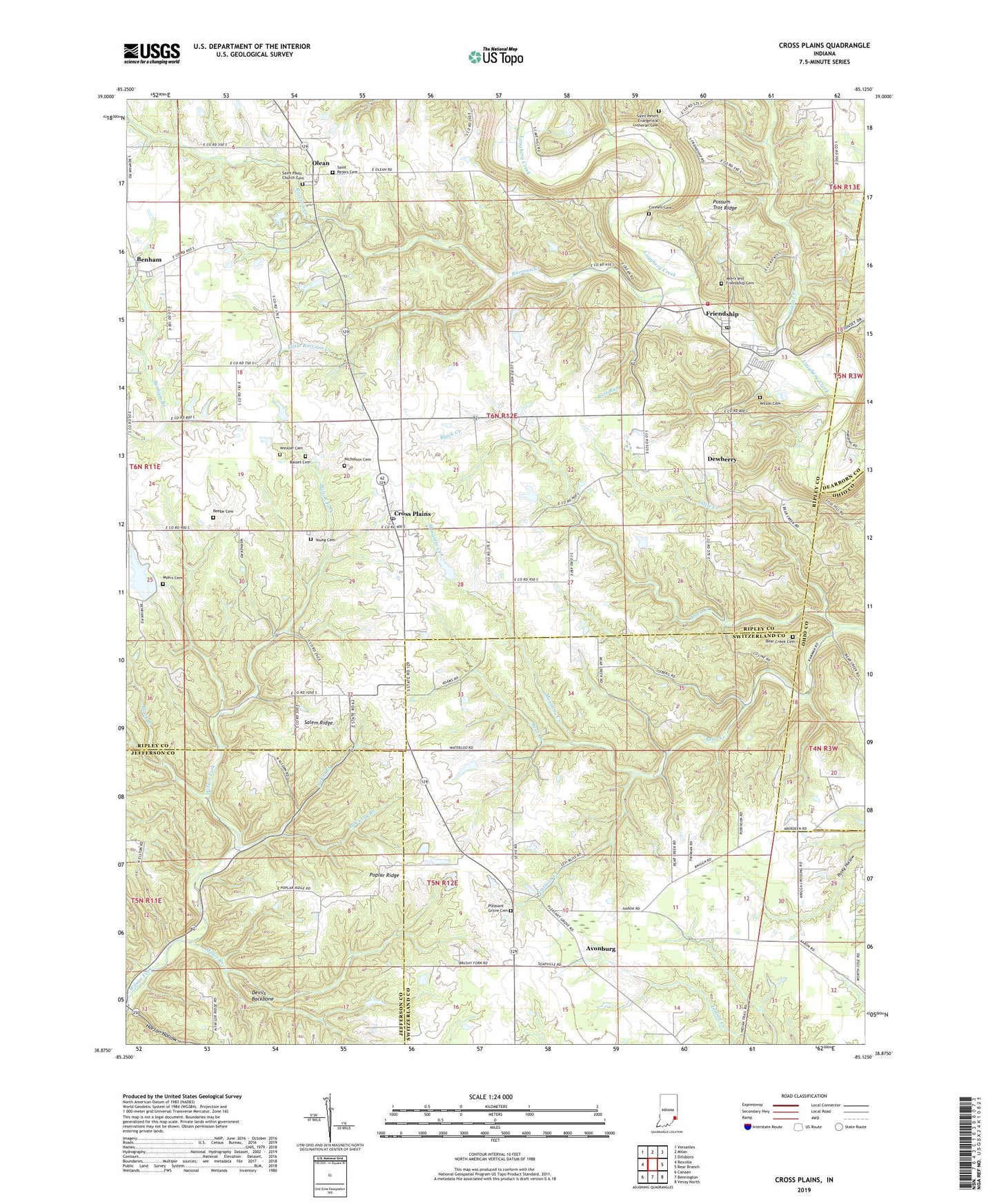
2022 topographic map quadrangle Cross Plains in the state of Indiana. Scale: 1:24000. Based on the newly updated USGS 7.5' US Topo map series, this map is in the following counties: Ripley, Switzerland, Jefferson, Ohio, Dearborn. The map contains contour data, water features, and other items you are used to seeing on USGS maps, but also has updated roads and other features. This is the next generation of topographic maps. Printed on high-quality waterproof paper with UV fade-resistant inks.
Quads adjacent to this one:
West: Rexville
Northwest: Versailles
North: Milan
Northeast: Dillsboro
East: Bear Branch
Southeast: Vevay North
South: Bennington
Southwest: Canaan
This map covers the same area as the classic USGS quad with code o38085h2.
Contains the following named places: Aaron, Akers and Friendship Cemetery, Arlington Avenue Baptist Church, Avonburg, Basset Cemetery, Bear Creek Cemetery, Bear Creek Church, Beebe Cemetery, Black Branch, Black Creek, Caesar Creek, Concord Church, Connell Cemetery, Cross Plains, Cross Plains Post Office, Devils Backbone, Dewberry, Friendship, Friendship Post Office, Friendship Volunteer Fire Department, Horton Hollow, Little Creek, Little Raccoon Creek, McCurry Branch, Miller Branch, Mosquito Creek, Myers Cemetery, Nicholson Cemetery, Olean, Pleasant Grove Cemetery, Pleasant Grove Church, Poplar Ridge, Possum Trot Ridge, Raccoon Creek, Rost Run, Saint Pauls Church, Saint Pauls Church Cemetery, Saint Peters Cemetery, Saint Peters Evangelical Lutheran Cemetery, Salem Branch, Salem Church, Salem Ridge, Township of Brown, Uhlman Creek, Wesley Chapel, Wilson Cemetery, Winkler Cemetery, Young Cemetery, ZIP Codes: 47017, 47224