MyTopo
Bennington Indiana US Topo Map
Couldn't load pickup availability
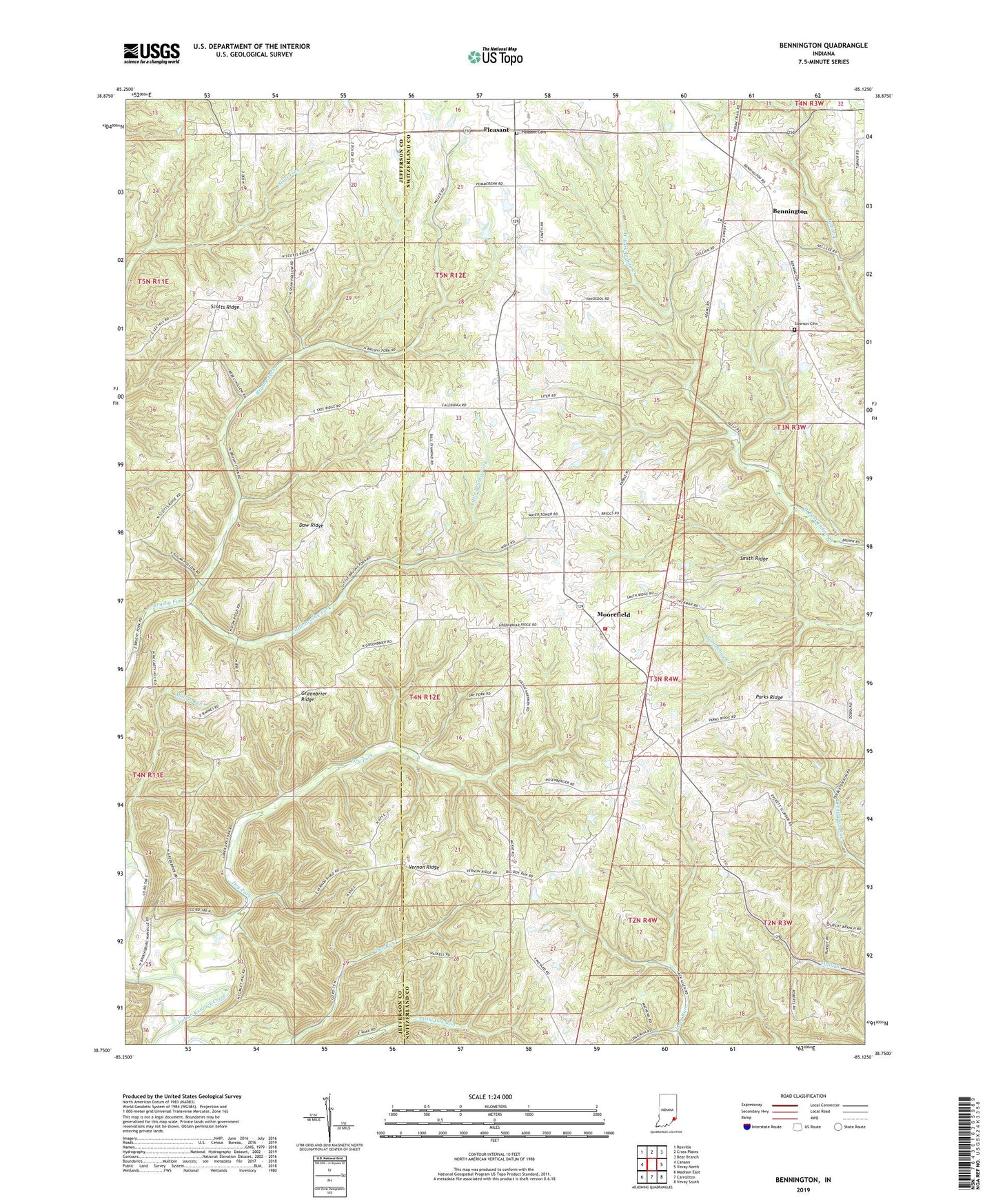
2022 topographic map quadrangle Bennington in the state of Indiana. Scale: 1:24000. Based on the newly updated USGS 7.5' US Topo map series, this map is in the following counties: Switzerland, Jefferson. The map contains contour data, water features, and other items you are used to seeing on USGS maps, but also has updated roads and other features. This is the next generation of topographic maps. Printed on high-quality waterproof paper with UV fade-resistant inks.
Quads adjacent to this one:
West: Canaan
Northwest: Rexville
North: Cross Plains
Northeast: Bear Branch
East: Vevay North
Southeast: Vevay South
South: Carrollton
Southwest: Madison East
This map covers the same area as the classic USGS quad with code o38085g2.
Contains the following named places: Bennington, Brushy Fork Church, Caledonia Church, Dow Ridge, Dry Fork, Ebenezer Church, Greenbrier Ridge, Home Chapel, Home Post Office, Little Brushy Fork, Long Run Church, Macedonia Church, Mollys Run, Moorefield, Moorefield Community Volunteer Fire Department, Parks Ridge, Pleasant, Pleasant Cemetery, Scotts Ridge, Slawson Cemetery, Smith Ridge, Township of Milton, Township of Pleasant, Vernon Ridge