MyTopo
Clarksburg Indiana US Topo Map
Couldn't load pickup availability
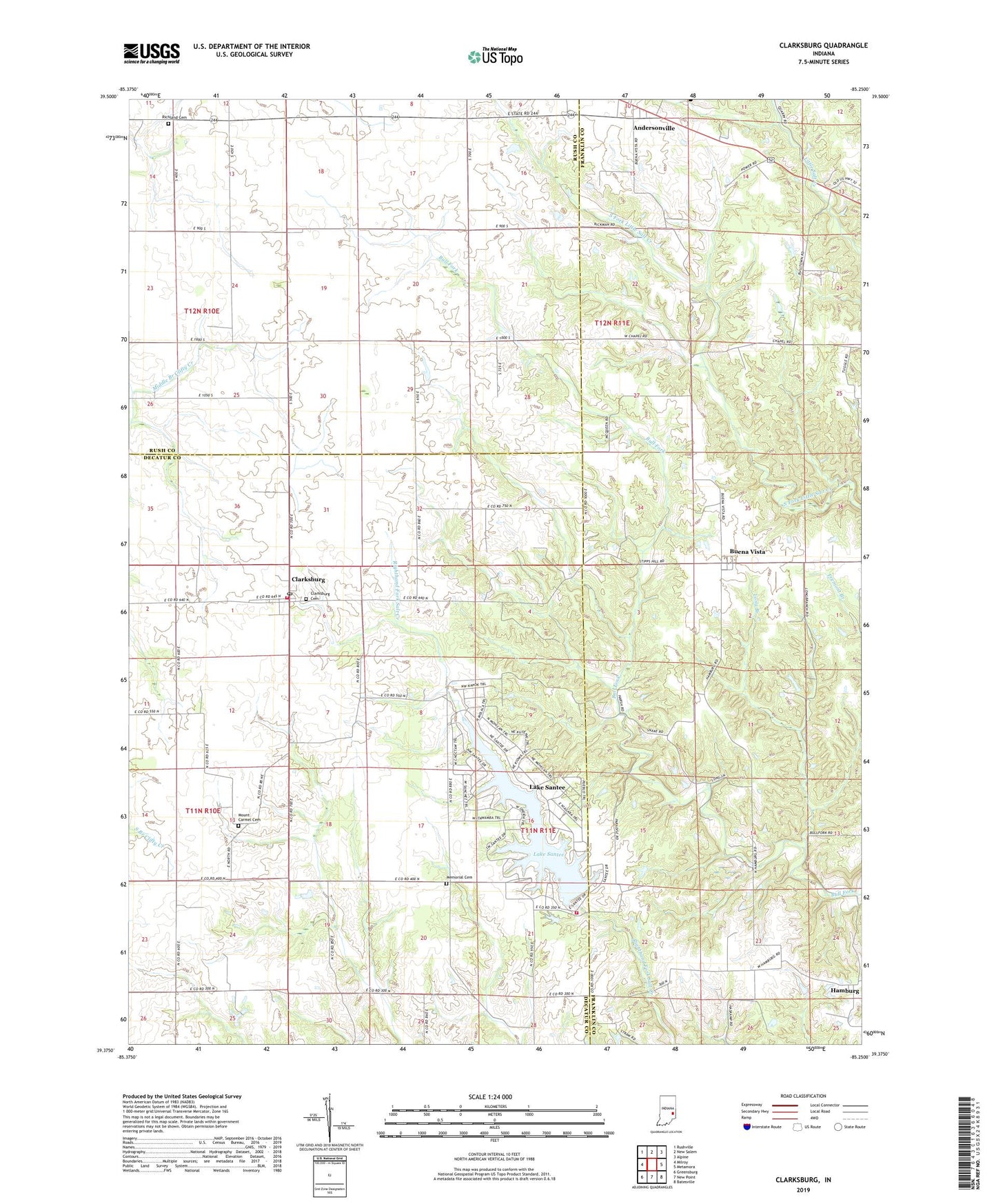
2022 topographic map quadrangle Clarksburg in the state of Indiana. Scale: 1:24000. Based on the newly updated USGS 7.5' US Topo map series, this map is in the following counties: Franklin, Decatur, Rush. The map contains contour data, water features, and other items you are used to seeing on USGS maps, but also has updated roads and other features. This is the next generation of topographic maps. Printed on high-quality waterproof paper with UV fade-resistant inks.
Quads adjacent to this one:
West: Milroy
Northwest: Rushville
North: New Salem
Northeast: Alpine
East: Metamora
Southeast: Batesville
South: New Point
Southwest: Greensburg
This map covers the same area as the classic USGS quad with code o39085d3.
Contains the following named places: Andersonville, Buena Vista, Chapel Church, Chapel School, Clarksburg, Clarksburg Cemetery, Clarksburg Census Designated Place, Clarksburg Community Volunteer Fire Department, Clarksburg Fire Station 2 Lake Santee, Clarksburg Post Office, Hamburg, Hopewell Church, Lake Santee, Lake Santee Census Designated Place, Lake Santee Dam, Long Branch, Memorial Cemetery, Mount Carmel Cemetery, Richland Cemetery, Township of Fugit, Township of Posey, Township of Richland