MyTopo
New Salem Indiana US Topo Map
Couldn't load pickup availability
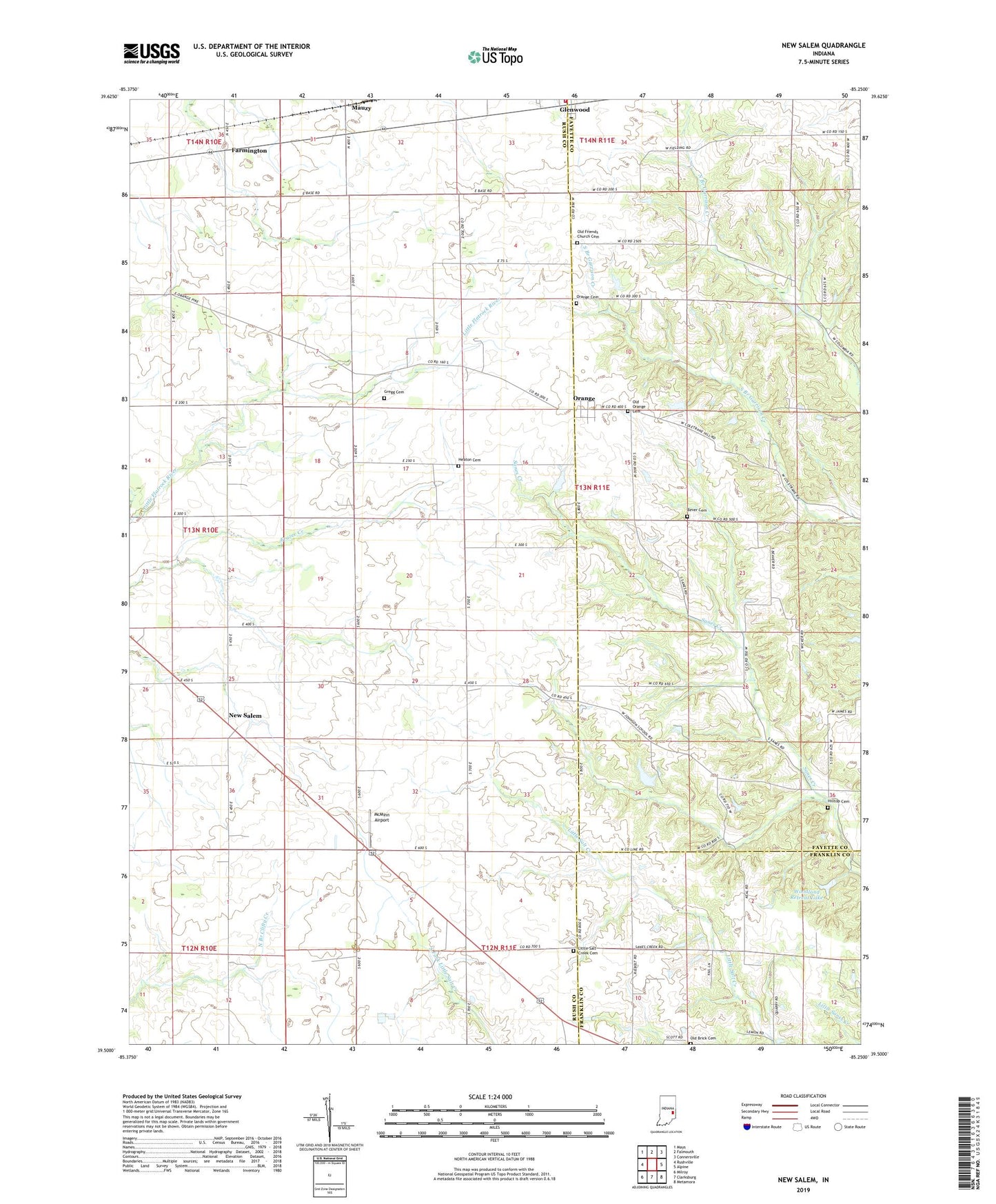
2022 topographic map quadrangle New Salem in the state of Indiana. Scale: 1:24000. Based on the newly updated USGS 7.5' US Topo map series, this map is in the following counties: Rush, Fayette, Franklin. The map contains contour data, water features, and other items you are used to seeing on USGS maps, but also has updated roads and other features. This is the next generation of topographic maps. Printed on high-quality waterproof paper with UV fade-resistant inks.
Quads adjacent to this one:
West: Rushville
Northwest: Mays
North: Falmouth
Northeast: Connersville
East: Alpine
Southeast: Metamora
South: Clarksburg
Southwest: Milroy
This map covers the same area as the classic USGS quad with code o39085e3.
Contains the following named places: Bever Cemetery, Farmington, Glenwood Volunteer Fire Department, Gregg Cemetery, Heaton Cemetery, Hilltop Cemetery, Little Flatrock Church, Little Salt Creek Cemetery, Mauzy, McMinn Airport, New Salem, New Salem Elementary and Junior High School, Old Brick Cemetery, Old Friends Church Cemetery, Old Orange Cemetery, Orange, Orange Cemetery, Sanes Creek Church, Township of Noble, Township of Orange, Woodland Retreat Dam, Woodland Retreat Lake, ZIP Code: 46133