MyTopo
Milroy Indiana US Topo Map
Couldn't load pickup availability
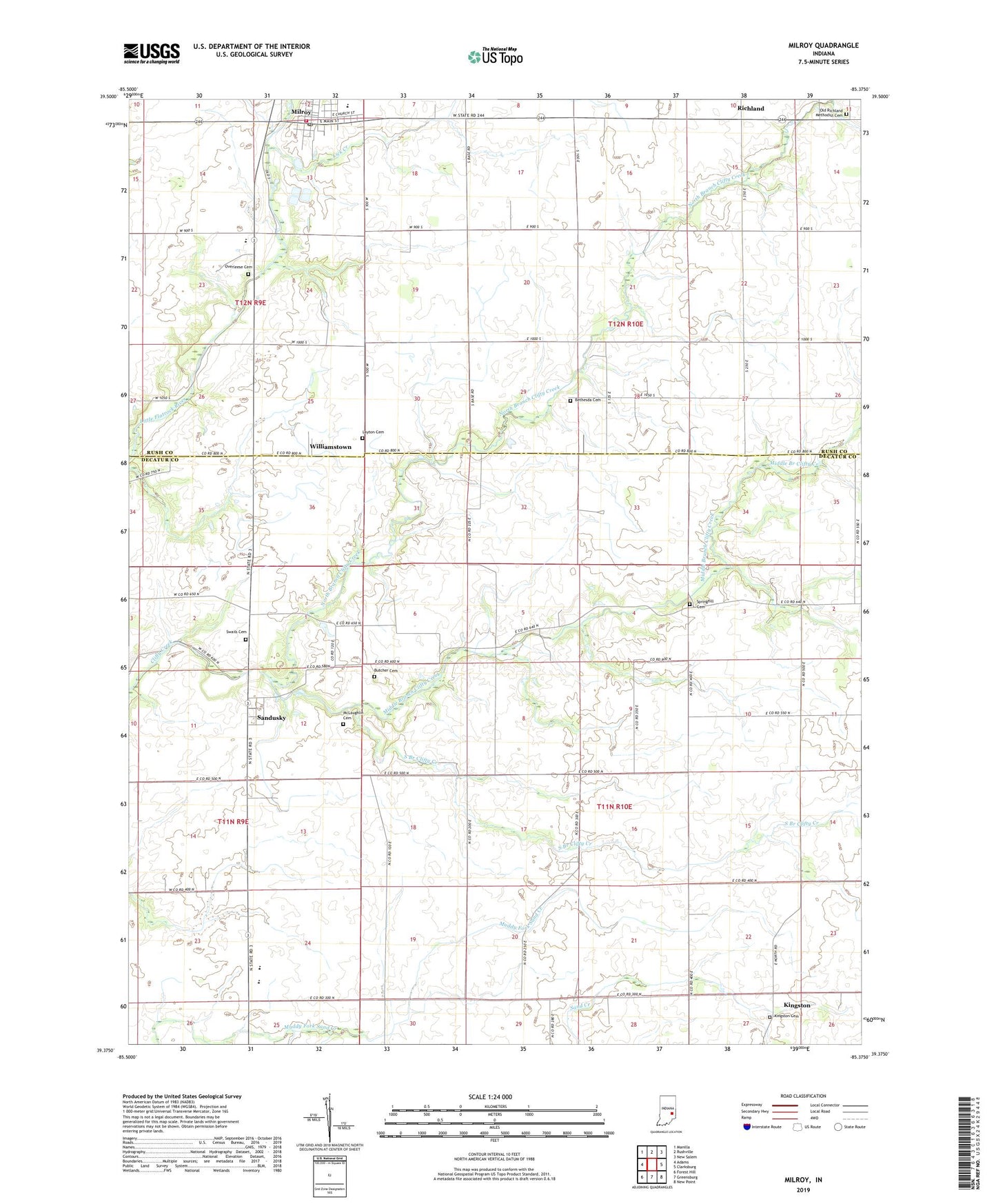
2022 topographic map quadrangle Milroy in the state of Indiana. Scale: 1:24000. Based on the newly updated USGS 7.5' US Topo map series, this map is in the following counties: Decatur, Rush. The map contains contour data, water features, and other items you are used to seeing on USGS maps, but also has updated roads and other features. This is the next generation of topographic maps. Printed on high-quality waterproof paper with UV fade-resistant inks.
Quads adjacent to this one:
West: Adams
Northwest: Manilla
North: Rushville
Northeast: New Salem
East: Clarksburg
Southeast: New Point
South: Greensburg
Southwest: Forest Hill
This map covers the same area as the classic USGS quad with code o39085d4.
Contains the following named places: Anderson Township Volunteer Fire Department, Bethesda Cemetery, Butcher Cemetery, Kingston, Kingston Cemetery, Layton Cemetery, Lick Creek, McLaughlin Cemetery, Middle Branch Clifty Creek, Milroy, Milroy Census Designated Place, Milroy Elementary and Junior High School, Milroy Emergency Medical Services, Milroy Post Office, North Branch Clifty Creek, Old Richland Methodist Cemetery, Overleese Cemetery, Richland, Sandusky, South Branch Clifty Creek, Springhill, Springhill Cemetery, Springhill Church, Swails Cemetery, Township of Anderson, Township of Clinton, Williamstown, ZIP Code: 46156