MyTopo
Clear Creek Indiana US Topo Map
Couldn't load pickup availability
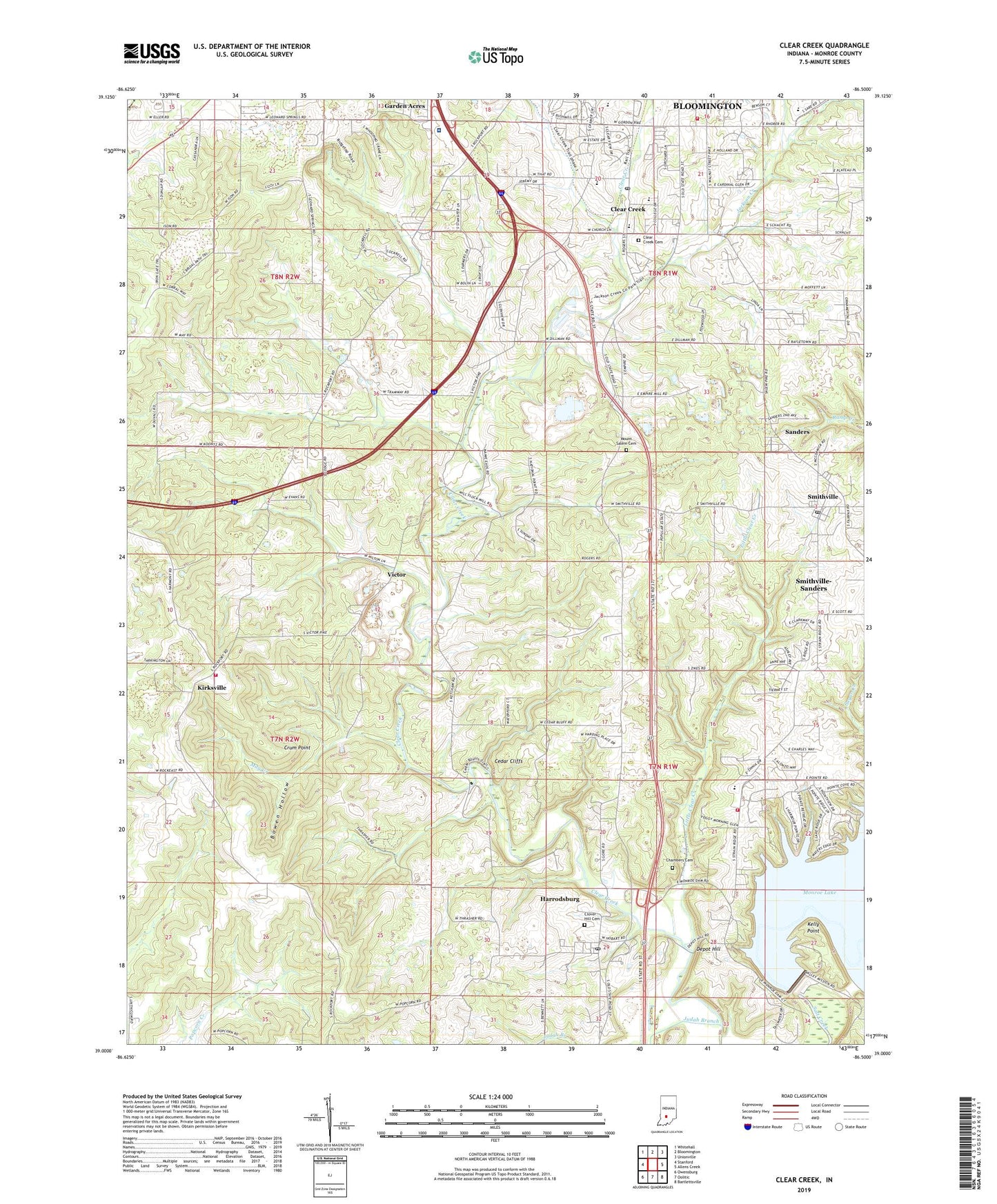
2022 topographic map quadrangle Clear Creek in the state of Indiana. Scale: 1:24000. Based on the newly updated USGS 7.5' US Topo map series, this map is in the following counties: Monroe. The map contains contour data, water features, and other items you are used to seeing on USGS maps, but also has updated roads and other features. This is the next generation of topographic maps. Printed on high-quality waterproof paper with UV fade-resistant inks.
Quads adjacent to this one:
West: Stanford
Northwest: Whitehall
North: Bloomington
Northeast: Unionville
East: Allens Creek
Southeast: Bartlettsville
South: Oolitic
Southwest: Owensburg
This map covers the same area as the classic USGS quad with code o39086a5.
Contains the following named places: Bloomington Speedway, Bowen Hollow, Cedar Cliffs, Chambers Cemetery, Clear Creek, Clear Creek Cemetery, Clear Creek Post Office, Clover Hill Cemetery, Crum Point, Deelsville Church, Depot Hill, Garden Acres, Harrodsburg, Harrodsburg Census Designated Place, Harrodsburg Post Office, Indian Creek School, Indian Creek Volunteer Firefighters, Jackson Creek, Judah Branch, Kelly Point, Kirksville, Little Clear Creek, May Creek, Mays Greenhouse, Monroe Fire Protection District Headquartes Station 11, Monroe Hospital, Monroe Lake Dam, Mount Salem Cemetery, Perry - Clear Creek Fire Department Station 21, Sanders, Sanders Elementary School, Smithville, Smithville Post Office, Smithville-Sanders Census Designated Place, South Side Church, South Union Church, Starlite Drive-In, Sugar Creek, Township of Clear Creek, Township of Perry, Victor, Walkers Chapel, ZIP Codes: 47403, 47434, 47458