MyTopo
Unionville Indiana US Topo Map
Couldn't load pickup availability
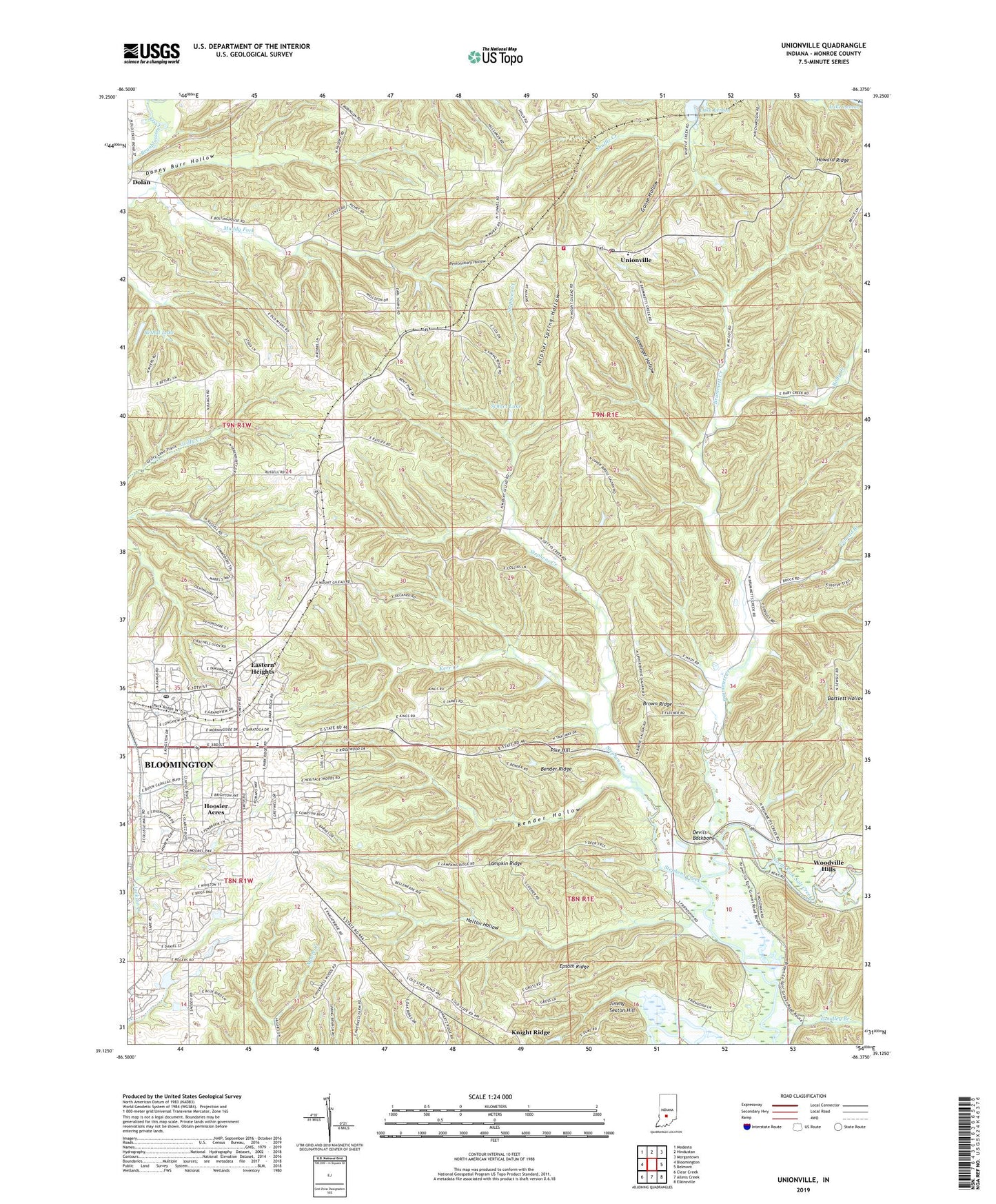
2022 topographic map quadrangle Unionville in the state of Indiana. Scale: 1:24000. Based on the newly updated USGS 7.5' US Topo map series, this map is in the following counties: Monroe. The map contains contour data, water features, and other items you are used to seeing on USGS maps, but also has updated roads and other features. This is the next generation of topographic maps. Printed on high-quality waterproof paper with UV fade-resistant inks.
Quads adjacent to this one:
West: Bloomington
Northwest: Modesto
North: Hindustan
Northeast: Morgantown
East: Belmont
Southeast: Elkinsville
South: Allens Creek
Southwest: Clear Creek
This map covers the same area as the classic USGS quad with code o39086b4.
Contains the following named places: Baby Creek, Bender Hollow, Bender Ridge, Benton Township Volunteer Fire, Benton Township Volunteer Fire Department, Bethal Lake, Bethal Lake Dam, Bethel Lane Church, Bridge Church, Brown Ridge, Brummett Creek, Brummett Creek Church, Buzzard Roost Recreation Area, College Mall Shopping Center, Conrad Branch, Danny Burr Hollow, Devils Backbone, Dolan, Dolan Ridge Mission, Eastern Heights, Epsom Ridge, Friendship Church, Goodley Branch, Goose Hollow, Helton Hollow, Hoosier Acres, Isominger Hollow, Jimmy Sexton Hill, Kerr Creek, Knight Ridge, Lampkin Ridge, Little Union Church, Locust Grove Church, Mount Gilead Church, New Unionville, Penitentiary Hollow, Philips School, Pike Hill, Saint Marks Church, Schacht Lake Dam, Schact Lake, Shuffle Creek, Stephens Creek, Sulphur Spring Hollow, Township of Benton, Unionville, Unionville Elementary School, Unionville Middle School, Unionville Post Office, WBWB-FM (Bloomington), WFIU-FM (Bloomington), Woodbridge Post Office, Woodville Hills, WTIU-TV (Bloomington), ZIP Code: 47408