MyTopo
Shirley Indiana US Topo Map
Couldn't load pickup availability
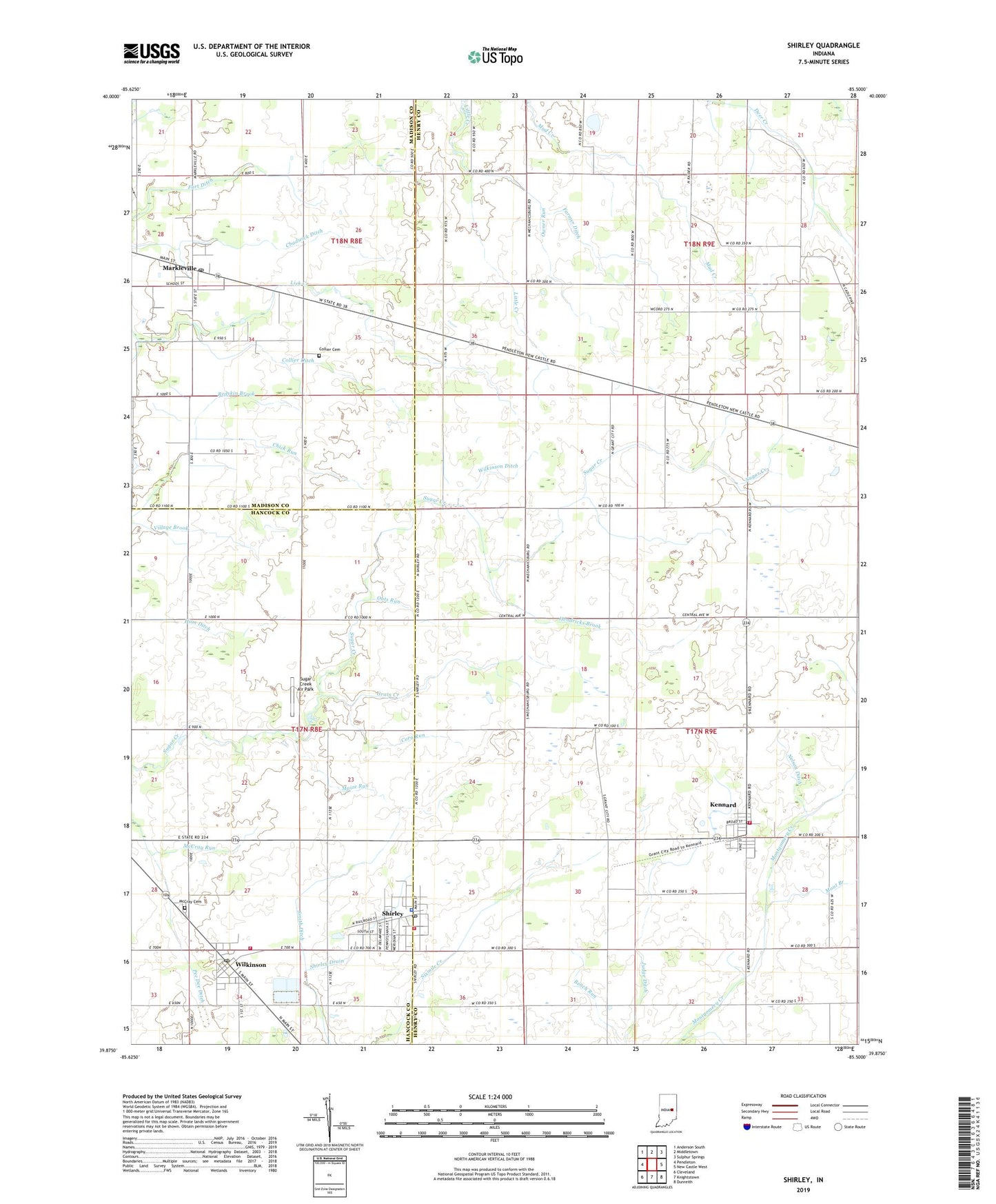
2022 topographic map quadrangle Shirley in the state of Indiana. Scale: 1:24000. Based on the newly updated USGS 7.5' US Topo map series, this map is in the following counties: Henry, Hancock, Madison. The map contains contour data, water features, and other items you are used to seeing on USGS maps, but also has updated roads and other features. This is the next generation of topographic maps. Printed on high-quality waterproof paper with UV fade-resistant inks.
Quads adjacent to this one:
West: Pendleton
Northwest: Anderson South
North: Middletown
Northeast: Sulphur Springs
East: New Castle West
Southeast: Dunreith
South: Knightstown
Southwest: Cleveland
This map covers the same area as the classic USGS quad with code o39085h5.
Contains the following named places: Center Chapel, Chadwick Ditch, Chick Run, Collier Cemetery, Collier Ditch, Corn Run, Farmer Ditch, Fort Ditch, Grain Creek, Harlan Church, Harlan Run, Hendricks Brook, Hendricks Chapel, Judge Ditch, Kennard, Kennard Post Office, Kennard Volunteer Fire Department, Maize Run, Markleville, Markleville Post Office, McCray Cemetery, McCray Run, Mont Branch, Nelson Ditch, Oats Run, Owner Run, Pee Dee Ditch, Pierce Ditch, Shirley, Shirley Drain, Shirley Police Department, Shirley Post Office, Shirley Volunteer Fire Department, Smith Ditch, Sugar Creek Air Park, Town of Kennard, Town of Markleville, Town of Shirley, Town of Wilkinson, Township of Adams, Township of Greensboro, Township of Harrison, Van Meter Ditch, Weeks Ditch, Wilkinson, Wilkinson Ditch, Wilkinson Fire Department, Wilkinson Post Office, Wilkinson Volunteer Fire Department, Woodville, ZIP Codes: 46056, 47351, 47384