MyTopo
Cataract Indiana US Topo Map
Couldn't load pickup availability
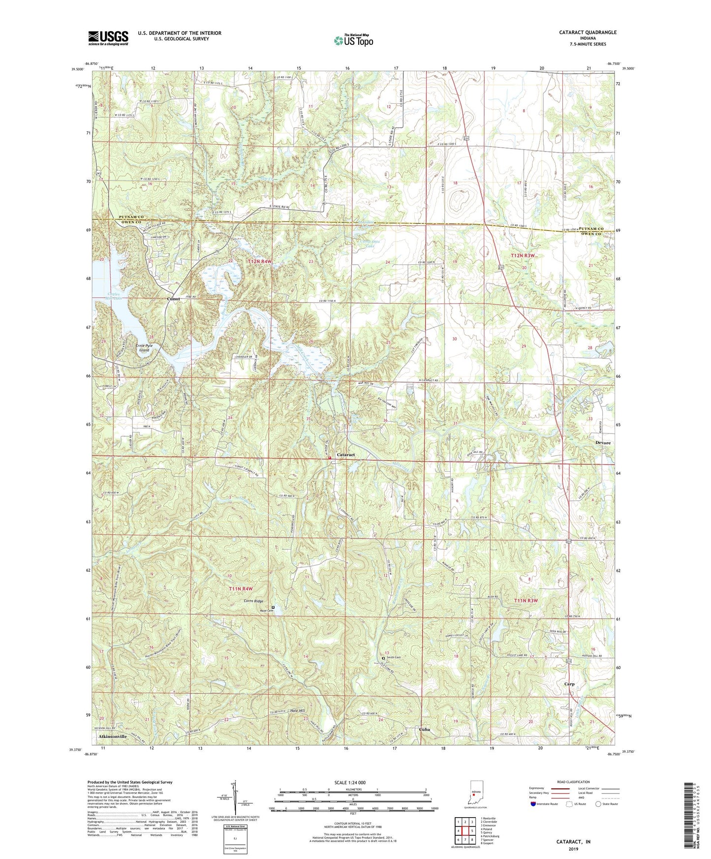
2022 topographic map quadrangle Cataract in the state of Indiana. Scale: 1:24000. Based on the newly updated USGS 7.5' US Topo map series, this map is in the following counties: Owen, Putnam. The map contains contour data, water features, and other items you are used to seeing on USGS maps, but also has updated roads and other features. This is the next generation of topographic maps. Printed on high-quality waterproof paper with UV fade-resistant inks.
Quads adjacent to this one:
West: Poland
Northwest: Reelsville
North: Cloverdale
Northeast: Eminence
East: Quincy
Southeast: Gosport
South: Spencer
Southwest: Patricksburg
This map covers the same area as the classic USGS quad with code o39086d7.
Contains the following named places: Atkinsonville, Bethany Church, Buckskin Church, Camp Otto Lake, Camp Otto Lake Dam, Carolina Church, Carp, Cataract, Cataract Volunteer Fire Department, Corns Ridge, Cuba, Cunot, Devore, Doe Creek, Ernie Pyle Island, Hale Hill, Lower Cataract Falls, Maze Cemetery, Mill Grove Church, Owen-Putnam State Forest, Paradise Lake, Smith Cemetery, Township of Jennings, Upper Cataract Falls