MyTopo
Fritchton Indiana US Topo Map
Couldn't load pickup availability
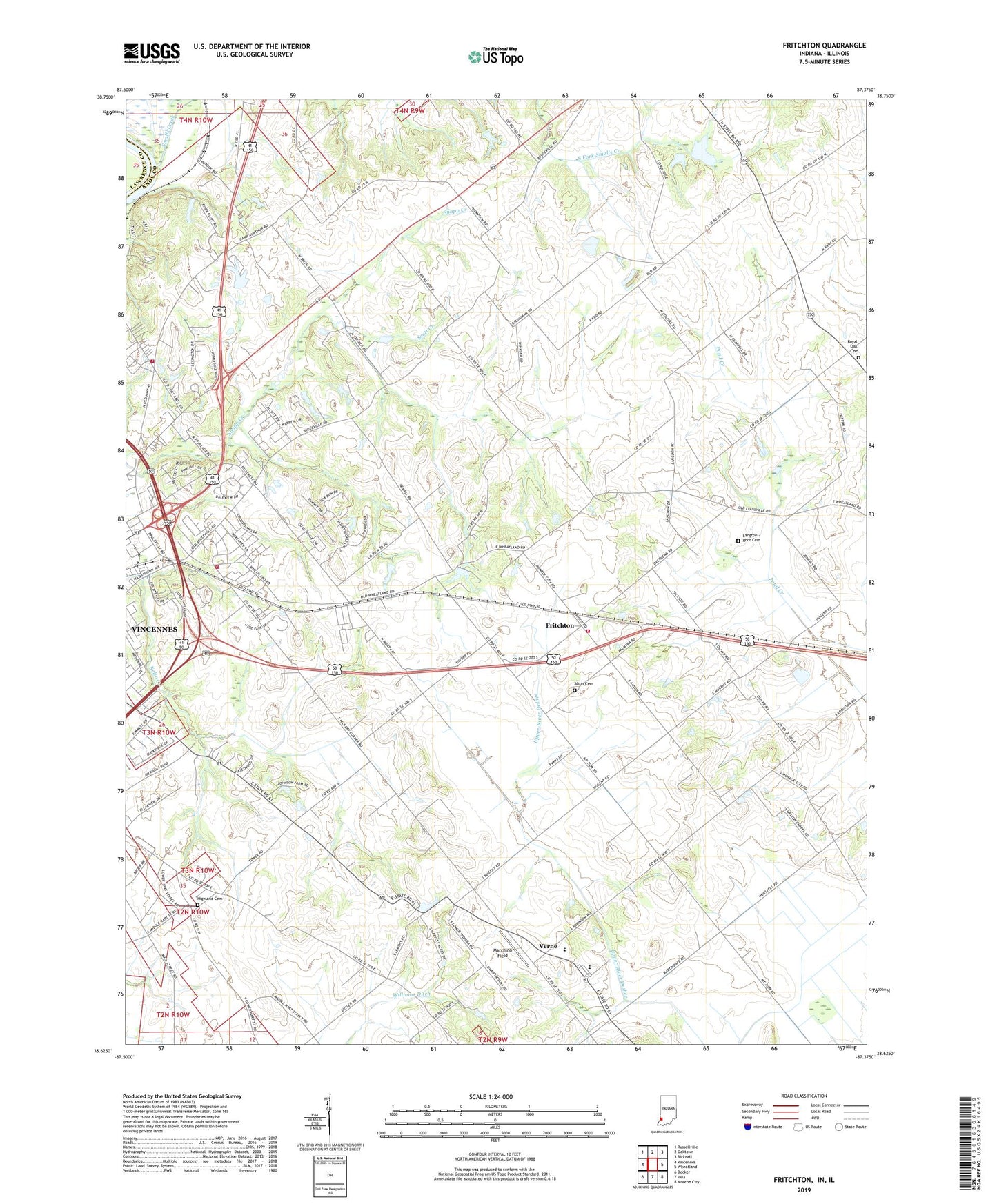
2022 topographic map quadrangle Fritchton in the state of Indiana. Scale: 1:24000. Based on the newly updated USGS 7.5' US Topo map series, this map is in the following counties: Knox, Lawrence. The map contains contour data, water features, and other items you are used to seeing on USGS maps, but also has updated roads and other features. This is the next generation of topographic maps. Printed on high-quality waterproof paper with UV fade-resistant inks.
Quads adjacent to this one:
West: Vincennes
Northwest: Russellville
North: Oaktown
Northeast: Bicknell
East: Wheatland
Southeast: Monroe City
South: Iona
Southwest: Decker
This map covers the same area as the classic USGS quad with code o38087f4.
Contains the following named places: Alton Cemetery, Fritchton, Highland Cemetery, Hillcrest Special Education School, Indiana Church, Indiana Presbyterian Cemetery, Jordanville Post Office, Knox County, Langton - Root Cemetery, Marchino Field, Palmyra Township Fire Department, Royal Oak Cemetery, Royal Oak Church, Saint Vincents Orphanage, Scott Creek, Smalls Creek, South Knox Junior and Senior High School, Township of Palmyra, Upper Indiana Cemetery, Upper Indiana Church, Verne, Vincennes Fire Department Station 4, Vincennes Township Fire Department Station 5, WADV-AM (Vincennes), Welton Chapel, White Oak State Fishing Area, WRTB-FM (Vincennes), WVUB-FM (Vincennes), WVUT-TV (Vincennes)