MyTopo
Iona Indiana US Topo Map
Couldn't load pickup availability
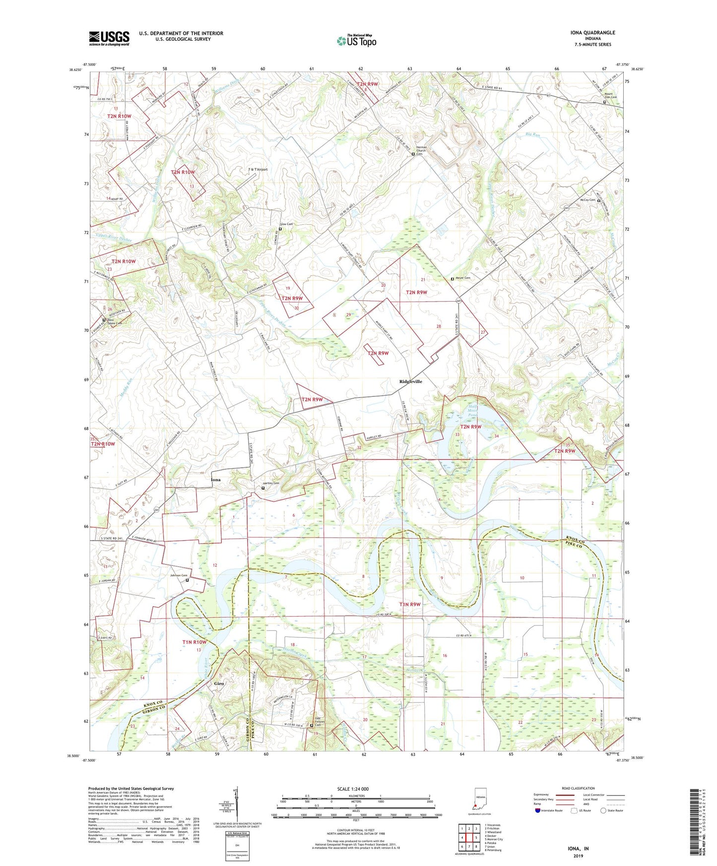
2022 topographic map quadrangle Iona in the state of Indiana. Scale: 1:24000. Based on the newly updated USGS 7.5' US Topo map series, this map is in the following counties: Knox, Pike, Gibson. The map contains contour data, water features, and other items you are used to seeing on USGS maps, but also has updated roads and other features. This is the next generation of topographic maps. Printed on high-quality waterproof paper with UV fade-resistant inks.
Quads adjacent to this one:
West: Decker
Northwest: Vincennes
North: Fritchton
Northeast: Wheatland
East: Monroe City
Southeast: Petersburg
South: Union
Southwest: Patoka
This map covers the same area as the classic USGS quad with code o38087e4.
Contains the following named places: Big Run, Conger Creek, Giro, Giro Church, Half Moon Pond, Harbin Creek, Hartley Cemetery, Herman Church Cemetery, Hermon Church, Iona, Johnson Cemetery, Long Pond, McCoy Cemetery, McCoy Creek, Meyer Cemetery, Mount Zion Cemetery, Mount Zion Church, Odd Fellows Cemetery, Ridgleville, Slow Cemetery, T & T Airport, Ten Acre Pond, Trinity Church, West Salem Cemetery, Williams Ditch, Wilson Creek