MyTopo
Russiaville Indiana US Topo Map
Couldn't load pickup availability
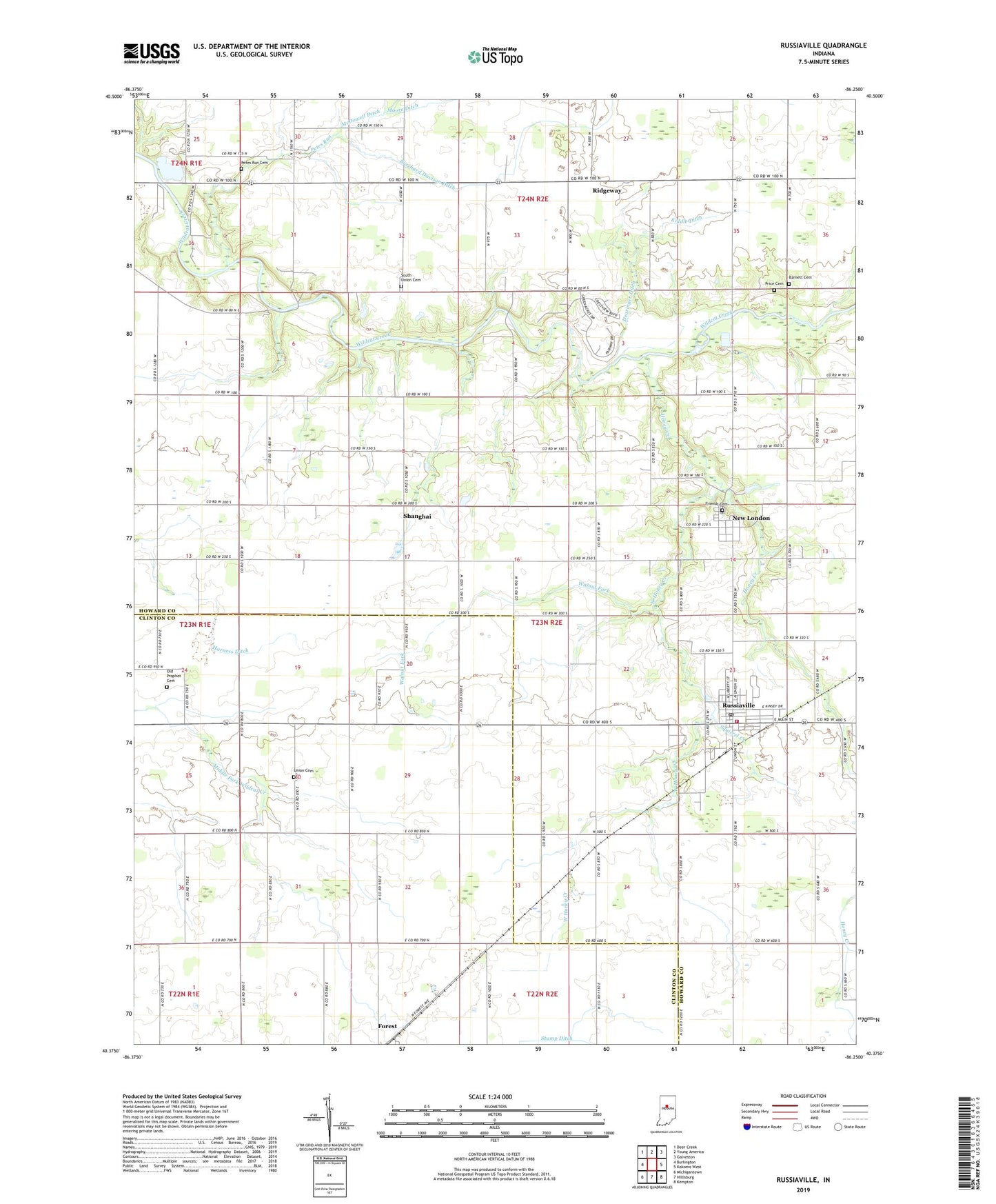
2022 topographic map quadrangle Russiaville in the state of Indiana. Scale: 1:24000. Based on the newly updated USGS 7.5' US Topo map series, this map is in the following counties: Howard, Clinton. The map contains contour data, water features, and other items you are used to seeing on USGS maps, but also has updated roads and other features. This is the next generation of topographic maps. Printed on high-quality waterproof paper with UV fade-resistant inks.
Quads adjacent to this one:
West: Burlington
Northwest: Deer Creek
North: Young America
Northeast: Galveston
East: Kokomo West
Southeast: Kempton
South: Hillisburg
Southwest: Michigantown
This map covers the same area as the classic USGS quad with code o40086d3.
Contains the following named places: Barnett Cemetery, Burchard Davison Ditch, Cloverdale Church, Dearinger Ditch, Friends Cemetery, Honey Creek, Howard Church, Kiddle Ditch, New London, New Zion Church, Oakland Church, Old Prophet Cemetery, Petes Run, Petes Run Cemetery, Price Cemetery, Ridgeway, Russiaville, Russiaville Ambulance Service, Russiaville Post Office, Russiaville Volunteer Fire Department, Shanghai, South Union Cemetery, Squirrel Creek, Town of Russiaville, Township of Honey Creek, Township of Monroe, Union Cemetery, Union Church, Walnut Fork, West Honey Creek, ZIP Code: 46979