MyTopo
Petersburg Indiana US Topo Map
Couldn't load pickup availability
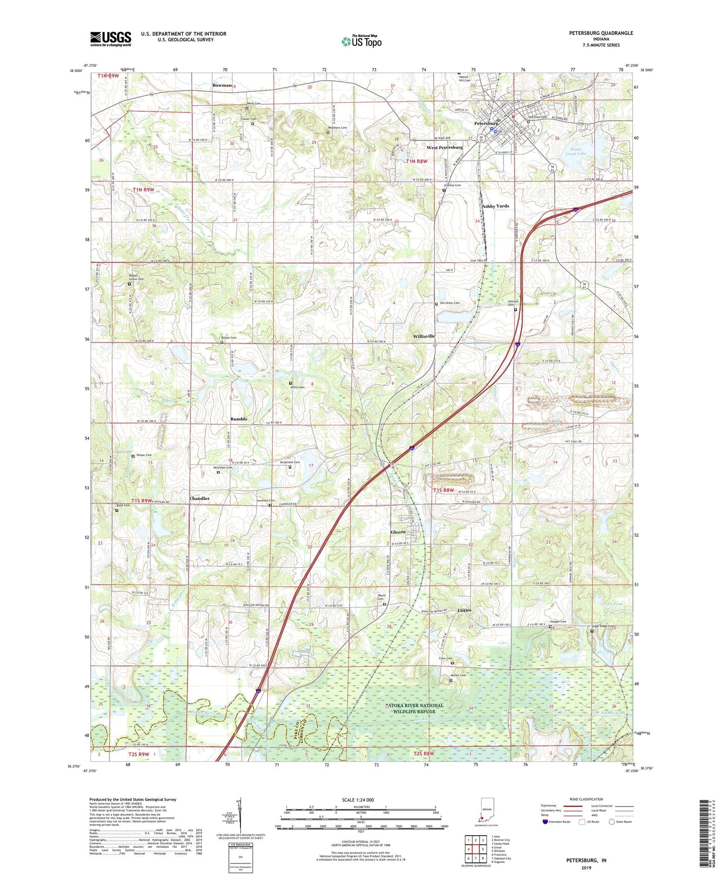
2022 topographic map quadrangle Petersburg in the state of Indiana. Scale: 1:24000. Based on the newly updated USGS 7.5' US Topo map series, this map is in the following counties: Pike, Gibson. The map contains contour data, water features, and other items you are used to seeing on USGS maps, but also has updated roads and other features. This is the next generation of topographic maps. Printed on high-quality waterproof paper with UV fade-resistant inks.
Quads adjacent to this one:
West: Union
Northwest: Iona
North: Monroe City
Northeast: Sandy Hook
East: Winslow
Southeast: Augusta
South: Oakland City
Southwest: Francisco
This map covers the same area as the classic USGS quad with code o38087d3.
Contains the following named places: Alford Airpark, Ashby Yards, Barren Ditch, Beck Cemetery, Blaize Cemetery, Bowman, Chandler, City of Petersburg, Crow Cemetery, DeJarnett Cemetery, Flat Creek, Fowler Cemetery, Gladish Chapel, Glezen, Globe Pond, Harvey Creek Church, Hedges Cemetery, Hephzibah Church, Hornady Park, Hurricane Creek, Indian Mound Cemetery, Johnson Cemetery, Littles, Loveless Cemetery, Martin Cemetery, McGillem Cemetery, Mission of Faith Church, North Patoka Township Volunteer Fire Department Station 2, Old Town Cemetery, Old Union Cemetery, Olive Branch Church, Petersburg, Petersburg Fire Department Station 1, Petersburg Police Department, Petersburg Post Office, Pike Central School, Pike County Sheriff Office, Poplar Grove Cemetery, Prides Creek Lake, Prides Creek Lake Dam Number 4, Robinson Creek, Rumble, South Fork Patoka River, Stuckey Cemetery, Sugar Creek, Sugar Ridge Cemetery, Sugar Ridge Church, Township of Logan, Township of Madison, Township of Washington, Weathers Cemetery, Weist Cemetery, West Petersburg, White River Church, Willis Cemetery, Willisville, Wilson Cemetery, Wyatt Cemetery, ZIP Code: 47567