MyTopo
Glendale Indiana US Topo Map
Couldn't load pickup availability
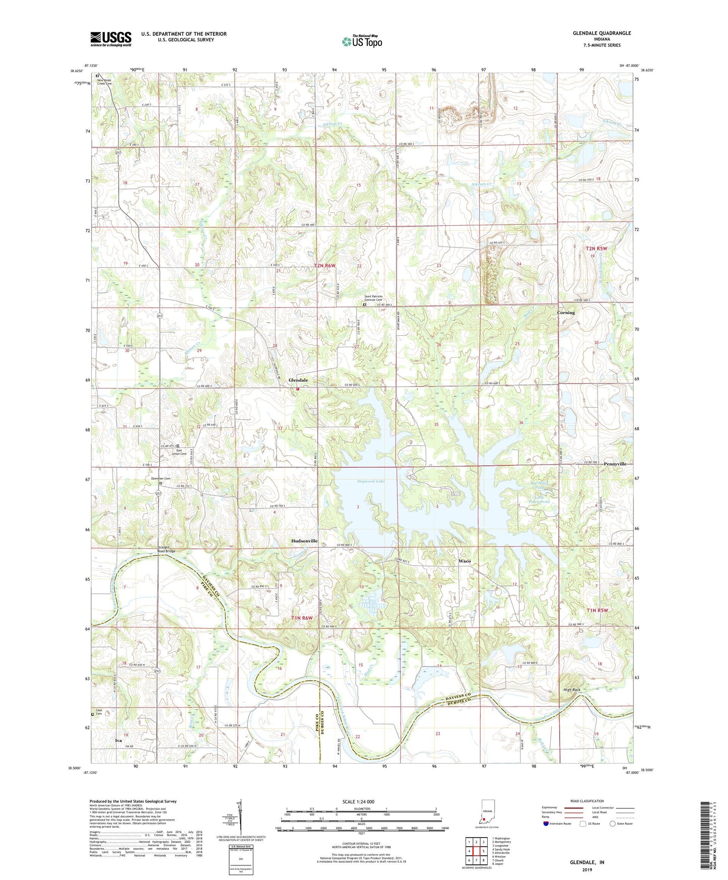
2022 topographic map quadrangle Glendale in the state of Indiana. Scale: 1:24000. Based on the newly updated USGS 7.5' US Topo map series, this map is in the following counties: Daviess, Pike, Dubois. The map contains contour data, water features, and other items you are used to seeing on USGS maps, but also has updated roads and other features. This is the next generation of topographic maps. Printed on high-quality waterproof paper with UV fade-resistant inks.
Quads adjacent to this one:
West: Sandy Hook
Northwest: Washington
North: Montgomery
Northeast: Loogootee
East: Alfordsville
Southeast: Jasper
South: Otwell
Southwest: Winslow
This map covers the same area as the classic USGS quad with code o38087e1.
Contains the following named places: Bear Creek, Big Piney Pond, Birch Creek, Camp Creek, Case Cemetery, Corning, Dogwood Lake, East Union Cemetery, Ebenezer Cemetery, Glendale, Glendale Reservoir Dam, Glendale State Fish and Wildlife Area, Harrison Township Volunteer Fire Department Montgomery, High Rock, Hudsonville, Iva, Little Piney Pond, Mount Zion Church, Mud Creek, New Veale Creek Cemetery, Oak Grove Church, Pennyville, Saint Patricks Church, Saint Patricks Glencoe Cemetery, Straight Road Bridge, Township of Harrison, Waco