MyTopo
Winslow Indiana US Topo Map
Couldn't load pickup availability
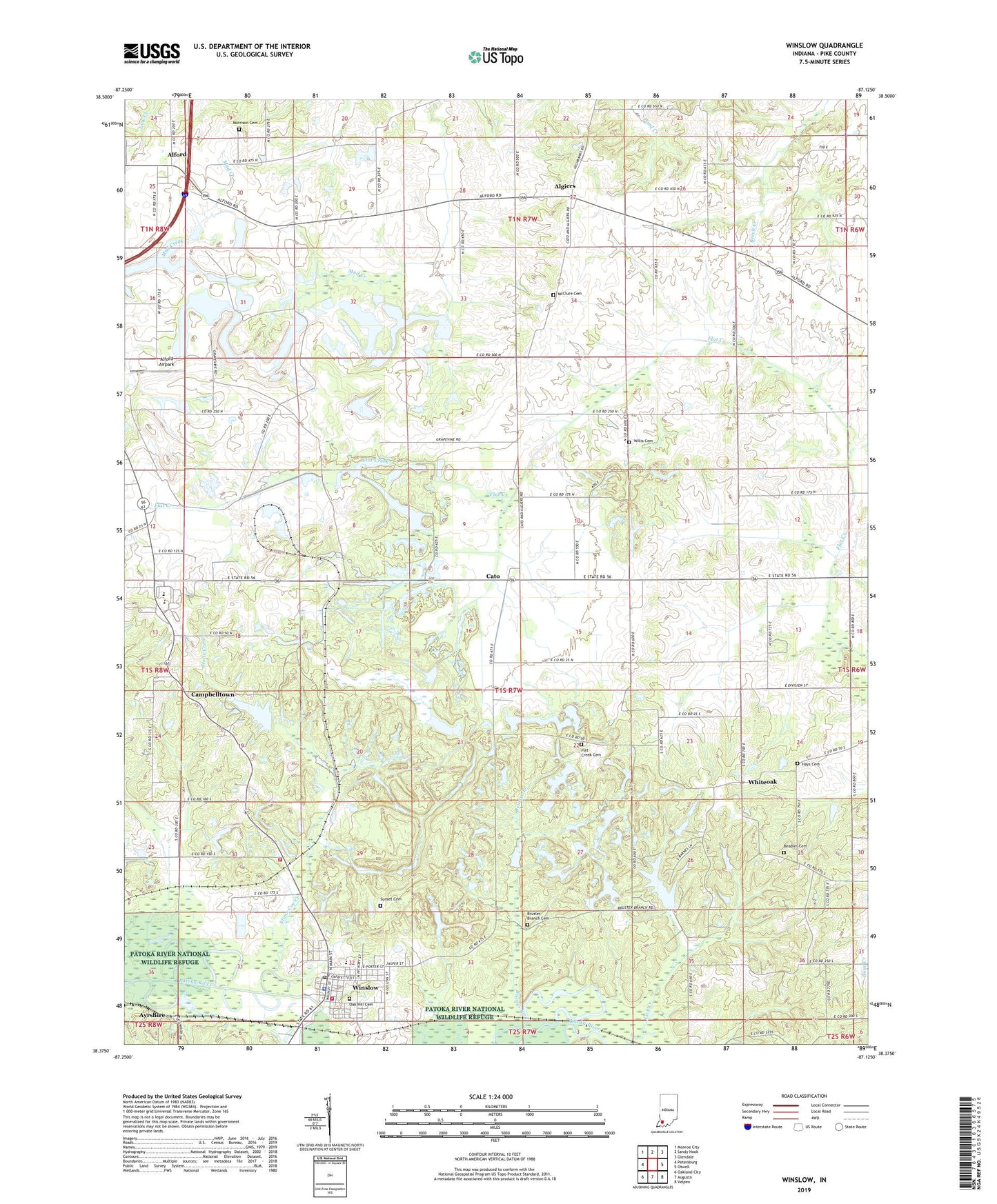
2022 topographic map quadrangle Winslow in the state of Indiana. Scale: 1:24000. Based on the newly updated USGS 7.5' US Topo map series, this map is in the following counties: Pike. The map contains contour data, water features, and other items you are used to seeing on USGS maps, but also has updated roads and other features. This is the next generation of topographic maps. Printed on high-quality waterproof paper with UV fade-resistant inks.
Quads adjacent to this one:
West: Petersburg
Northwest: Monroe City
North: Sandy Hook
Northeast: Glendale
East: Otwell
Southeast: Velpen
South: Augusta
Southwest: Oakland City
This map covers the same area as the classic USGS quad with code o38087d2.
Contains the following named places: Alford, Algiers, Beadles Cemetery, Brenton Chapel, Bruster Branch, Bruster Branch Cemetery, Campbelltown, Cato, Flat Creek Cemetery, Flat Creek Memorial Church, Hays Cemetery, Lick Creek, McClure Cemetery, Morrison Cemetery, Mount Heaborn Church, Mount Olive Church, Oak Hill Cemetery, Patoka Township Volunteer Fire Department, Pike County, Pleasant Ridge Church, Riverside Park, Spraggans Church, Stone Coe Creek, Sunset Cemetery, Town of Winslow, Township of Jefferson, Township of Marion, Township of Patoka, White Oak Lake, White Oak Lake Dam, Whiteoak, Willis Cemetery, Winslow, Winslow Elementary School, Winslow Police Department, Winslow Post Office, Winslow Volunteer Fire Department, ZIP Code: 47598