MyTopo
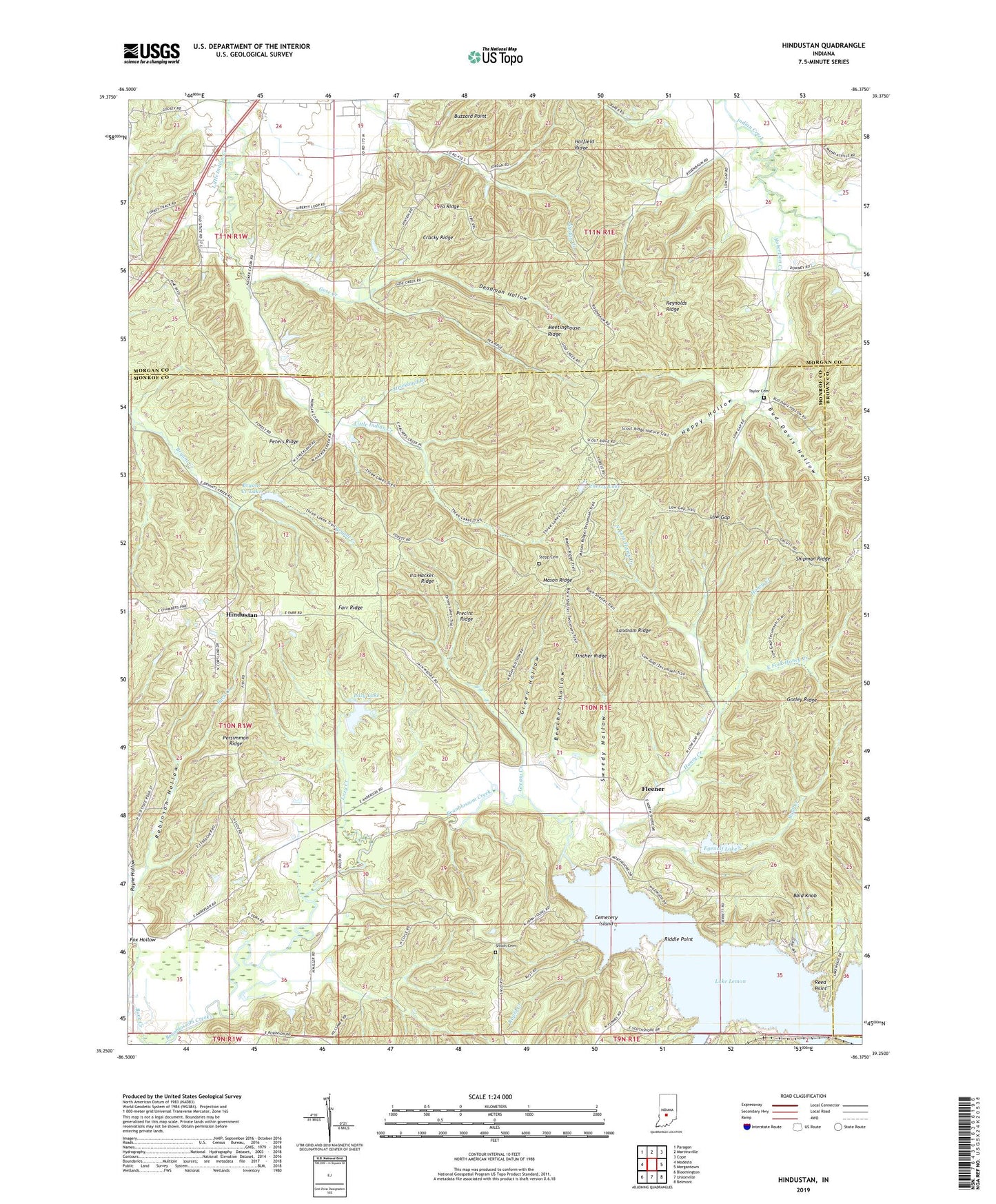
Hindustan Indiana US Topo Map
Couldn't load pickup availability
2022 topographic map quadrangle Hindustan in the state of Indiana. Scale: 1:24000. Based on the newly updated USGS 7.5' US Topo map series, this map is in the following counties: Monroe, Morgan, Brown. The map contains contour data, water features, and other items you are used to seeing on USGS maps, but also has updated roads and other features. This is the next generation of topographic maps. Printed on high-quality waterproof paper with UV fade-resistant inks.
Quads adjacent to this one:
West: Modesto
Northwest: Paragon
North: Martinsville
Northeast: Cope
East: Morgantown
Southeast: Belmont
South: Unionville
Southwest: Bloomington
This map covers the same area as the classic USGS quad with code o39086c4.
Contains the following named places: Bald Knob, Bean Blossom Dam, Beanblossom Lake, Beecher Hollow, Brown Elementary School, Bryant Creek Lake, Bryant Creek Lake Dam, Buck Creek, Bud Davis Hollow, Cemetery Island, Cherry Lake, Cherry Lake Dam, Cracky Ridge, Deadman Hollow, Draper Hollow, East Fork Honey Creek, Egenolf Lake, Egenolf Lake Dam, Farr Ridge, Fleener, Gorley Ridge, Gose Creek, Greasy Creek, Green Hollow, Happy Hollow, Hindustan, Honey Creek, Indiana Department of Natural Resources - Division of Forestry Fire Control Headquarters, Ira Hacker Ridge, Lake Lemon, Landram Ridge, Lazy Creek, Lazy Lake, Lazy Lake Dam, Liberty Church, Low Gap, Mason Ridge, Mason Ridge Camping Area, Meetinghouse Ridge, Monroe Mills Post Office, North Fork Honey Creek, Oak Ridge Camping Area, Payne Hollow, Pea Ridge, Persimmon Ridge, Peters Ridge, Precint Ridge, Rapid Creek, Reed Point, Reynolds Ridge, Riddle Point, Robertson Creek, Robinson Hollow, Scout Ridge Nature Reserve, Scout Ridge Youth Campground, Shiloh Cemetery, Shipman Ridge, Stepp Cemetery, Strickland Branch, Sweedy Hollow, Taylor Cemetery, Three Lakes Trail, Tincher Ridge, Turkey Track, Wheeler Mission Campground, Wolf Creek, ZIP Code: 47468


