MyTopo
Modesto Indiana US Topo Map
Couldn't load pickup availability
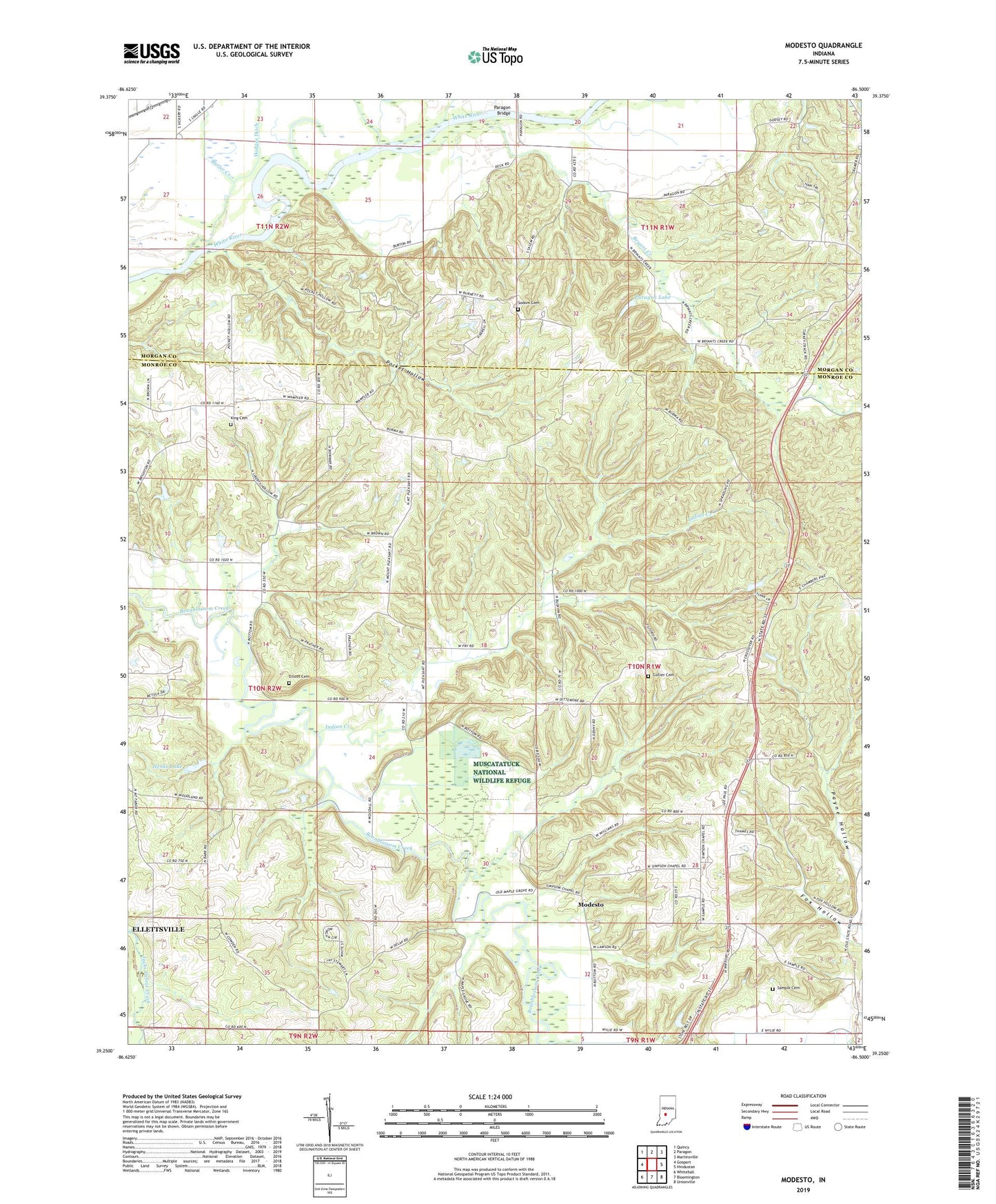
2022 topographic map quadrangle Modesto in the state of Indiana. Scale: 1:24000. Based on the newly updated USGS 7.5' US Topo map series, this map is in the following counties: Monroe, Morgan. The map contains contour data, water features, and other items you are used to seeing on USGS maps, but also has updated roads and other features. This is the next generation of topographic maps. Printed on high-quality waterproof paper with UV fade-resistant inks.
Quads adjacent to this one:
West: Gosport
Northwest: Quincy
North: Paragon
Northeast: Martinsville
East: Hindustan
Southeast: Unionville
South: Bloomington
Southwest: Whitehall
This map covers the same area as the classic USGS quad with code o39086c5.
Contains the following named places: Brown Elementary School, Bryant Creek, Butler Creek, Collier Cemetery, Elliott Cemetery, Fall Creek, Fox Hollow, Henke Lake, Henke Lake Dam, Indian Creek, King Cemetery, Liberty Church, Modesto, Morgan-Monroe State Forest, Mount Olive Church, Mount Pleasant Church, New Salem Church, Paragon Bridge, Paragon Lake, Paragon Lake Dam, Pocket Hollow, Sample Cemetery, Simpson Church, Sodom Cemetery, Township of Baker, Township of Washington, Union Church, Wayport, Zion Hill Church, ZIP Code: 47429