MyTopo
Paragon Indiana US Topo Map
Couldn't load pickup availability
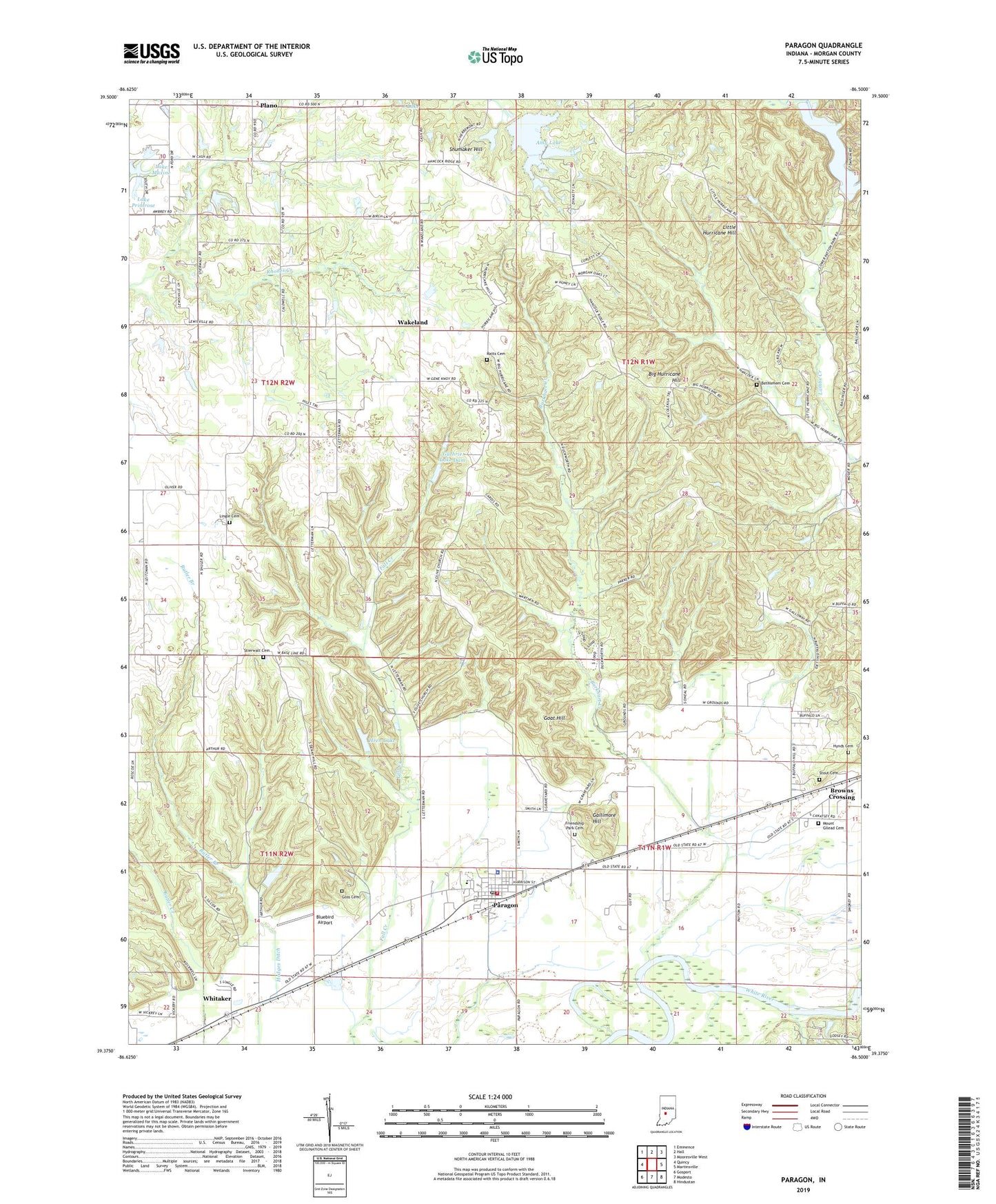
2022 topographic map quadrangle Paragon in the state of Indiana. Scale: 1:24000. Based on the newly updated USGS 7.5' US Topo map series, this map is in the following counties: Morgan. The map contains contour data, water features, and other items you are used to seeing on USGS maps, but also has updated roads and other features. This is the next generation of topographic maps. Printed on high-quality waterproof paper with UV fade-resistant inks.
Quads adjacent to this one:
West: Quincy
Northwest: Eminence
North: Hall
Northeast: Mooresville West
East: Martinsville
Southeast: Hindustan
South: Modesto
Southwest: Gosport
This map covers the same area as the classic USGS quad with code o39086d5.
Contains the following named places: Amy Lake, Amy Lake Dam, Bethlehem Cemetery, Big Hurricane Hill, Bluebird Airport, Browns Crossing, Burkhart Creek, Butler Branch, Corinth Church, Friendship Park Cemetery, Gallimore Hill, Goat Hill, Goss Cemetery, Guthrie Lake, Guthrie Lake Dam, Hodges Ditch, Hren Lake, Hren Lake Dam, Hynds Cemetery, Lake Maxine, Lake Primrose, Lambs Creek Church, Lingle Cemetery, Little Hurricane Hill, McClures Mobile Home Park, Mount Gilead Cemetery, Olive Church, Paragon, Paragon Elementary School, Paragon Fire Station 17, Paragon Police Department, Paragon Post Office, Paragon Volunteer Fire Department, Patton Dam, Patton Lake, Plano, Potato Mound, Ratts Cemetery, Shumaker Hill, Stierwalt Cemetery, Stout Cemetery, Town of Paragon, Township of Ashland, Township of Ray, Wakeland, Whitaker, ZIP Code: 46166