MyTopo
Decatur Indiana US Topo Map
Couldn't load pickup availability
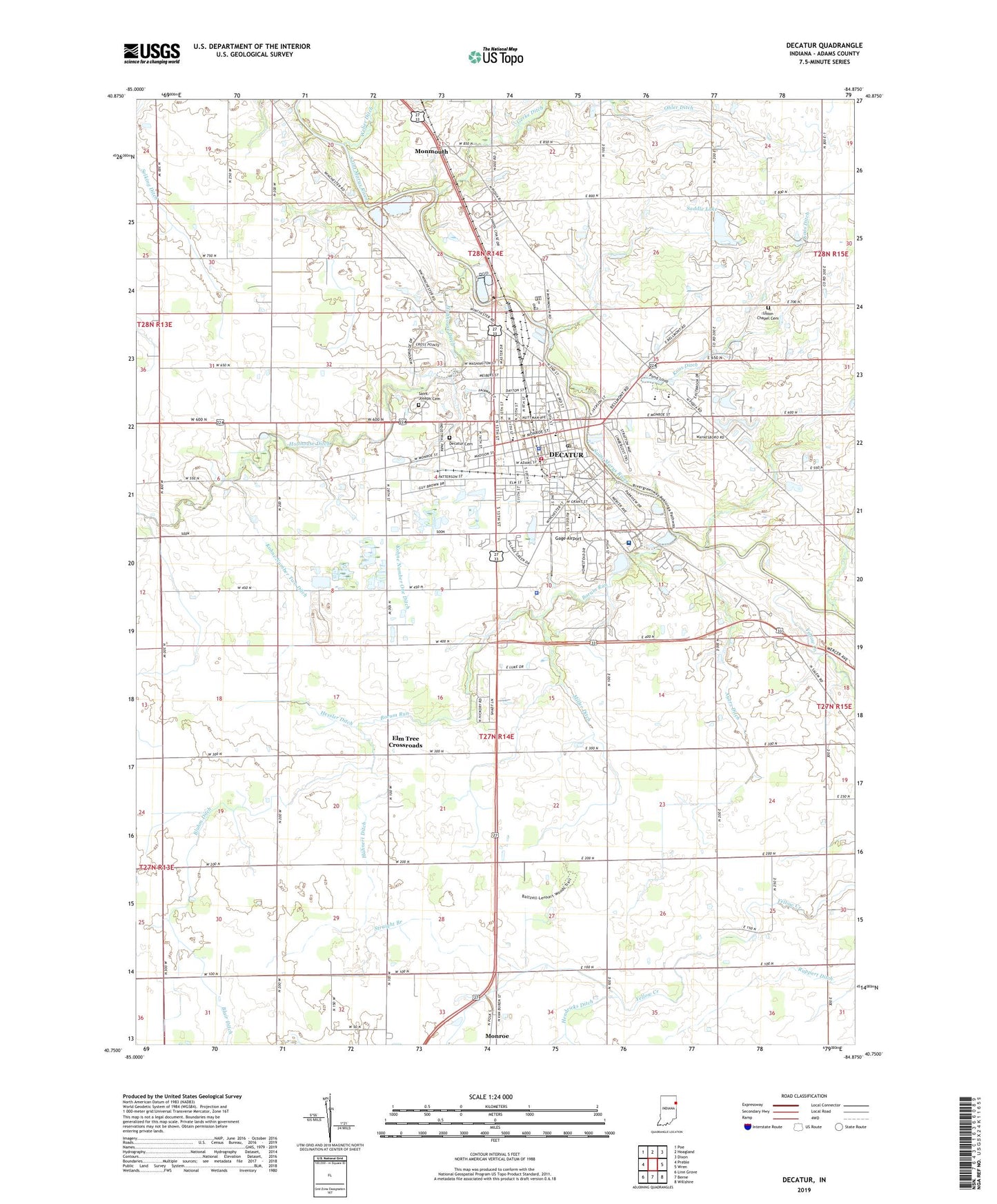
2022 topographic map quadrangle Decatur in the state of Indiana. Scale: 1:24000. Based on the newly updated USGS 7.5' US Topo map series, this map is in the following counties: Adams. The map contains contour data, water features, and other items you are used to seeing on USGS maps, but also has updated roads and other features. This is the next generation of topographic maps. Printed on high-quality waterproof paper with UV fade-resistant inks.
Quads adjacent to this one:
West: Preble
Northwest: Poe
North: Hoagland
Northeast: Dixon
East: Wren
Southeast: Willshire
South: Berne
Southwest: Linn Grove
This map covers the same area as the classic USGS quad with code o40084g8.
Contains the following named places: Adams County Emergency Medical Services, Adams County Home, Adams County Sheriff's Office, Adams Memorial Hospital, Antioch Church, Ayers Ditch, Blair Ditch, Bluhm Ditch, Borum Run, City of Decatur, Decatur, Decatur Cemetery, Decatur Fire Department, Decatur Police Department, Decatur Post Office, Elm Tree Crossroads, Gage Airport, Hahnert Ditch, Hanna City Park, Hendricks Ditch, Hessler Ditch, Holthouse Ditch, Kohne Number One Ditch, Kohne Number Two Ditch, Koos Ditch, Lincoln Amish School Number Two, McMillen Park, Miller Ditch, Monmouth, Mount Pleasant Church, Northwest Elementary School, Ohler Ditch, Ruppert Ditch, Saddle Lake, Saddle Lake Dam, Saint Joseph Cemetery, Saint Josephs School, Saint Pauls Church, Southeast Elementary School, Straight Branch, Stratton Park, Township of Washington, Union Chapel, Union Chapel Cemetery, WADM-AM (Decatur), WADM-FM (Decatur), Yellow Creek, ZIP Code: 46733