MyTopo
Huntingburg Indiana US Topo Map
Couldn't load pickup availability
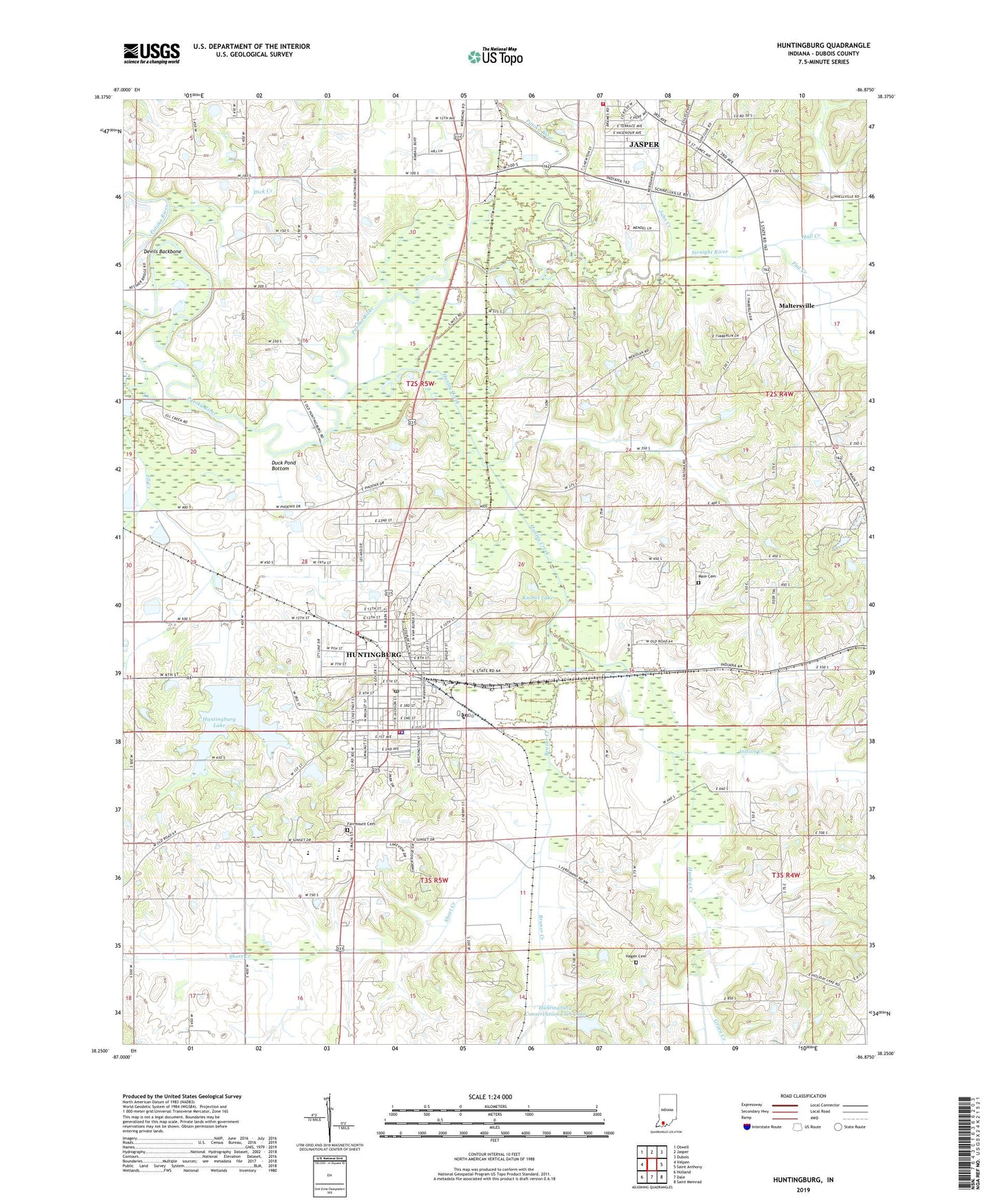
2022 topographic map quadrangle Huntingburg in the state of Indiana. Scale: 1:24000. Based on the newly updated USGS 7.5' US Topo map series, this map is in the following counties: Dubois. The map contains contour data, water features, and other items you are used to seeing on USGS maps, but also has updated roads and other features. This is the next generation of topographic maps. Printed on high-quality waterproof paper with UV fade-resistant inks.
Quads adjacent to this one:
West: Velpen
Northwest: Otwell
North: Jasper
Northeast: Dubois
East: Saint Anthony
Southeast: Saint Meinrad
South: Dale
Southwest: Holland
This map covers the same area as the classic USGS quad with code o38086c8.
Contains the following named places: Bruner Creek, City of Huntingburg, Crestview Elementary School, Devils Backbone, Dick Creek, Dubois County, Duck Pond Bottom, Ell Creek, Fairmount Cemetery, Flat Creek, Green Creek, Hagen Cemetery, Hall Creek, Hunley Creek, Huntingburg, Huntingburg City Lake Dam, Huntingburg Conservation Club Dam, Huntingburg Conservation Club Lake, Huntingburg Fire Department, Huntingburg Fire Department Station 2, Huntingburg Lake, Huntingburg Middle School, Huntingburg Pit, Huntingburg Police Department, Huntingburg Post Office, Indian Creek, Jahn Creek, Jasper Fire Department Station 2, Knebel Lake, Main Cemetery, Maltersville, Maple Park Elementary School, Saint Josephs Hospital, Short Creek, Southridge High School, Straight River, Township of Patoka, WBDC-FM (Huntingburg), WITZ-AM (Jasper), WITZ-FM (Jasper), ZIP Code: 47542