MyTopo
Velpen Indiana US Topo Map
Couldn't load pickup availability
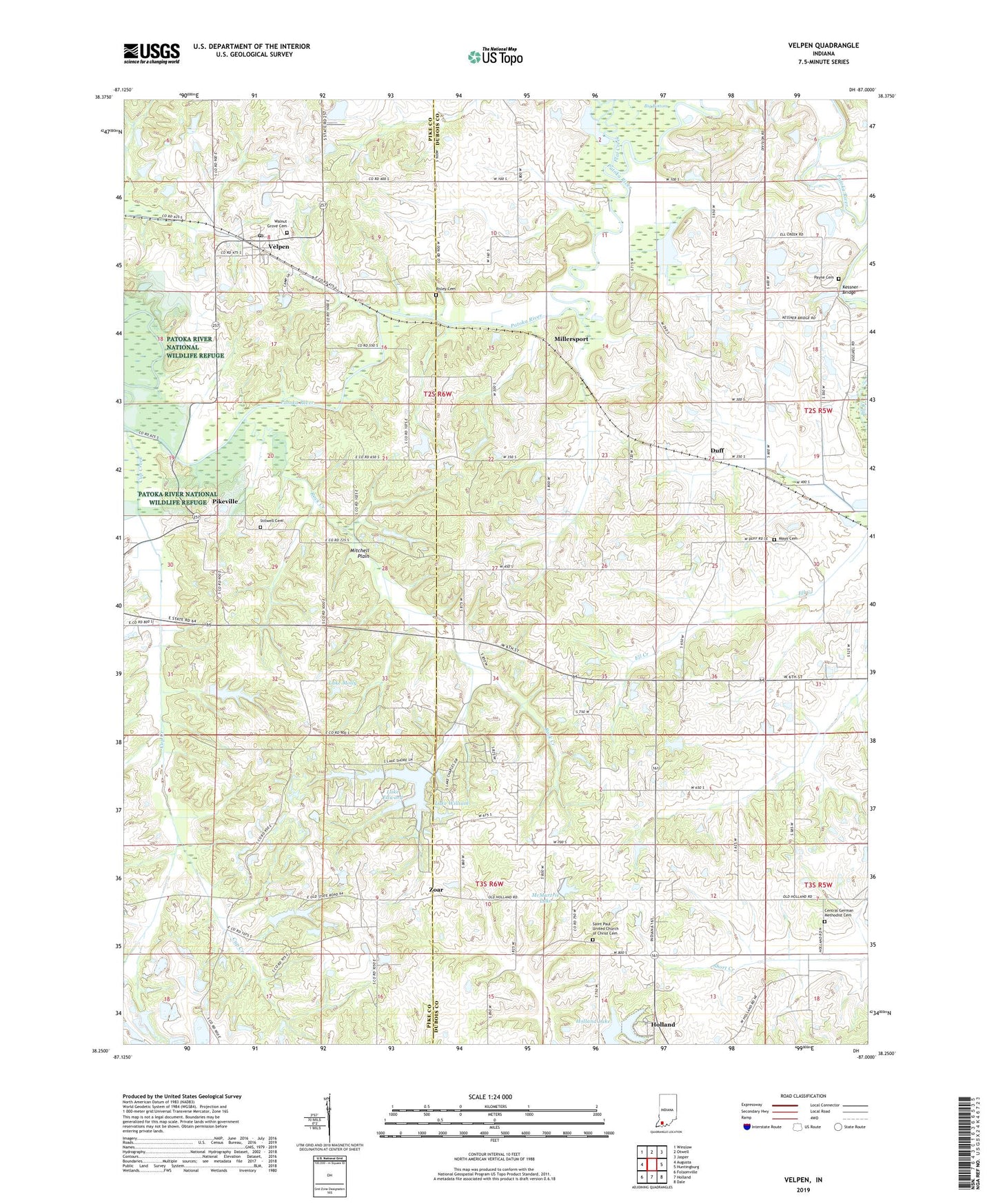
2022 topographic map quadrangle Velpen in the state of Indiana. Scale: 1:24000. Based on the newly updated USGS 7.5' US Topo map series, this map is in the following counties: Dubois, Pike. The map contains contour data, water features, and other items you are used to seeing on USGS maps, but also has updated roads and other features. This is the next generation of topographic maps. Printed on high-quality waterproof paper with UV fade-resistant inks.
Quads adjacent to this one:
West: Augusta
Northwest: Winslow
North: Otwell
Northeast: Jasper
East: Huntingburg
Southeast: Dale
South: Holland
Southwest: Folsomville
This map covers the same area as the classic USGS quad with code o38087c1.
Contains the following named places: Beadens Creek, Central German Methodist Cemetery, Cup Creek, Duff, Duff Conservation Club, Flat Creek, Holland Lake, Holland Old Water Supply Dam Number 1, Kessner Bridge, Lake Edward, Lake Edward Dam, Lake Helmerich, Lake Helmerich Dam, Lake Molly, Lake Molly Dam, Lake William, Lake William Dam, Maple Grove Camp, Mayo Cemetery, McMurtrie Lake, Millersport, Payne Cemetery, Pikeville, Risley Cemetery, Rock Creek, Saint Paul United Church of Christ Cemetery, Stilwell Cemetery, Velpen, Velpen Post Office, Walnut Grove Cemetery, Zoar, ZIP Code: 47590