MyTopo
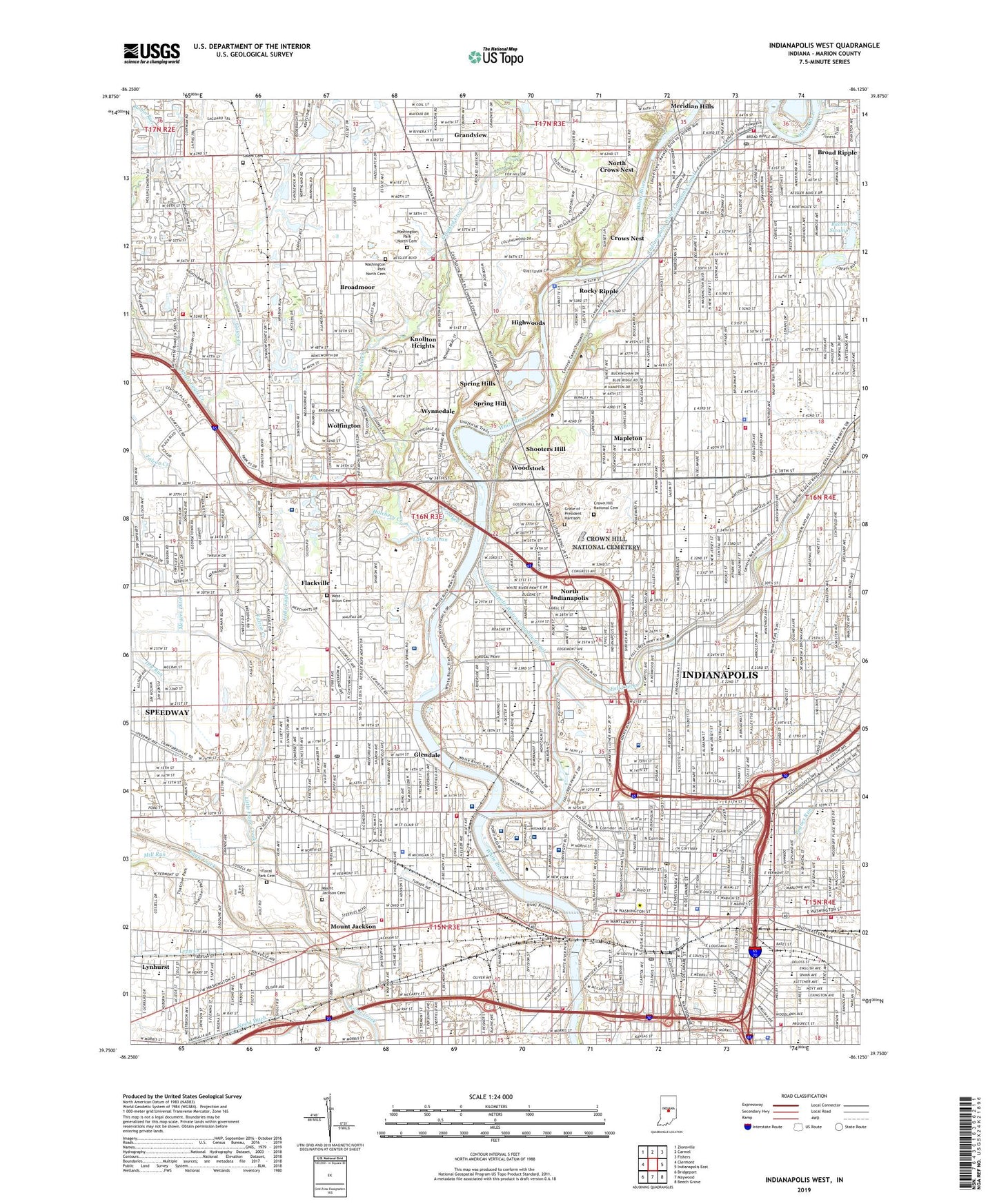
Indianapolis West Indiana US Topo Map
Couldn't load pickup availability
2022 topographic map quadrangle Indianapolis West in the state of Indiana. Scale: 1:24000. Based on the newly updated USGS 7.5' US Topo map series, this map is in the following counties: Marion. The map contains contour data, water features, and other items you are used to seeing on USGS maps, but also has updated roads and other features. This is the next generation of topographic maps. Printed on high-quality waterproof paper with UV fade-resistant inks.
Quads adjacent to this one:
West: Clermont
Northwest: Zionsville
North: Carmel
Northeast: Fishers
East: Indianapolis East
Southeast: Beech Grove
South: Maywood
Southwest: Bridgeport
This map covers the same area as the classic USGS quad with code o39086g2.
Contains the following named places: 500 Airport, 500 Shopping Center, A J Thatcher Park, Arsenal Park, Arsenal Technical High School, Augusta Branch, Bacon Swamp, Bahr Park, Belmont, Benjamin Harrison Elementary School, Bird Branch, Bishop Chatard High School, Bloch Park, Brickyard Crossing Golf Course, Brickyard Plaza Shopping Center, Broad Ripple, Broad Ripple High School, Broad Ripple Park, Broadmoor, Broadmoor Country Club, Brooklyn Heights, Brown School Number 6, Bush Stadium, Butler Athletic Fields, Butler University, Cable School Number 4, Carl G Fisher Elementary School, Cathedral High School, Centennial And 20th Street Park, Centennial And Goff Park, Central State Hospital, Central State Hospital Colony, Charity Dye Elementary School, Christ the King School, Chuck Klein Softball Complex, Circle Centre Mall Shopping Center, City of Indianapolis, City of Indianapolis (balance), Clarence L Farrington Junior High School, Clifton, Coburn School, Coffin Golf Course, Colbertson Ditch, Colgan School Number 10, Convention Center Plaza, Crispus Attucks High School, Crooked Creek, Crooked Creek Elementary School, Cross Creek Shopping Center, Crown Hill National Cemetery, Crows Nest, Culbertson Ditch, Culver Branch, Davey Athletic Complex, Dixieland Flea Market, Douglas Park Golf Course, Dry Run, Dry Run Diverson Ditch, Eagledale Plaza, East Mall, Eliza A Blaker Elementary School, Emmaus School, Fairview Station, Falcon Creek, Fall Creek, Fall Creek And 16th Street Park, Flackville, Flackville School Number 100, Fleming Garden School, Fletcher School Number 8, Floral Park Cemetery, Foster School Number 32, Frank Young Park, Franklin School Number 36, Friedmann Park, Garden City Elementary School, George W Carver Elementary School, Georgetown Plaza, Georgetown Square Business Park, Glendale, Golden Hill Park, Grandview, Grandview Elementary School, Grave of President Harrison, Guion Creek, H L Harshman Junior High School, Hatchery Creek, Henry W Longfellow Junior High School, Herron Art Institute, Highland Country Club, Highwood Branch, Highwoods, Hill Park, Holcomb Gardens, Holliday Park, Holy Angels School, Holy Cross Central School, Holy Trinity School, Immaculate Heart School, Indiana Business College, Indiana Department of Natural Resources Airport, Indiana State Fairgrounds, Indiana University Health Methodist Hospital, Indiana University Health University Hospital, Indiana University Law School, Indiana University Medical Center, Indiana University Regional Campus, Indiana World War Memorial, Indianapolis, Indianapolis Downtown Airport, Indianapolis Motor Speedway, Indianapolis Water Company Canal, Indianapolis Water Company Riverside Station, Indianapolis Water Company White River Station, Indianola Park, ISHC Landing Pad, James A Allison Elementary School, James Whitcomb Riley Monument, Jefferson School Number 7, John Hope Elementary School, Joseph J Bingham Elementary School, Kindred Hospital - Indianapolis, Knollton Heights, Kuntz Stadium, Lacy Branch, Lafayette Place Shopping Center, Lafayette Shoppes Shopping Center, Lafayette Square Airfield, Lafayette Square Shopping Center, Lain Technical Institute, Lake Sullivan, Larue D Carter Memorial Hospital, Latin School, Little Eagle Creek, Lucas Oil Stadium, Lynhurst, Lynn Creek, Maibucker Ditch, Major Taylor Velodrome Park, Mallory Technical Institute, Mapleton, Marion County, Martin Luther King Memorial Park, McCarty Triangle Park, Memorial Plaza, Merchants Plaza Shopping Center, Methodist Hospital Helistop, Meyers Ditch, Military Park, Mill Run, Monument Circle, Moreland Park, Mount Jackson, Mount Jackson Cemetery, Nathaniel Hawthorne Elementary School, Norris Plaza, North Crows Nest, North Indianapolis, North Mall, North Meridian Street Historic District, North Park, North Westway Park Airport, Old Northside Historic District, Pan American Plaza, Park 65 Office Center, Pogues Run, RCA Dome, Regenstrief Health Center, Reverend Mozel Sanders Park, Rhodius Park, Richard L Roudebush Veterans Affairs Medical Center, Ridenour Park, Riley Hospital for Children at Indiana University Health, Riley Park, Ristow Branch, Riverside Golf Course, Robin Run, Rocky Ripple, Saddlebrook Golf Course, Saint Francis Colonnade, Saint Vincents Hospital, Salem Cemetery, Shooters Hill, Sidney and Lois Eskenazi Hospital, Sixtyfirst And Broadway Park, Soap Box Derby Racetrack, Soldiers and Sailors Monument, South Grove Golf Course, South Mall, Speedway Industrial Park, Spring Hills, Stephen Collins Foster Elementary School, Taggart Riverside Park, Tarkington Park, Thatcher Golf Course, Thomas A Edison Junior High School, Tibbs And 21st Street Park, Tibbs Drive-In, Town of Crows Nest, Town of North Crows Nest, Town of Rocky Ripple, Town of Speedway, Town of Spring Hill, Town of Wynnedale, Township of Center, Union Station, University Park, Victory Field, WAJC-FM (Indianapolis), Washington Irving Elementary School, Washington Park North Cemetery, Watkins Park, Wellington, West Mall, West Union Cemetery, Westlane Shopping Center, Westview Hospital, White River State Park, Willard Park, William A Bell Elementary School, Winona Memorial Hospital, WIRE-AM (Indianapolis), Wolfington, Woodruff Place, Woodstock, Woodstock Country Club, WPGW-AM (Portland), WXLW-AM (Speedway), Wynnedale, ZIP Codes: 46202, 46204, 46205, 46208, 46222, 46228


