MyTopo
Jonesville Indiana US Topo Map
Couldn't load pickup availability
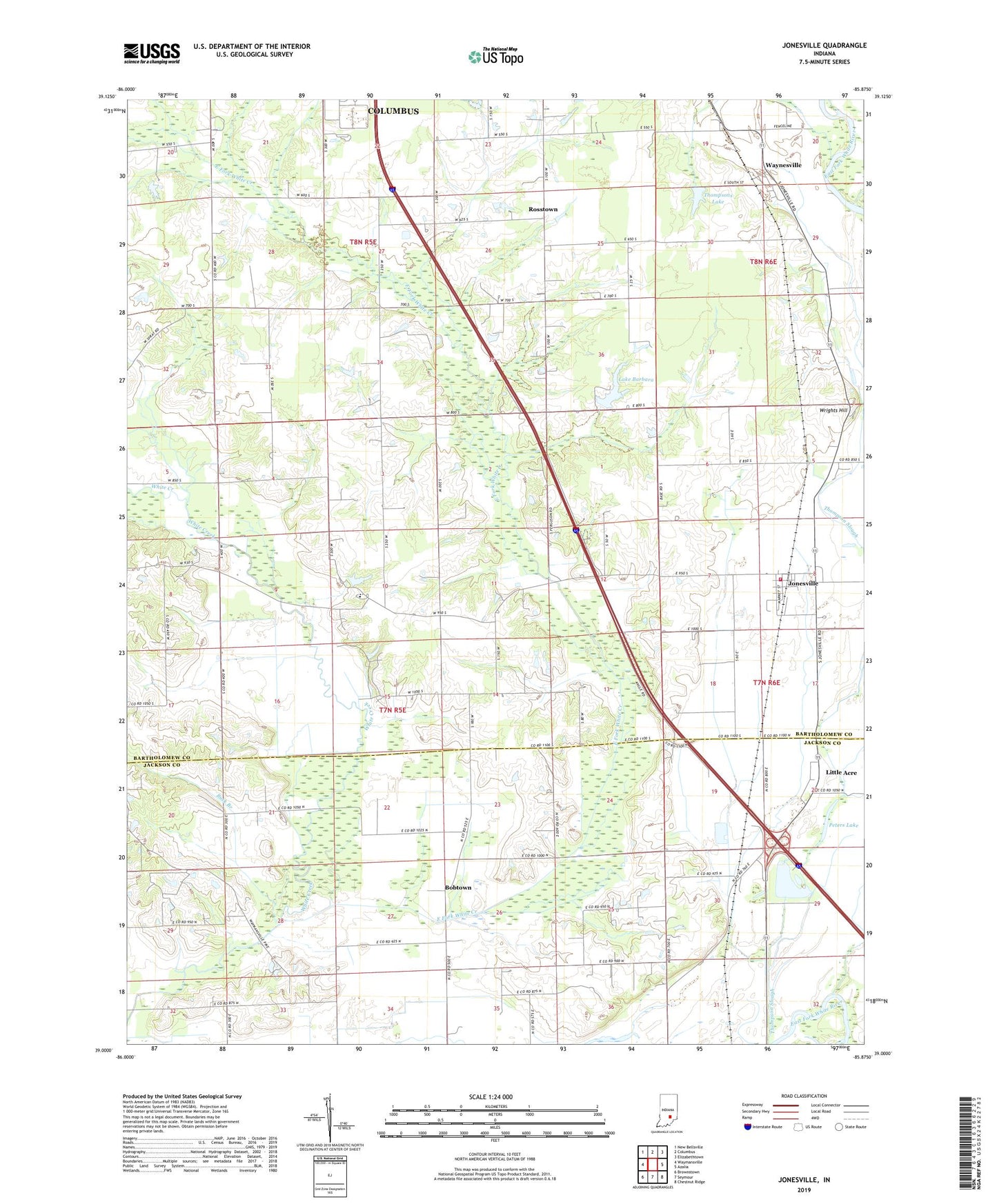
2022 topographic map quadrangle Jonesville in the state of Indiana. Scale: 1:24000. Based on the newly updated USGS 7.5' US Topo map series, this map is in the following counties: Bartholomew, Jackson. The map contains contour data, water features, and other items you are used to seeing on USGS maps, but also has updated roads and other features. This is the next generation of topographic maps. Printed on high-quality waterproof paper with UV fade-resistant inks.
Quads adjacent to this one:
West: Waymansville
Northwest: New Bellsville
North: Columbus
Northeast: Elizabethtown
East: Azalia
Southeast: Chestnut Ridge
South: Seymour
Southwest: Brownstown
This map covers the same area as the classic USGS quad with code o39085a8.
Contains the following named places: Bobtown, Buck Branch, Cooley Creek, Corya Pork Farm, East Fork White Creek, John Thompson County Ditch, Jonesville, Jonesville Fire Department Station 1, Lake Barbara, Little Acre, Meyer Lake Dam, Peters Lake, Peters Switch, Rosstown, Saint Johns Church, Thompsons Lake, Town of Jonesville, Township of Wayne, Walker Chapel, Waynesville, White Creek Church, White Creek Lutheran School, White Creek Post Office, Wrights Hill, ZIP Code: 47247